La Bazoge, Sarthe
La Bazoge | |
|---|---|
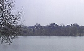 From the lake | |
Location of La Bazoge  | |
 La Bazoge  La Bazoge | |
| Coordinates: 48°05′58″N 0°09′22″E / 48.0994°N 0.1561°ECoordinates: 48°05′58″N 0°09′22″E / 48.0994°N 0.1561°E | |
| Country | France |
| Region | Pays de la Loire |
| Department | Sarthe |
| Arrondissement | Le Mans |
| Canton | Bonnétable |
| Intercommunality | Maine Cœur de Sarthe |
| Government | |
| • Mayor (2020–2026) | Michel Lalande |
| Area 1 | 22.87 km2 (8.83 sq mi) |
| Population (Jan. 2018)[1] | 3,640 |
| • Density | 160/km2 (410/sq mi) |
| Demonym(s) | Bazogien, Bazogienne |
| Time zone | UTC+01:00 (CET) |
| • Summer (DST) | UTC+02:00 (CEST) |
| INSEE/Postal code | 72024 /72650 |
| Elevation | 49–148 m (161–486 ft) |
| Website | www.labazoge72.fr |
| 1 French Land Register data, which excludes lakes, ponds, glaciers > 1 km2 (0.386 sq mi or 247 acres) and river estuaries. | |
La Bazoge is a commune in the Sarthe department in the region of Pays de la Loire in north-western France. It is twinned with the village of Bardney in Lincolnshire and Martfeld (Deutschland).
See also[]
- Communes of the Sarthe department
References[]
- ^ "Populations légales 2018". INSEE. 28 December 2020.
| Wikimedia Commons has media related to La Bazoge (Sarthe). |
Authority control | |
|---|---|
| General |
|
| National libraries | |
This Sarthe geographical article is a stub. You can help Wikipedia by . |
Categories:
- Communes of Sarthe
- Sarthe geography stubs