La Roche-de-Glun
La Roche de Glun | |
|---|---|
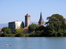 The village seen from Glun | |
 Coat of arms | |
show Location of La Roche de Glun | |
 La Roche de Glun | |
| Coordinates: 45°00′46″N 4°50′54″E / 45.0128°N 4.8483°ECoordinates: 45°00′46″N 4°50′54″E / 45.0128°N 4.8483°E | |
| Country | France |
| Region | Auvergne-Rhône-Alpes |
| Department | Drôme |
| Arrondissement | Valence |
| Canton | Tain-l'Hermitage |
| Government | |
| • Mayor (2020–2026) | Michel Gounon |
| Area 1 | 12.79 km2 (4.94 sq mi) |
| Population (Jan. 2018)[1] | 3,333 |
| • Density | 260/km2 (670/sq mi) |
| Time zone | UTC+01:00 (CET) |
| • Summer (DST) | UTC+02:00 (CEST) |
| INSEE/Postal code | 26271 /26600 |
| Elevation | 103–147 m (338–482 ft) (avg. 119 m or 390 ft) |
| 1 French Land Register data, which excludes lakes, ponds, glaciers > 1 km2 (0.386 sq mi or 247 acres) and river estuaries. | |


La Roche-de-Glun (French pronunciation: [la ʁɔʃ də ɡlœ̃]; Occitan: La Ròcha de Glun) is a commune in the Drôme department in southeastern France.
Population[]
| Year | Pop. | ±% |
|---|---|---|
| 1911 | 900 | — |
| 1962 | 880 | −2.2% |
| 1968 | 1,227 | +39.4% |
| 1975 | 1,467 | +19.6% |
| 1982 | 2,113 | +44.0% |
| 1990 | 2,800 | +32.5% |
| 1999 | 2,740 | −2.1% |
| 2008 | 3,154 | +15.1% |
See also[]
References[]
- ^ "Populations légales 2018". INSEE. 28 December 2020.
| Wikimedia Commons has media related to La Roche-de-Glun. |
| show Authority control |
|---|
This Drôme geographical article is a stub. You can help Wikipedia by . |
Categories:
- Communes of Drôme
- Drôme geography stubs