Lanthes
From Wikipedia, the free encyclopedia
Commune in Bourgogne-Franche-Comté, France
Lanthes | |
|---|---|
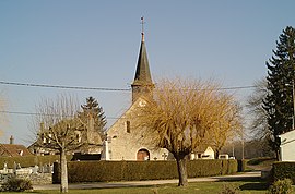 The church in Lanthes | |
 Coat of arms | |
 Lanthes  Lanthes | |
Coordinates:  46°59′40″N 5°12′16″E / 46.9944°N 5.2044°E / 46.9944; 5.2044Coordinates: 46°59′40″N 5°12′16″E / 46.9944°N 5.2044°E / 46.9944; 5.2044 46°59′40″N 5°12′16″E / 46.9944°N 5.2044°E / 46.9944; 5.2044Coordinates: 46°59′40″N 5°12′16″E / 46.9944°N 5.2044°E / 46.9944; 5.2044 | |
| Country | France |
| Region | Bourgogne-Franche-Comté |
| Department | Côte-d'Or |
| Arrondissement | Beaune |
| Canton | Brazey-en-Plaine |
| Intercommunality | Rives de Saône |
| Government | |
| • Mayor (2020–2026) | Anne Rosenblatt-Petitjean |
| Area 1 | 9.79 km2 (3.78 sq mi) |
| Population (Jan. 2018)[1] | 252 |
| • Density | 26/km2 (67/sq mi) |
| Time zone | UTC+01:00 (CET) |
| • Summer (DST) | UTC+02:00 (CEST) |
| INSEE/Postal code | 21340 /21250 |
| Elevation | 184–194 m (604–636 ft) (avg. 180 m or 590 ft) |
| 1 French Land Register data, which excludes lakes, ponds, glaciers > 1 km2 (0.386 sq mi or 247 acres) and river estuaries. | |

show This article may be expanded with text translated from the corresponding article in French. (January 2009) Click [show] for important translation instructions.
|
Lanthes (French pronunciation: [lɑ̃t]) is a commune in the Côte-d'Or department in eastern France.
Population[]
| Year | Pop. | ±% |
|---|---|---|
| 1962 | 95 | — |
| 1968 | 134 | +41.1% |
| 1975 | 110 | −17.9% |
| 1982 | 188 | +70.9% |
| 1990 | 204 | +8.5% |
| 1999 | 180 | −11.8% |
| 2008 | 244 | +35.6% |
See also[]
References[]
- ^ "Populations légales 2018". INSEE. 28 December 2020.
| Wikimedia Commons has media related to Lanthes. |
| show | |
|---|---|
|
Retrieved from ""
Categories:
- Communes of Côte-d'Or
- Côte-d'Or geography stubs
Hidden categories:
- Articles with short description
- Short description is different from Wikidata
- Infobox mapframe without OSM relation ID on Wikidata
- Coordinates on Wikidata
- Pages using infobox settlement with image map1 but not image map
- Articles to be expanded from January 2009
- All articles to be expanded
- Geography articles needing translation from French Wikipedia
- Commons category link from Wikidata
- Articles with BNF identifiers
- All stub articles
- Pages using the Kartographer extension