Le Bourget-du-Lac
Le Bourget-du-Lac | |
|---|---|
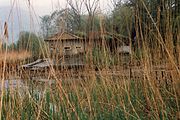
 Le Bourget-du-Lac, with the Lac du Bourget, , and Chambéry Airport | |
 Coat of arms | |
show Location of Le Bourget-du-Lac | |
 Le Bourget-du-Lac | |
| Coordinates: 45°38′44″N 5°51′33″E / 45.6456°N 05.8591°ECoordinates: 45°38′44″N 5°51′33″E / 45.6456°N 05.8591°E | |
| Country | France |
| Region | Auvergne-Rhône-Alpes |
| Department | Savoie |
| Arrondissement | Chambéry |
| Canton | La Motte-Servolex |
| Intercommunality | CA Grand Lac |
| Government | |
| • Mayor (2020–2026) | Nicolas Mercat |
| Area 1 | 20.05 km2 (7.74 sq mi) |
| Population (Jan. 2018)[1] | 5,018 |
| • Density | 250/km2 (650/sq mi) |
| Time zone | UTC+01:00 (CET) |
| • Summer (DST) | UTC+02:00 (CEST) |
| INSEE/Postal code | 73051 /73370 |
| Elevation | 226–1,496 m (741–4,908 ft) (avg. 241 m or 791 ft) |
| Website | www.lebourgetdulac.fr |
| 1 French Land Register data, which excludes lakes, ponds, glaciers > 1 km2 (0.386 sq mi or 247 acres) and river estuaries. | |


Le Bourget-du-Lac (French pronunciation: [lə buʁʒɛ dy lak], literally Le Bourget of the Lake) or Arpitan: Le Borgèt-du-Lèc[1] is a commune in the Savoie department in the Auvergne-Rhône-Alpes region in eastern/south-eastern France.
It lies near the Lac du Bourget and 12 km (7.5 mi) from Chambéry.

Climate[]
Le Bourget-du-Lac is right on the boundary between a mid-latitude, four seasons humid subtropical climate (Cfa) and an oceanic climate (Cfb) under the Köppen system. In spite of this, it is highly influenced by its interior position within France, near several mountain ranges, resulting in quite hot summers and winters with frequent temperatures below freezing, especially at night. Convective rainfall is frequent for much of the year, rendering high precipitation/day quotas. The nearest weather station is located at Chambéry Airport, 3 km east of the town.
| hideClimate data for Chambéry Airport, Savoie, France (1981–2010 averages) | |||||||||||||
|---|---|---|---|---|---|---|---|---|---|---|---|---|---|
| Month | Jan | Feb | Mar | Apr | May | Jun | Jul | Aug | Sep | Oct | Nov | Dec | Year |
| Record high °C (°F) | 17.9 (64.2) |
20.5 (68.9) |
25.1 (77.2) |
29.5 (85.1) |
32.7 (90.9) |
36.1 (97.0) |
38.8 (101.8) |
38.8 (101.8) |
32.0 (89.6) |
29.0 (84.2) |
23.3 (73.9) |
22.7 (72.9) |
38.8 (101.8) |
| Average high °C (°F) | 5.8 (42.4) |
7.9 (46.2) |
12.6 (54.7) |
16.3 (61.3) |
20.8 (69.4) |
24.6 (76.3) |
27.4 (81.3) |
26.6 (79.9) |
22.0 (71.6) |
16.7 (62.1) |
10.1 (50.2) |
6.4 (43.5) |
16.4 (61.6) |
| Daily mean °C (°F) | 2.2 (36.0) |
3.6 (38.5) |
7.4 (45.3) |
10.7 (51.3) |
15.2 (59.4) |
18.7 (65.7) |
21.0 (69.8) |
20.4 (68.7) |
16.5 (61.7) |
12.1 (53.8) |
6.3 (43.3) |
3.1 (37.6) |
11.4 (52.6) |
| Average low °C (°F) | −1.4 (29.5) |
−0.7 (30.7) |
2.1 (35.8) |
5.1 (41.2) |
9.7 (49.5) |
12.8 (55.0) |
14.7 (58.5) |
14.2 (57.6) |
11.0 (51.8) |
7.4 (45.3) |
2.5 (36.5) |
−0.2 (31.6) |
6.4 (43.6) |
| Record low °C (°F) | −19.0 (−2.2) |
−14.4 (6.1) |
−10.3 (13.5) |
−4.6 (23.7) |
−1.4 (29.5) |
2.8 (37.0) |
5.4 (41.7) |
5.0 (41.0) |
1.0 (33.8) |
−4.3 (24.3) |
−10.8 (12.6) |
−13.5 (7.7) |
−19.0 (−2.2) |
| Average precipitation mm (inches) | 102.6 (4.04) |
91.5 (3.60) |
100.0 (3.94) |
92.2 (3.63) |
104.2 (4.10) |
94.8 (3.73) |
86.6 (3.41) |
91.7 (3.61) |
111.8 (4.40) |
122.6 (4.83) |
105.0 (4.13) |
118.0 (4.65) |
1,221 (48.07) |
| Average precipitation days | 9.8 | 8.2 | 10.4 | 10.3 | 11.5 | 9.7 | 7.9 | 8.9 | 8.6 | 10.8 | 10.0 | 10.5 | 116.6 |
| Average snowy days | 5.4 | 4.6 | 2.2 | 1.2 | 0.0 | 0.0 | 0.0 | 0.0 | 0.0 | 0.0 | 1.7 | 3.2 | 18.3 |
| Mean monthly sunshine hours | 77.7 | 104.4 | 156.7 | 172.8 | 202.5 | 234.0 | 260.1 | 232.5 | 176.3 | 121.4 | 71.2 | 60.6 | 1,870.2 |
| Source 1: Météo France | |||||||||||||
| Source 2: Infoclimat [2] | |||||||||||||
See also[]
References[]
- ^ "Populations légales 2018". INSEE. 28 December 2020.
External links[]
| Wikimedia Commons has media related to Le Bourget-du-Lac. |
| show Authority control |
|---|
- Le Bourget-du-Lac
- Communes of Savoie