Le Grand-Serre
Le Grand-Serre | |
|---|---|
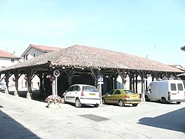 Medieval hall | |
show Location of Le Grand-Serre | |
 Le Grand-Serre | |
| Coordinates: 45°16′14″N 5°06′14″E / 45.2706°N 5.1039°ECoordinates: 45°16′14″N 5°06′14″E / 45.2706°N 5.1039°E | |
| Country | France |
| Region | Auvergne-Rhône-Alpes |
| Department | Drôme |
| Arrondissement | Valence |
| Canton | Drôme des collines |
| Government | |
| • Mayor (2020–2026) | Agnès Genthon |
| Area 1 | 24.74 km2 (9.55 sq mi) |
| Population (Jan. 2018)[1] | 914 |
| • Density | 37/km2 (96/sq mi) |
| Time zone | UTC+01:00 (CET) |
| • Summer (DST) | UTC+02:00 (CEST) |
| INSEE/Postal code | 26143 /26530 |
| Elevation | 329–519 m (1,079–1,703 ft) (avg. 480 m or 1,570 ft) |
| 1 French Land Register data, which excludes lakes, ponds, glaciers > 1 km2 (0.386 sq mi or 247 acres) and river estuaries. | |


Le Grand-Serre (French pronunciation: [lə ɡʁɑ̃ sɛʁ]) is a commune in the Drôme department in southeastern France.
Geography[]
The Galaure flows west through the northern part of the commune, then forms part of its north-western border.
The nearest communes are Marcollin and Saint Clair sur Galaure.
Population[]
| Year | Pop. | ±% |
|---|---|---|
| 1911 | 1,385 | — |
| 1962 | 773 | −44.2% |
| 1968 | 800 | +3.5% |
| 1975 | 702 | −12.3% |
| 1982 | 721 | +2.7% |
| 1990 | 722 | +0.1% |
| 1999 | 735 | +1.8% |
| 2008 | 793 | +7.9% |
Education[]
2 schools are located in the commune, a primary school and a high school.
Events[]
- Each year during summer is organized a party in the village called "La Vogue". Every village in Drôme does his own party that lasts 2 or 3 days.
See also[]
References[]
- ^ "Populations légales 2018". INSEE. 28 December 2020.
| Wikimedia Commons has media related to Le Grand-Serre. |
| show Authority control |
|---|
This Drôme geographical article is a stub. You can help Wikipedia by . |
Categories:
- Communes of Drôme
- Drôme geography stubs