Les Nouillers
show This article may be expanded with text translated from the corresponding article in French. (December 2008) Click [show] for important translation instructions. |
Les Nouillers | |
|---|---|
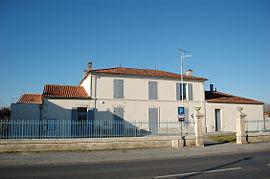 Town hall | |
show Location of Les Nouillers | |
 Les Nouillers | |
| Coordinates: 45°55′56″N 0°39′45″W / 45.9322°N 0.6625°WCoordinates: 45°55′56″N 0°39′45″W / 45.9322°N 0.6625°W | |
| Country | France |
| Region | Nouvelle-Aquitaine |
| Department | Charente-Maritime |
| Arrondissement | Saint-Jean-d'Angély |
| Canton | Saint-Jean-d'Angély |
| Government | |
| • Mayor (2020–2026) | Stéphane Ardoin[1] |
| Area 1 | 24.15 km2 (9.32 sq mi) |
| Population (Jan. 2018)[2] | 712 |
| • Density | 29/km2 (76/sq mi) |
| Time zone | UTC+01:00 (CET) |
| • Summer (DST) | UTC+02:00 (CEST) |
| INSEE/Postal code | 17266 /17380 |
| Elevation | 2–64 m (6.6–210.0 ft) (avg. 48 m or 157 ft) |
| 1 French Land Register data, which excludes lakes, ponds, glaciers > 1 km2 (0.386 sq mi or 247 acres) and river estuaries. | |


Les Nouillers is a commune in the Charente-Maritime department in the Nouvelle-Aquitaine region in southwestern France.
Geography[]
The river Boutonne forms all of the commune's northern border.
Population[]
| Year | Pop. | ±% |
|---|---|---|
| 1962 | 544 | — |
| 1968 | 593 | +9.0% |
| 1975 | 534 | −9.9% |
| 1982 | 618 | +15.7% |
| 1990 | 607 | −1.8% |
| 1999 | 611 | +0.7% |
| 2008 | 626 | +2.5% |
Sights[]
- The Chateau of Nouillers built in the 16th century
See also[]
References[]
- ^ "Répertoire national des élus: les maires". data.gouv.fr, Plateforme ouverte des données publiques françaises (in French). 2 December 2020.
- ^ "Populations légales 2018". INSEE. 28 December 2020.
External links[]
| Wikimedia Commons has media related to Les Nouillers. |
This Charente-Maritime geographical article is a stub. You can help Wikipedia by . |
Categories:
- Communes of Charente-Maritime
- Charente-Maritime geography stubs