List of Marine Protected Areas of Italy
This list is of the Marine Protected Areas (Italian: aree marine protette) of Italy. As of the most recent Official list of natural protected areas [it], decreed on 27 April 2010 and published in the official gazzette on 31 May 2010 by the Ministry for Environment, Land and Sea Protection, there were twenty-seven such marine protected areas, and a further two "Submerged Parks" (Italian: parchi sommersi); in 2018, two new marine protected areas were created. Typically subdivided into Zones A, B, and C, each affording a different level of protection, these areas help safeguard in total some 228,000 hectares (2,280 km2) of the seas around Italy as well as some 700 kilometres (430 mi) of its coastline. The Ligurian Sea Cetacean Sanctuary is not included in these figures.[1][2][3] While some stakeholders have opposed such measures, fearing the impact on short-term economic exploitation, a study of the alternatives at Portofino suggested that steps at protection might offer not only environmental benefits but also the concomitant potential of enhanced long-term usufruct.[4]
List of Marine Protected Areas[]


List of Submerged Parks[]
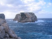
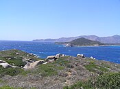
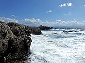
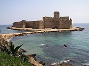
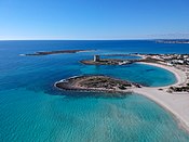
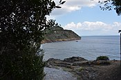
| Name | Image | Region | Area (km2) |
Coast (km) |
Established | Coordinates | EUAP Code | Reference |
|---|---|---|---|---|---|---|---|---|
| Baia | 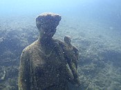 |
Campania | 1.77 | 3.72 | 2002 | 40°49′19″N 14°04′39″E / 40.8219°N 14.0774°E | EUAP0849 | [30] |
| Gaiola |  |
Campania | 0.41 | 1.99 | 2002 | 40°47′31″N 14°11′13″E / 40.7919°N 14.1869°E | EUAP0850 | [31] |
See also[]
| Wikimedia Commons has media related to Marine protected areas in Italy. |
- Conservation in Italy
- List of National Parks of Italy
- List of Regional Parks of Italy
References[]
- ^ "Aree marine istituite" (in Italian). Ministry for Environment, Land and Sea Protection. 10 August 2013. Retrieved 18 December 2021.
- ^ "Elenco ufficiale delle aree naturali protette" (in Italian). Ministry for Environment, Land and Sea Protection. 31 May 2010. Retrieved 18 December 2021.
- ^ "Elenco ufficiale aree protette (EUAP)" (in Italian). Europa. Retrieved 18 December 2021.
- ^ Salmona, Paola; Verardi, Debora (2001). "The marine protected area of Portofino, Italy: a difficult balance". Ocean & Coastal Management. Elsevier. 44 (1): 39–60. doi:10.1016/S0964-5691(00)00084-3.
External links[]
- (in Italian) Marine Protected Areas
- (in Italian) Official list of protected areas

- Protected areas of Italy
- Marine protected areas