Loucrup
show This article may be expanded with text translated from the corresponding article in French. (July 2014) Click [show] for important translation instructions. |
Loucrup | |
|---|---|
 The village of Loucrup | |
 Coat of arms | |
show Location of Loucrup | |
 Loucrup | |
| Coordinates: 43°07′15″N 0°04′15″E / 43.1208°N 0.0708°ECoordinates: 43°07′15″N 0°04′15″E / 43.1208°N 0.0708°E | |
| Country | France |
| Region | Occitanie |
| Department | Hautes-Pyrénées |
| Arrondissement | Tarbes |
| Canton | Ossun |
| Intercommunality | CA Tarbes-Lourdes-Pyrénées |
| Government | |
| • Mayor (2020–2026) | Jean-François Dron[1] |
| Area 1 | 3.62 km2 (1.40 sq mi) |
| Population (Jan. 2018)[2] | 234 |
| • Density | 65/km2 (170/sq mi) |
| Time zone | UTC+01:00 (CET) |
| • Summer (DST) | UTC+02:00 (CEST) |
| INSEE/Postal code | 65281 /65200 |
| Elevation | 397–588 m (1,302–1,929 ft) (avg. 542 m or 1,778 ft) |
| 1 French Land Register data, which excludes lakes, ponds, glaciers > 1 km2 (0.386 sq mi or 247 acres) and river estuaries. | |


Loucrup is a commune in the Hautes-Pyrénées department in south-western France.
Sight and monuments[]
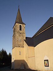
Saint-Martin Church
- Saint-Martin Church (19th century)
- Roman oppidum at the sources of the Aube on the Toulouse-Dax Roman road
- Medieval castle now disappeared that was on the road to Layrisse
- Former station on the Campan-Lourdes tramway line that operated from 1914 to 1932 ()
- viewpoint over the Pyrénées
- Source of the Aube, a tributary of the Échez
- Tourist route between Bagnères-de-Bigorre and Lourdes
People linked to the commune[]
- (born 1851 in Loucrup; died 1926 in Beaudéan) was a French historian. He wrote numerous works on the history of the Hautes-Pyrénées.
See also[]
References[]
- ^ "Répertoire national des élus: les maires". data.gouv.fr, Plateforme ouverte des données publiques françaises (in French). 2 December 2020.
- ^ "Populations légales 2018". INSEE. 28 December 2020.
| Wikimedia Commons has media related to Loucrup. |
This Hautes-Pyrénées geographical article is a stub. You can help Wikipedia by . |
Categories:
- Communes of Hautes-Pyrénées
- Hautes-Pyrénées geography stubs