Louit
Louit | |
|---|---|
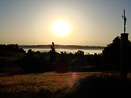 A view of the village in the morning mist | |
 Coat of arms | |
show Location of Louit | |
 Louit | |
| Coordinates: 43°18′13″N 0°09′22″E / 43.3036°N 0.1561°ECoordinates: 43°18′13″N 0°09′22″E / 43.3036°N 0.1561°E | |
| Country | France |
| Region | Occitanie |
| Department | Hautes-Pyrénées |
| Arrondissement | Tarbes |
| Canton | Les Coteaux |
| Intercommunality | Coteaux du Val-d'Arros |
| Government | |
| • Mayor (2020–2026) | André Trinc[1] |
| Area 1 | 5.04 km2 (1.95 sq mi) |
| Population (Jan. 2018)[2] | 192 |
| • Density | 38/km2 (99/sq mi) |
| Time zone | UTC+01:00 (CET) |
| • Summer (DST) | UTC+02:00 (CEST) |
| INSEE/Postal code | 65285 /65350 |
| Elevation | 240–353 m (787–1,158 ft) (avg. 258 m or 846 ft) |
| 1 French Land Register data, which excludes lakes, ponds, glaciers > 1 km2 (0.386 sq mi or 247 acres) and river estuaries. | |


Louit is a commune in the Hautes-Pyrénées department in south-western France.
See also[]
References[]
- ^ "Répertoire national des élus: les maires". data.gouv.fr, Plateforme ouverte des données publiques françaises (in French). 2 December 2020.
- ^ "Populations légales 2018". INSEE. 28 December 2020.
| Wikimedia Commons has media related to Louit. |
This Hautes-Pyrénées geographical article is a stub. You can help Wikipedia by . |
Categories:
- Communes of Hautes-Pyrénées
- Hautes-Pyrénées geography stubs