Malita, Davao Occidental
This article needs additional citations for verification. (May 2014) |
Malita | |
|---|---|
Municipality | |
| Municipality of Malita | |
 Hilltop view of Malita | |
 Seal | |
Nickname(s):
| |
| Motto(s): Angat Malita! | |
 Map of Davao Occidental with Malita highlighted | |
show OpenStreetMap | |
 Malita Location within the Philippines | |
| Coordinates: 6°24′N 125°36′E / 6.4°N 125.6°ECoordinates: 6°24′N 125°36′E / 6.4°N 125.6°E | |
| Country | Philippines |
| Region | Davao Region |
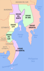
| Province | Davao Occidental |
| District | Lone district |
| Founded | November 17, 1937 |
| Barangays | 30 (see Barangays) |
| Government | |
| • Type | Sangguniang Bayan |
| • Mayor | Bradly L. Bautista |
| • Vice Mayor | Estefanie B. Dumama |
| • Representative | Lorna Bautista-Bandigan |
| • Municipal Council | show
Members |
| • Electorate | 67,286 voters (2019) |
| Area | |
| • Total | 883.37 km2 (341.07 sq mi) |
| Elevation | 197 m (646 ft) |
| Highest elevation | 1,786 m (5,860 ft) |
| Lowest elevation | 0 m (0 ft) |
| Population (2020 census) [3] | |
| • Total | 118,197 |
| • Density | 130/km2 (350/sq mi) |
| • Households | 28,204 |
| Economy | |
| • Income class | 1st municipal income class |
| • Poverty incidence | 57.26% (2015)[4] |
| • Revenue | ₱304,303,708.87 (2016) |
| Service provider | |
| • Electricity | Davao del Sur Electric Cooperative (DASURECO) |
| Time zone | UTC+8 (PST) |
| ZIP code | 8012 |
| PSGC | |
| IDD : area code | +63 (0)82 |
| Climate type | tropical rainforest climate |
| Native languages | Davawenyo Cebuano Kalagan Tagalog |
| Website | www |


Malita, officially the Municipality of Malita (Cebuano: Lungsod sa Malita; Filipino: Bayan ng Malita), is a 1st class municipality and capital of the province of Davao Occidental, Philippines. According to the 2020 census, it has a population of 118,197 people. [3]
Malita is known for various cultural arts and heritage of its people and tribes. Gaginaway Festival is celebrated annually every full moon on the month of November and Araw ng Malita is also celebrated annually on November 17.
Etymology[]
According to folk etymology, the name "Malita" is derived from the Spanish word "maleta" which means suitcase. It is said that purportedly Don Mariano Peralta, a retired veteran of the Spanish–American War who ventured to the place, decided to live on the vast, fertile plain across the river. One day while bodily fording the deep and swift river with his suitcase and other belongings in hand, the force of the current overwhelmed his perilous balance and got swept by the water consequently losing his grip on the suitcase. His frantic shouts of "maleta, maleta" attracted the attention of the bathing natives who after realizing the situation promptly responded and retrieved the vanishing to settle as Malita. How it came to its present spelling and usage maybe attributed to the natives’ prevalent use of suitcase. Hardly forgetting the shouts of Peralta, the natives later thought the word referred to the land he intended long 'e' sound for the vowels 'i' and 'e'.
History[]
Malita is the oldest community in the province. Malita's existence dates back scores of years before its formal creation as municipality on November 17, 1936. Records show that Malita must have existed long before the passage of the Philippine Commission Act, the Laws of the Moro Province that mentioned Malita in Section 1 of Act No. 164 dated December 10, 1904. Through the said Act it is presumed that it existed as a barrio of Santa Cruz long before the coming of the Americans to Davao. Executive Order No. 64 issued by President Manuel L. Quezon officially created Malita into a municipality. Marcelino Maruya, from whom the town of Don Marcelino was named after, was the first appointed municipal mayor.
Waves of migrants from the Visayan islands, most of whom hail from Cebu, came on what is now Malita long before it became a municipality. They were later followed by immigrants from Luzon. Even after the destruction brought by World War II by the belligerents, there are still waves of migrants towards Malita and other parts of then-Davao province. This increased its population until it later became the most populous municipality in the province.
Geography[]
Climate[]
| hideClimate data for Malita, Davao Occidental | |||||||||||||
|---|---|---|---|---|---|---|---|---|---|---|---|---|---|
| Month | Jan | Feb | Mar | Apr | May | Jun | Jul | Aug | Sep | Oct | Nov | Dec | Year |
| Average high °C (°F) | 30 (86) |
30 (86) |
31 (88) |
32 (90) |
31 (88) |
29 (84) |
29 (84) |
30 (86) |
30 (86) |
30 (86) |
30 (86) |
30 (86) |
30 (86) |
| Average low °C (°F) | 23 (73) |
23 (73) |
23 (73) |
24 (75) |
24 (75) |
24 (75) |
24 (75) |
24 (75) |
24 (75) |
24 (75) |
24 (75) |
23 (73) |
24 (74) |
| Average precipitation mm (inches) | 38 (1.5) |
29 (1.1) |
37 (1.5) |
45 (1.8) |
102 (4.0) |
166 (6.5) |
179 (7.0) |
176 (6.9) |
157 (6.2) |
133 (5.2) |
86 (3.4) |
46 (1.8) |
1,194 (46.9) |
| Average rainy days | 8.1 | 7.0 | 8.9 | 11.1 | 22.1 | 26.1 | 26.7 | 26.5 | 25.6 | 25.5 | 19.5 | 11.7 | 218.8 |
| Source: Meteoblue [5] | |||||||||||||
Barangays[]

The municipality of Malita is subdivided into 30 barangays:[6]
- Bito
- Bolila
- Buhangin
- Culaman
- Datu Danwata
- Demoloc
- Felis
- Fishing Village
- Kibalatong
- Kidalapong
- Kilalag
- Kinangan
- Lacaron
- Lagumit
- Lais
- Little Baguio
- Macol
- Mana
- Manuel Peralta
- New Argao
- Pangian
- Pinalpalan
- Poblacion
- Sangay
- Talogoy
- Tical
- Ticulon
- Tingolo
- Tubalan
- Pangaleon
Demographics[]
| Year | Pop. | ±% p.a. |
|---|---|---|
| 1918 | 17,050 | — |
| 1939 | 30,775 | +2.85% |
| 1948 | 27,744 | −1.15% |
| 1960 | 28,228 | +0.14% |
| 1970 | 46,060 | +5.01% |
| 1975 | 64,898 | +7.12% |
| 1980 | 60,638 | −1.35% |
| 1990 | 82,786 | +3.16% |
| 1995 | 83,457 | +0.15% |
| 2000 | 100,000 | +3.95% |
| 2007 | 106,135 | +0.82% |
| 2010 | 109,568 | +1.17% |
| 2015 | 117,746 | +1.38% |
| 2020 | 118,197 | +0.08% |
| Source: Philippine Statistics Authority [7] [8] [9][10] | ||
Economy[]
| Poverty Incidence of Malita | |
| Source: Philippine Statistics Authority[11][12][13][14][15][16] | |
The municipality is the main economic center of Davao Occidental province. Agriculture and fishery is the main industry of the municipality. Being far from other major urban centers in its vicinity like Davao City, Digos City, and Gen. Santos City, and although only a town, Malita also serves as the major urban center of the province. However, as economic activity in the town continues its rapid growth, Malita will soon become the province's first component city for years to come.
Local government[]

Municipal officials (2013-2016):
- Congressman: Franklin Bautista (2nd District of Davao del Sur)
- Mayor: Benjamin Bautista, Jr.
- Vice Mayor: Bradly Bautista
- Councilors:
- Estefanie T. Bautista
- Zaldy S. Lataban
- Marianela C. Malinao
- Ali G. Colina, Jr.
- Artemio J. Peralta
- Paulito M. Montero
- Jimmy L. Danwata
- Raymund G. Danwata
Education[]
Tertiary[]
- Southern Philippines Agri-Business and Marine and Aquatic School of Technology - Poblacion, Malita (Main Campus) and Buhangin, Malita (Buhangin Campus)
- Adventure College of Malita, Inc.
- Seng Pek Chuan Academy, Inc.
- Don Juan Technical Academy of Davao, Inc. (Malita Branch)
Secondary[]
- B'laan National High School
- Benjamin V. Bautista Sr. Special High School
- Demoloc Valley National High School
- Fishing Village Comprehensive National High School
- Holy Cross of Malita, Inc.
- Mariano Peralta National High School (Campuses in barangays: Poblacion, Sangay, Manuel Peralta, Datu Danwata, Talogoy, Pangian, and New Argao)
- Ticulon National High School
- Tubalan Comprehensive National High School
References[]
- ^ Municipality of Malita | (DILG)
- ^ "2015 Census of Population, Report No. 3 – Population, Land Area, and Population Density" (PDF). Philippine Statistics Authority. Quezon City, Philippines. August 2016. ISSN 0117-1453. Archived (PDF) from the original on May 25, 2021. Retrieved July 16, 2021.
- ^ Jump up to: a b Census of Population (2020). "Region XI (Davao Region)". Total Population by Province, City, Municipality and Barangay. PSA. Retrieved 8 July 2021.
- ^ https://psa.gov.ph/sites/default/files/City%20and%20Municipal-level%20Small%20Area%20Poverty%20Estimates_%202009%2C%202012%20and%202015_0.xlsx; publication date: 10 July 2019; publisher: Philippine Statistics Authority.
- ^ "Malita: Average Temperatures and Rainfall". Meteoblue. Retrieved 28 January 2020.
- ^ "Municipality/City: Malita" Archived 2013-10-30 at the Wayback Machine. Philippine Standard Geographic Code Interactive. Retrieved on 2013-11-03.
- ^ Census of Population (2015). "Region XI (Davao Region)". Total Population by Province, City, Municipality and Barangay. PSA. Retrieved 20 June 2016.
- ^ Census of Population and Housing (2010). "Region XI (Davao Region)". Total Population by Province, City, Municipality and Barangay. NSO. Retrieved 29 June 2016.
- ^ Censuses of Population (1903–2007). "Region XI (Davao Region)". Table 1. Population Enumerated in Various Censuses by Province/Highly Urbanized City: 1903 to 2007. NSO.
- ^ "Province of Davao del Sur". Municipality Population Data. Local Water Utilities Administration Research Division. Retrieved 17 December 2016.
- ^ "Poverty incidence (PI):". Philippine Statistics Authority. Retrieved 28 December 2020.
- ^ https://psa.gov.ph/sites/default/files/NSCB_LocalPovertyPhilippines_0.pdf; publication date: 29 November 2005; publisher: Philippine Statistics Authority.
- ^ https://psa.gov.ph/sites/default/files/2003%20SAE%20of%20poverty%20%28Full%20Report%29_1.pdf; publication date: 23 March 2009; publisher: Philippine Statistics Authority.
- ^ https://psa.gov.ph/sites/default/files/2006%20and%202009%20City%20and%20Municipal%20Level%20Poverty%20Estimates_0_1.pdf; publication date: 3 August 2012; publisher: Philippine Statistics Authority.
- ^ https://psa.gov.ph/sites/default/files/2012%20Municipal%20and%20City%20Level%20Poverty%20Estima7tes%20Publication%20%281%29.pdf; publication date: 31 May 2016; publisher: Philippine Statistics Authority.
- ^ https://psa.gov.ph/sites/default/files/City%20and%20Municipal-level%20Small%20Area%20Poverty%20Estimates_%202009%2C%202012%20and%202015_0.xlsx; publication date: 10 July 2019; publisher: Philippine Statistics Authority.
External links[]
| Wikimedia Commons has media related to Malita, Davao Occidental. |
- Malita Profile at PhilAtlas.com
- Philippine Standard Geographic Code
- Philippine Census Information
- Local Governance Performance Management System
| show Places adjacent to Malita, Davao Occidental |
|---|
| show |
|---|
- Municipalities of Davao Occidental
- Provincial capitals of the Philippines