Basco, Batanes
Basco | |
|---|---|
Municipality | |
| Municipality of Basco | |
 Basco Municipal Hall | |
 Flag  Seal | |
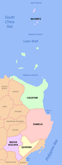
 Map of Batanes with Basco highlighted | |
show OpenStreetMap | |
 Basco Location in the Philippines | |
| Coordinates: 20°27′N 121°58′E / 20.45°N 121.97°ECoordinates: 20°27′N 121°58′E / 20.45°N 121.97°E | |
| Country | Philippines |
| Region | Cagayan Valley |
| Province | Batanes |
| District | Lone district |
| Barangays | 6 (see Barangays) |
| Government | |
| • Type | Sangguniang Bayan |
| • Mayor | Demetrius Paul C. Narag |
| • Vice Mayor | German A. Caccam |
| • Representative | Ciriaco B. Gato Jr. |
| • Municipal Council | show
Members |
| • Electorate | 5,535 voters (2019) |
| Area | |
| • Total | 49.46 km2 (19.10 sq mi) |
| Elevation | 23.4 m (76.8 ft) |
| Highest elevation | 1,013 m (3,323 ft) |
| Lowest elevation | 0 m (0 ft) |
| Population (2020 census) [4] | |
| • Total | 9,517 |
| • Density | 190/km2 (500/sq mi) |
| • Households | 2,309 |
| Economy | |
| • Income class | 5th municipal income class |
| • Poverty incidence | 14.40% (2015)[5] |
| • Revenue | ₱54,122,632.74 (2016) |
| Service provider | |
| • Electricity | Batanes Electric Cooperative (BATANELCO) |
| Time zone | UTC+8 (PST) |
| ZIP code | 3900 |
| PSGC | |
| IDD : area code | +63 (0)78 |
| Climate type | tropical monsoon climate |
| Native languages | Ivatan Tagalog Ilocano |

Basco, officially the Municipality of Basco (Ivatan: Kavahayan nu Basco; Tagalog: Bayan ng Basco), is a 5th class municipality and capital of the province of Batanes, Philippines. According to the 2020 census, it has a population of 9,517 people. [4]
Basco is located on Batan Island, the second largest among the Batanes Islands, the northernmost islands of the Philippines. The town has a domestic airport, Basco Airport, serving flights from Manila and Baguio.[citation needed]
The town is named after Capitán General José Basco, who led the pacification and conquest of the islands during his term as Governor-General.
The Basco Lighthouse is one of the landmarks.
Geography[]
Basco is located at 20°27′N 121°58′E / 20.45°N 121.97°E.
According to the Philippine Statistics Authority, the municipality has a land area of 49.46 square kilometres (19.10 sq mi) [6] constituting 22.58% of the 219.01-square-kilometre- (84.56 sq mi) total area of Batanes.
Barangays[]

Basco is politically subdivided into 6 barangays.[7]
The sitio of Diptan was converted into a barrio, known as San Antonio, in 1955.[8] Also in the same year, the sitios of Coral, Hago, Tuva, Diojango, Canalaan, Honaan and Dimnalamay were converted into the barrio of San Joaquin.[9]
| PSGC | Barangay | Population | ±% p.a. | |||
|---|---|---|---|---|---|---|
| 2020 [4] | 2010 [10] | |||||
| 020901005 | Chanarian | 3.8% | 360 | 334 | 0.73% | |
| 020901001 | Ihubok II (Kayvaluganan) | 24.6% | 2,344 | 2,103 | 1.05% | |
| 020901002 | Ihubok I (Kaychanarianan) | 19.1% | 1,822 | 1,665 | 0.87% | |
| 020901006 | Kayhuvokan | 17.9% | 1,700 | 1,641 | 0.34% | |
| 020901003 | San Antonio | 20.7% | 1,969 | 1,772 | 1.02% | |
| 020901004 | San Joaquin | 4.0% | 384 | 392 | −0.20% | |
| Total | 9,517 | 7,907 | 1.81% | |||
Climate[]
| hideClimate data for Basco, Philippines (2001–2010, extremes 1903–2012) | |||||||||||||
|---|---|---|---|---|---|---|---|---|---|---|---|---|---|
| Month | Jan | Feb | Mar | Apr | May | Jun | Jul | Aug | Sep | Oct | Nov | Dec | Year |
| Record high °C (°F) | 31.8 (89.2) |
32.6 (90.7) |
34.8 (94.6) |
35.5 (95.9) |
36.4 (97.5) |
36.5 (97.7) |
37.6 (99.7) |
37.2 (99.0) |
36.1 (97.0) |
35.9 (96.6) |
32.9 (91.2) |
32.8 (91.0) |
37.6 (99.7) |
| Average high °C (°F) | 24.5 (76.1) |
25.4 (77.7) |
26.5 (79.7) |
28.6 (83.5) |
29.9 (85.8) |
30.2 (86.4) |
30.5 (86.9) |
30.2 (86.4) |
29.7 (85.5) |
28.8 (83.8) |
27.0 (80.6) |
25.2 (77.4) |
28.0 (82.4) |
| Daily mean °C (°F) | 21.6 (70.9) |
22.4 (72.3) |
23.3 (73.9) |
25.4 (77.7) |
26.8 (80.2) |
27.4 (81.3) |
27.6 (81.7) |
27.4 (81.3) |
26.8 (80.2) |
25.7 (78.3) |
24.1 (75.4) |
22.1 (71.8) |
25.1 (77.2) |
| Average low °C (°F) | 18.7 (65.7) |
19.4 (66.9) |
20.1 (68.2) |
22.3 (72.1) |
23.6 (74.5) |
24.5 (76.1) |
24.7 (76.5) |
24.5 (76.1) |
23.9 (75.0) |
22.7 (72.9) |
21.3 (70.3) |
18.9 (66.0) |
22.1 (71.8) |
| Record low °C (°F) | 11.4 (52.5) |
12.0 (53.6) |
13.0 (55.4) |
15.6 (60.1) |
17.2 (63.0) |
19.0 (66.2) |
18.0 (64.4) |
15.0 (59.0) |
17.6 (63.7) |
17.4 (63.3) |
14.5 (58.1) |
11.5 (52.7) |
11.4 (52.5) |
| Average rainfall mm (inches) | 130.1 (5.12) |
122.1 (4.81) |
58.3 (2.30) |
47.6 (1.87) |
224.6 (8.84) |
234.6 (9.24) |
223.5 (8.80) |
304.6 (11.99) |
350.8 (13.81) |
281.2 (11.07) |
272.0 (10.71) |
96.8 (3.81) |
2,346.2 (92.37) |
| Average rainy days (≥ 0.1 mm) | 17 | 12 | 10 | 6 | 12 | 14 | 16 | 19 | 20 | 18 | 19 | 14 | 177 |
| Average relative humidity (%) | 78 | 79 | 79 | 79 | 81 | 83 | 82 | 83 | 84 | 80 | 80 | 76 | 80 |
| Source: PAGASA[11][12] | |||||||||||||
Basco has a tropical monsoon climate (Köppen climate classification Am), with slightly cooler temperatures especially during the winter months due to its northerly location compared to other cities down south such as Laoag or Manila. Unlike these two cities whose hottest months are April and May, Basco experiences its warmest temperature during the months of June and July, similar to Taiwan.
Demographics[]
| Year | Pop. | ±% p.a. |
|---|---|---|
| 1903 | 2,347 | — |
| 1918 | 2,338 | −0.03% |
| 1939 | 2,782 | +0.83% |
| 1948 | 3,312 | +1.96% |
| 1960 | 2,868 | −1.19% |
| 1970 | 3,757 | +2.73% |
| 1975 | 3,984 | +1.18% |
| 1980 | 4,341 | +1.73% |
| 1990 | 5,729 | +2.81% |
| 1995 | 5,772 | +0.14% |
| 2000 | 6,717 | +3.30% |
| 2007 | 7,517 | +1.56% |
| 2010 | 7,907 | +1.86% |
| 2015 | 8,579 | +1.57% |
| 2020 | 9,517 | +2.06% |
| Source: Philippine Statistics Authority [13] [10] [14][15] | ||
In the 2020 census, Basco had a population of 9,517. [4] The population density was 190 inhabitants per square kilometre (490/sq mi).
Economy[]
| Poverty Incidence of Basco | |
| Source: Philippine Statistics Authority[16][17][18][19][20][21] | |
Transportation[]
Basco is accessible by air from Manila via Basco Airport. It is served by PAL Express and SKYJET, and via Tuguegarao in Cagayan by Regional Airlines like and Air Republiq (as of January 2013).[citation needed]
Education[]
- Schools
- Basco Central School
- Batanes National Science High School
- Batanes State College
- Chanarian Barrio School
- Diptan Elementary School
- Saint Dominic College
- Tukon Barrio School
- Valugan Barrio School
References[]
- ^ Municipality of Basco | (DILG)
- ^ https://www.philatlas.com/luzon/r02/batanes/basco.html.
- ^ "2015 Census of Population, Report No. 3 – Population, Land Area, and Population Density" (PDF). Philippine Statistics Authority. Quezon City, Philippines. August 2016. ISSN 0117-1453. Archived (PDF) from the original on May 25, 2021. Retrieved July 16, 2021.
- ^ Jump up to: a b c d Census of Population (2020). "Region II (Cagayan Valley)". Total Population by Province, City, Municipality and Barangay. PSA. Retrieved 8 July 2021.
- ^ https://psa.gov.ph/sites/default/files/City%20and%20Municipal-level%20Small%20Area%20Poverty%20Estimates_%202009%2C%202012%20and%202015_0.xlsx; publication date: 10 July 2019; publisher: Philippine Statistics Authority.
- ^ "Province: Batanes". PSGC Interactive. Quezon City, Philippines: Philippine Statistics Authority. Retrieved 12 November 2016.
- ^ "Municipal: Basco, Batanes". PSGC Interactive. Quezon City, Philippines: Philippine Statistics Authority. Retrieved 8 January 2016.
- ^ "Republic Act No. 1332; An Act to Convert the Sitio of Diptan in the Municipality of Basco, Province of Batanes, into a Barrio to Be Known As the Barrio of San Antonio De Padua of Said Municipality". LawPH.com. Archived from the original on 3 May 2012.
- ^ "Republic Act No. 1334; An Act to Convert the Sitios of Coral, Hago, Tuva, Diojango, Canalaan, Honaan and Dimnalamay, into a Barrio to Be Known As the Barrio of San Joaquin, in the Municipality of Basco, Province of Batanes". LawPH.com. Archived from the original on 3 May 2012. Retrieved 19 January 2021.
- ^ Jump up to: a b Census of Population and Housing (2010). "Region II (Cagayan Valley)". Total Population by Province, City, Municipality and Barangay. NSO. Retrieved 29 June 2016.
- ^ "Basco, Batanes Climatological Normal Values". Philippine Atmospheric, Geophysical and Astronomical Services Administration. Archived from the original on 8 October 2018. Retrieved 8 October 2018.
- ^ "Basco, Batanes Climatological Extremes". Philippine Atmospheric, Geophysical and Astronomical Services Administration. Archived from the original on 8 October 2018. Retrieved 8 October 2018.
- ^ Census of Population (2015). "Region II (Cagayan Valley)". Total Population by Province, City, Municipality and Barangay. PSA. Retrieved 20 June 2016.
- ^ Censuses of Population (1903–2007). "Region II (Cagayan Valley)". Table 1. Population Enumerated in Various Censuses by Province/Highly Urbanized City: 1903 to 2007. NSO.
- ^ "Province of Batanes". Municipality Population Data. Local Water Utilities Administration Research Division. Retrieved 17 December 2016.
- ^ "Poverty incidence (PI):". Philippine Statistics Authority. Retrieved 28 December 2020.
- ^ https://psa.gov.ph/sites/default/files/NSCB_LocalPovertyPhilippines_0.pdf; publication date: 29 November 2005; publisher: Philippine Statistics Authority.
- ^ https://psa.gov.ph/sites/default/files/2003%20SAE%20of%20poverty%20%28Full%20Report%29_1.pdf; publication date: 23 March 2009; publisher: Philippine Statistics Authority.
- ^ https://psa.gov.ph/sites/default/files/2006%20and%202009%20City%20and%20Municipal%20Level%20Poverty%20Estimates_0_1.pdf; publication date: 3 August 2012; publisher: Philippine Statistics Authority.
- ^ https://psa.gov.ph/sites/default/files/2012%20Municipal%20and%20City%20Level%20Poverty%20Estima7tes%20Publication%20%281%29.pdf; publication date: 31 May 2016; publisher: Philippine Statistics Authority.
- ^ https://psa.gov.ph/sites/default/files/City%20and%20Municipal-level%20Small%20Area%20Poverty%20Estimates_%202009%2C%202012%20and%202015_0.xlsx; publication date: 10 July 2019; publisher: Philippine Statistics Authority.
External links[]
![]() Media related to Basco, Batanes at Wikimedia Commons
Media related to Basco, Batanes at Wikimedia Commons
| show Places adjacent to Basco, Batanes |
|---|
- Municipalities of Batanes
- Provincial capitals of the Philippines