Montfroc
Montfroc | |
|---|---|
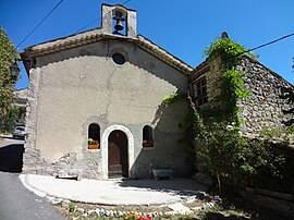 The church in Montfroc | |
show Location of Montfroc | |
 Montfroc | |
| Coordinates: 44°10′33″N 5°38′23″E / 44.1758°N 5.6397°ECoordinates: 44°10′33″N 5°38′23″E / 44.1758°N 5.6397°E | |
| Country | France |
| Region | Auvergne-Rhône-Alpes |
| Department | Drôme |
| Arrondissement | Nyons |
| Canton | Nyons et Baronnies |
| Government | |
| • Mayor (2020–2026) | Jean-Noël Pasero |
| Area 1 | 14.76 km2 (5.70 sq mi) |
| Population (Jan. 2018)[1] | 76 |
| • Density | 5.1/km2 (13/sq mi) |
| Time zone | UTC+01:00 (CET) |
| • Summer (DST) | UTC+02:00 (CEST) |
| INSEE/Postal code | 26200 /26560 |
| Elevation | 732–1,533 m (2,402–5,030 ft) |
| 1 French Land Register data, which excludes lakes, ponds, glaciers > 1 km2 (0.386 sq mi or 247 acres) and river estuaries. | |


Montfroc (French pronunciation: [mɔ̃fʁɔk]) is a commune in the Drôme department in southeastern France.
Population[]
| Year | Pop. | ±% |
|---|---|---|
| 1911 | 247 | — |
| 1962 | 18 | −92.7% |
| 1968 | 44 | +144.4% |
| 1975 | 45 | +2.3% |
| 1982 | 87 | +93.3% |
| 1990 | 71 | −18.4% |
| 1999 | 57 | −19.7% |
| 2008 | 81 | +42.1% |
See also[]
References[]
- ^ "Populations légales 2018". INSEE. 28 December 2020.
| Wikimedia Commons has media related to Montfroc. |
| show Authority control |
|---|
This Drôme geographical article is a stub. You can help Wikipedia by . |
Categories:
- Communes of Drôme
- Drôme geography stubs