Montguyon
Montguyon | |
|---|---|
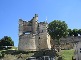 Ruins of the chateau | |
 Coat of arms | |
show Location of Montguyon | |
 Montguyon | |
| Coordinates: 45°12′58″N 0°11′14″W / 45.2161°N 0.1872°WCoordinates: 45°12′58″N 0°11′14″W / 45.2161°N 0.1872°W | |
| Country | France |
| Region | Nouvelle-Aquitaine |
| Department | Charente-Maritime |
| Arrondissement | Jonzac |
| Canton | Les Trois Monts |
| Intercommunality | Haute-Saintonge |
| Government | |
| • Mayor (2020–2026) | Julien Mouchebœuf |
| Area 1 | 18.18 km2 (7.02 sq mi) |
| Population (Jan. 2018)[1] | 1,569 |
| • Density | 86/km2 (220/sq mi) |
| Time zone | UTC+01:00 (CET) |
| • Summer (DST) | UTC+02:00 (CEST) |
| INSEE/Postal code | 17241 /17270 |
| Elevation | 30–121 m (98–397 ft) (avg. 60 m or 200 ft) |
| 1 French Land Register data, which excludes lakes, ponds, glaciers > 1 km2 (0.386 sq mi or 247 acres) and river estuaries. | |


Montguyon (French pronunciation: [mɔ̃ɡɥijɔ̃]) is a commune in the Charente-Maritime department in southwestern France.
Population[]
| Year | Pop. | ±% |
|---|---|---|
| 1793 | 1,450 | — |
| 1800 | 1,298 | −10.5% |
| 1806 | 1,299 | +0.1% |
| 1821 | 1,421 | +9.4% |
| 1831 | 1,471 | +3.5% |
| 1836 | 1,457 | −1.0% |
| 1841 | 1,454 | −0.2% |
| 1846 | 1,415 | −2.7% |
| 1851 | 1,422 | +0.5% |
| 1856 | 1,404 | −1.3% |
| 1861 | 1,513 | +7.8% |
| 1866 | 1,542 | +1.9% |
| 1872 | 1,509 | −2.1% |
| 1876 | 1,534 | +1.7% |
| 1881 | 1,659 | +8.1% |
| 1886 | 1,684 | +1.5% |
| 1891 | 1,650 | −2.0% |
| 1896 | 1,572 | −4.7% |
| 1901 | 1,616 | +2.8% |
| 1906 | 1,674 | +3.6% |
| 1911 | 1,619 | −3.3% |
| 1921 | 1,522 | −6.0% |
| 1926 | 1,537 | +1.0% |
| 1931 | 1,567 | +2.0% |
| 1936 | 1,545 | −1.4% |
| 1946 | 1,467 | −5.0% |
| 1954 | 1,542 | +5.1% |
| 1962 | 1,737 | +12.6% |
| 1968 | 1,841 | +6.0% |
| 1975 | 1,648 | −10.5% |
| 1982 | 1,662 | +0.8% |
| 1990 | 1,647 | −0.9% |
| 1999 | 1,461 | −11.3% |
| 2008 | 1,453 | −0.5% |
See also[]
References[]
- ^ "Populations légales 2018". INSEE. 28 December 2020.
| Wikimedia Commons has media related to Montguyon. |
| show Authority control |
|---|
This Charente-Maritime geographical article is a stub. You can help Wikipedia by . |
Categories:
- Communes of Charente-Maritime
- Charente-Maritime geography stubs