Montvendre
Montvendre | |
|---|---|
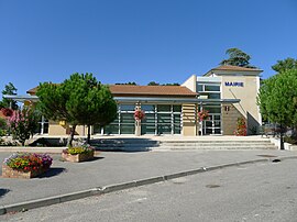 The town hall of Montvendre | |
show Location of Montvendre | |
 Montvendre | |
| Coordinates: 44°52′21″N 5°01′24″E / 44.8725°N 5.0233°ECoordinates: 44°52′21″N 5°01′24″E / 44.8725°N 5.0233°E | |
| Country | France |
| Region | Auvergne-Rhône-Alpes |
| Department | Drôme |
| Arrondissement | Valence |
| Canton | Crest |
| Intercommunality | CA Valence Romans Agglo |
| Government | |
| • Mayor (2020–2026) | Bruno Servian |
| Area 1 | 17.24 km2 (6.66 sq mi) |
| Population (Jan. 2018)[1] | 1,195 |
| • Density | 69/km2 (180/sq mi) |
| Time zone | UTC+01:00 (CET) |
| • Summer (DST) | UTC+02:00 (CEST) |
| INSEE/Postal code | 26212 /26120 |
| Elevation | 157–646 m (515–2,119 ft) (avg. 209 m or 686 ft) |
| 1 French Land Register data, which excludes lakes, ponds, glaciers > 1 km2 (0.386 sq mi or 247 acres) and river estuaries. | |


Montvendre (French pronunciation: [mɔ̃vɑ̃dʁ]) is a commune in the Drôme department in southeastern France.
Population[]
|
|
See also[]
References[]
- ^ "Populations légales 2018". INSEE. 28 December 2020.
| Wikimedia Commons has media related to Montvendre. |
This Drôme geographical article is a stub. You can help Wikipedia by . |
Categories:
- Communes of Drôme
- Drôme geography stubs