Mulsanne
Mulsanne | |
|---|---|
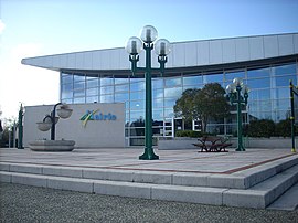 The town hall of Mulsanne | |
show Location of Mulsanne | |
 Mulsanne | |
| Coordinates: 47°54′29″N 0°14′53″E / 47.9081°N 0.2481°ECoordinates: 47°54′29″N 0°14′53″E / 47.9081°N 0.2481°E | |
| Country | France |
| Region | Pays de la Loire |
| Department | Sarthe |
| Arrondissement | Le Mans |
| Canton | Écommoy |
| Intercommunality | Le Mans Métropole |
| Government | |
| • Mayor (2020–2026) | Jean-Yves Lecoq |
| Area 1 | 15.25 km2 (5.89 sq mi) |
| Population (Jan. 2018)[1] | 5,232 |
| • Density | 340/km2 (890/sq mi) |
| Demonym(s) | Mulsannais |
| Time zone | UTC+01:00 (CET) |
| • Summer (DST) | UTC+02:00 (CEST) |
| INSEE/Postal code | 7209213 /72230 |
| Elevation | 44–82 m (144–269 ft) |
| 1 French Land Register data, which excludes lakes, ponds, glaciers > 1 km2 (0.386 sq mi or 247 acres) and river estuaries. | |


Mulsanne (French pronunciation: [mylsan]) is a commune in the Sarthe department in the region of Pays de la Loire in north-western France.[2]
Motor racing[]
The Circuit de la Sarthe, which is used in the sports car endurance race 24 Hours of Le Mans, features the long straight Ligne Droite des Hunaudières leading to Mulsanne, making a tight right hand turn before the entrance of the village itself. The famous straight is often called the Mulsanne Straight in English.[3]
See also[]
- Communes of the Sarthe department
Notes[]
- ^ "Populations légales 2018". INSEE. 28 December 2020.
- ^ INSEE 2015.
- ^ ACO 2015.
References[]
- ACO (25 July 2015), "The legendary spots on the circuit: The Mulsanne Straight", 24 Hours of Le Mans, retrieved 25 July 2015
External links[]
| Wikimedia Commons has media related to Mulsanne. |
- www.mulsanne.fr (in French)
| show Communes of the Sarthe department |
|---|
This Sarthe geographical article is a stub. You can help Wikipedia by . |
Categories:
- Communes of Sarthe
- Sarthe geography stubs