Oğuzlar, Çorum
This article needs additional citations for verification. (December 2009) |
Oğuzlar | |
|---|---|
 Oğuzlar | |
| Coordinates: 40°45′08″N 34°42′17″E / 40.75222°N 34.70472°ECoordinates: 40°45′08″N 34°42′17″E / 40.75222°N 34.70472°E | |
| Country | Turkey |
| Province | Çorum |
| Government | |
| • Mayor | Orhan Ateş (CHP) |
| Area | |
| • District | 301.64 km2 (116.46 sq mi) |
| Population (2012)[2] | |
| • Urban | 3,228 |
| • District | 6,393 |
| • District density | 21/km2 (55/sq mi) |
| Climate | Csb[3] |

Oğuzlar is a district of Çorum Province in the Black Sea region of Turkey. It is located at 68 km from the city of Çorum. The population is 11,724, half of which live in the town of Oğuzlar, and the other half in the villages of the district. The mayor is Orhan Ateş (CHP).
Formerly known as Karabörk Divanı, Karaviran and Karaören, the village was founded in the 13th century by Karadonlu Can Baba, a follower of Sufi mystic Haji Bektash Veli. The name Oğuzlar, after the Oghuz Turks who conquered much of Anatolia, was given in 1990.
Oğuzlar is an agricultural district growing walnuts, hazelnuts and various grains. In recent decades the younger generations have migrated to larger cities in search of jobs and careers.
The town's water supply was put in place in 1973.
References[]
- ^ "Area of regions (including lakes), km²". Regional Statistics Database. Turkish Statistical Institute. 2002. Retrieved 2013-03-05.
- ^ "Population of province/district centers and towns/villages by districts - 2012". Address Based Population Registration System (ABPRS) Database. Turkish Statistical Institute. Retrieved 2013-02-27.
- ^ Oğuzlar Climate-Data.org
Oğuzlar, Çorum in Çorum Province of Turkey | |||||||||||||||||||||||||||
|---|---|---|---|---|---|---|---|---|---|---|---|---|---|---|---|---|---|---|---|---|---|---|---|---|---|---|---|
| Districts | 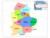 | ||||||||||||||||||||||||||
|
Metropolitan municipalities are bolded. | |||||||||||||||||||||||||||
This geographical article about a location in Çorum Province, Turkey is a stub. You can help Wikipedia by . |
- Populated places in Çorum Province
- Districts of Çorum Province
- Çorum Province geography stubs