Pellerey
From Wikipedia, the free encyclopedia
Commune in Bourgogne-Franche-Comté, France
Pellerey | |
|---|---|
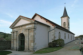 The church in Pellerey | |
 Pellerey  Pellerey | |
Coordinates:  47°30′21″N 4°46′59″E / 47.5058°N 4.7831°E / 47.5058; 4.7831Coordinates: 47°30′21″N 4°46′59″E / 47.5058°N 4.7831°E / 47.5058; 4.7831 47°30′21″N 4°46′59″E / 47.5058°N 4.7831°E / 47.5058; 4.7831Coordinates: 47°30′21″N 4°46′59″E / 47.5058°N 4.7831°E / 47.5058; 4.7831 | |
| Country | France |
| Region | Bourgogne-Franche-Comté |
| Department | Côte-d'Or |
| Arrondissement | Dijon |
| Canton | Is-sur-Tille |
| Intercommunality | Forêts, Seine et Suzon |
| Government | |
| • Mayor (2020–2026) | Nicolas Boucherot[1] |
| Area 1 | 12.44 km2 (4.80 sq mi) |
| Population (Jan. 2018)[2] | 98 |
| • Density | 7.9/km2 (20/sq mi) |
| Time zone | UTC+01:00 (CET) |
| • Summer (DST) | UTC+02:00 (CEST) |
| INSEE/Postal code | 21479 /21440 |
| Elevation | 357–510 m (1,171–1,673 ft) (avg. 377 m or 1,237 ft) |
| 1 French Land Register data, which excludes lakes, ponds, glaciers > 1 km2 (0.386 sq mi or 247 acres) and river estuaries. | |

Pellerey is a commune in the Côte-d'Or department and Bourgogne-Franche-Comté region of eastern France.
Population[]
| Year | Pop. | ±% |
|---|---|---|
| 1946 | 160 | — |
| 1954 | 156 | −2.5% |
| 1962 | 135 | −13.5% |
| 1968 | 117 | −13.3% |
| 1975 | 115 | −1.7% |
| 1982 | 113 | −1.7% |
| 1990 | 106 | −6.2% |
| 1999 | 103 | −2.8% |
| 2008 | 95 | −7.8% |
| 2016 | 104 | +9.5% |
See also[]
References[]
- ^ "Répertoire national des élus: les maires". data.gouv.fr, Plateforme ouverte des données publiques françaises (in French). 2 December 2020.
- ^ "Populations légales 2018". INSEE. 28 December 2020.
| Wikimedia Commons has media related to Pellerey. |
| show | |
|---|---|
|
Retrieved from ""
Categories:
- Communes of Côte-d'Or
- Côte-d'Or geography stubs
Hidden categories:
- CS1 French-language sources (fr)
- Articles with short description
- Short description is different from Wikidata
- Infobox mapframe without OSM relation ID on Wikidata
- Coordinates on Wikidata
- Pages using infobox settlement with image map1 but not image map
- Commons category link from Wikidata
- Articles with BNF identifiers
- All stub articles
- Pages using the Kartographer extension