Roynac
Roynac | |
|---|---|
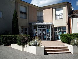 Town hall | |
show Location of Roynac | |
 Roynac | |
| Coordinates: 44°38′37″N 4°56′26″E / 44.6436°N 4.9406°ECoordinates: 44°38′37″N 4°56′26″E / 44.6436°N 4.9406°E | |
| Country | France |
| Region | Auvergne-Rhône-Alpes |
| Department | Drôme |
| Arrondissement | Nyons |
| Canton | Dieulefit |
| Intercommunality | Montélimar Agglomération |
| Government | |
| • Mayor (2008–2014) | André Gilles |
| Area 1 | 17.06 km2 (6.59 sq mi) |
| Population (Jan. 2018)[1] | 486 |
| • Density | 28/km2 (74/sq mi) |
| Time zone | UTC+01:00 (CET) |
| • Summer (DST) | UTC+02:00 (CEST) |
| INSEE/Postal code | 26287 /26450 |
| Elevation | 159–497 m (522–1,631 ft) (avg. 213 m or 699 ft) |
| 1 French Land Register data, which excludes lakes, ponds, glaciers > 1 km2 (0.386 sq mi or 247 acres) and river estuaries. | |


Roynac is a commune in the Drôme department in southeastern France.
Population[]
| Year | Pop. | ±% |
|---|---|---|
| 1911 | 538 | — |
| 1962 | 342 | −36.4% |
| 1968 | 356 | +4.1% |
| 1975 | 338 | −5.1% |
| 1982 | 311 | −8.0% |
| 1990 | 357 | +14.8% |
| 1999 | 415 | +16.2% |
| 2008 | 431 | +3.9% |
See also[]
References[]
- ^ "Populations légales 2018". INSEE. 28 December 2020.
| Wikimedia Commons has media related to Roynac. |
| show Authority control |
|---|
This Drôme geographical article is a stub. You can help Wikipedia by . |
Categories:
- Communes of Drôme
- Drôme geography stubs