Saint-Christophe-et-le-Laris
Saint-Christophe-et-le-Laris | |
|---|---|
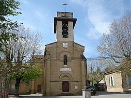 The church of Saint-Christophe-et-le-Laris | |
show Location of Saint-Christophe-et-le-Laris | |
 Saint-Christophe-et-le-Laris | |
| Coordinates: 45°12′39″N 5°04′20″E / 45.2108°N 5.0722°ECoordinates: 45°12′39″N 5°04′20″E / 45.2108°N 5.0722°E | |
| Country | France |
| Region | Auvergne-Rhône-Alpes |
| Department | Drôme |
| Arrondissement | Valence |
| Canton | Drôme des collines |
| Intercommunality | CA Valence Romans Agglo |
| Government | |
| • Mayor (2020–2026) | Francis Barry[1] |
| Area 1 | 11.35 km2 (4.38 sq mi) |
| Population (Jan. 2018)[2] | 418 |
| • Density | 37/km2 (95/sq mi) |
| Time zone | UTC+01:00 (CET) |
| • Summer (DST) | UTC+02:00 (CEST) |
| INSEE/Postal code | 26298 /26350 |
| Elevation | 320–502 m (1,050–1,647 ft) (avg. 350 m or 1,150 ft) |
| 1 French Land Register data, which excludes lakes, ponds, glaciers > 1 km2 (0.386 sq mi or 247 acres) and river estuaries. | |


Saint-Christophe-et-le-Laris (Arpitan: Sent-Cristofllo-et-lo-Larrés) is a commune in the Drôme department in southeastern France.
Population[]
| Year | Pop. | ±% |
|---|---|---|
| 1911 | 591 | — |
| 1962 | 319 | −46.0% |
| 1968 | 377 | +18.2% |
| 1975 | 323 | −14.3% |
| 1982 | 297 | −8.0% |
| 1990 | 318 | +7.1% |
| 1999 | 289 | −9.1% |
| 2008 | 393 | +36.0% |
See also[]
References[]
- ^ "Répertoire national des élus: les maires". data.gouv.fr, Plateforme ouverte des données publiques françaises (in French). 2 December 2020.
- ^ "Populations légales 2018". INSEE. 28 December 2020.
| Wikimedia Commons has media related to Saint-Christophe-et-le-Laris. |
This Drôme geographical article is a stub. You can help Wikipedia by . |
Categories:
- Communes of Drôme
- Drôme geography stubs