Saint-Vincent-la-Commanderie
Saint-Vincent-la-Commanderie | |
|---|---|
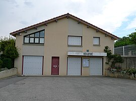 Town hall | |
show Location of Saint-Vincent-la-Commanderie | |
 Saint-Vincent-la-Commanderie | |
| Coordinates: 44°56′20″N 5°07′08″E / 44.939°N 5.119°ECoordinates: 44°56′20″N 5°07′08″E / 44.939°N 5.119°E | |
| Country | France |
| Region | Auvergne-Rhône-Alpes |
| Department | Drôme |
| Arrondissement | Valence |
| Canton | Vercors-Monts du Matin |
| Intercommunality | CA Valence Romans Agglo |
| Government | |
| • Mayor (2020–2026) | Françoise Agrain[1] |
| Area 1 | 13.34 km2 (5.15 sq mi) |
| Population (Jan. 2018)[2] | 556 |
| • Density | 42/km2 (110/sq mi) |
| Time zone | UTC+01:00 (CET) |
| • Summer (DST) | UTC+02:00 (CEST) |
| INSEE/Postal code | 26382 /26300 |
| Elevation | 326–1,108 m (1,070–3,635 ft) (avg. 390 m or 1,280 ft) |
| 1 French Land Register data, which excludes lakes, ponds, glaciers > 1 km2 (0.386 sq mi or 247 acres) and river estuaries. | |


Saint-Vincent-la-Commanderie is a commune in the Drôme department in southeastern France.
Population[]
| Year | Pop. | ±% |
|---|---|---|
| 1962 | 212 | — |
| 1968 | 236 | +11.3% |
| 1975 | 213 | −9.7% |
| 1982 | 229 | +7.5% |
| 1990 | 318 | +38.9% |
| 1999 | 391 | +23.0% |
| 2008 | 415 | +6.1% |
See also[]
References[]
- ^ "Répertoire national des élus: les maires". data.gouv.fr, Plateforme ouverte des données publiques françaises (in French). 2 December 2020.
- ^ "Populations légales 2018". INSEE. 28 December 2020.
| Wikimedia Commons has media related to Saint-Vincent-la-Commanderie. |
This Drôme geographical article is a stub. You can help Wikipedia by . |
Categories:
- Communes of Drôme
- Drôme geography stubs