Sainte-Marie-la-Blanche
From Wikipedia, the free encyclopedia
Commune in Bourgogne-Franche-Comté, France
Sainte-Marie-la-Blanche | |
|---|---|
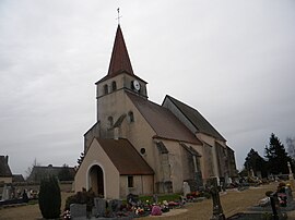 The church in Sainte-Marie-la-Blanche | |
 Coat of arms | |
 Sainte-Marie-la-Blanche  Sainte-Marie-la-Blanche | |
Coordinates:  46°58′43″N 4°53′31″E / 46.9786°N 4.8919°E / 46.9786; 4.8919Coordinates: 46°58′43″N 4°53′31″E / 46.9786°N 4.8919°E / 46.9786; 4.8919 46°58′43″N 4°53′31″E / 46.9786°N 4.8919°E / 46.9786; 4.8919Coordinates: 46°58′43″N 4°53′31″E / 46.9786°N 4.8919°E / 46.9786; 4.8919 | |
| Country | France |
| Region | Bourgogne-Franche-Comté |
| Department | Côte-d'Or |
| Arrondissement | Beaune |
| Canton | Ladoix-Serrigny |
| Intercommunality | Beaune Côte et Sud |
| Government | |
| • Mayor (2020–2026) | Michel Quinet |
| Area 1 | 6.79 km2 (2.62 sq mi) |
| Population (Jan. 2018)[1] | 890 |
| • Density | 130/km2 (340/sq mi) |
| Time zone | UTC+01:00 (CET) |
| • Summer (DST) | UTC+02:00 (CEST) |
| INSEE/Postal code | 21558 /21200 |
| Elevation | 186–212 m (610–696 ft) (avg. 198 m or 650 ft) |
| 1 French Land Register data, which excludes lakes, ponds, glaciers > 1 km2 (0.386 sq mi or 247 acres) and river estuaries. | |

Sainte-Marie-la-Blanche (French pronunciation: [sɛ̃t maʁi la blɑ̃ʃ]) is a commune in the Côte-d'Or department in eastern France.
Population[]
| Year | Pop. | ±% |
|---|---|---|
| 1962 | 425 | — |
| 1968 | 443 | +4.2% |
| 1975 | 484 | +9.3% |
| 1982 | 696 | +43.8% |
| 1990 | 693 | −0.4% |
| 1999 | 672 | −3.0% |
| 2008 | 798 | +18.8% |
See also[]
References[]
- ^ "Populations légales 2018". INSEE. 28 December 2020.
| Wikimedia Commons has media related to Sainte-Marie-la-Blanche. |
| show | |
|---|---|
|
| show Authority control | |
|---|---|
| General |
|
| National libraries | |
Retrieved from ""
Categories:
- Communes of Côte-d'Or
- Côte-d'Or geography stubs
Hidden categories:
- Articles with short description
- Short description is different from Wikidata
- Infobox mapframe without OSM relation ID on Wikidata
- Coordinates on Wikidata
- Pages using infobox settlement with image map1 but not image map
- Commons category link from Wikidata
- Articles with VIAF identifiers
- Articles with BNF identifiers
- Articles with WorldCat-VIAF identifiers
- All stub articles
- Pages using the Kartographer extension