Sarıveliler
Sarıveliler | |
|---|---|
District | |
 Location of Sarıveliler within Turkey. | |
 Sarıveliler Location of Sarıveliler within Turkey. | |
| Coordinates: 36°42′N 32°37′E / 36.700°N 32.617°E | |
| Country | |
| Province | Karaman |
| Government | |
| • Mayor | Halil Kulak () |
| Area | |
| • District | 372.78 km2 (143.93 sq mi) |
| Elevation | 1,405 m (4,610 ft) |
| Population (2012)[2] | |
| • Urban | 5,290 |
| • District | 12,463 |
| • District density | 33/km2 (87/sq mi) |
| Time zone | UTC+2 (EET) |
| • Summer (DST) | UTC+3 (EEST) |
| Postal code | 70xxx |
| Area code(s) | 0338 |
| Licence plate | 70 |
| Website | www.sariveliler.gov.tr |

Sarıveliler is a town and district of Karaman Province in the Central Anatolia region of Turkey. According to 2000 census, population of the district is 21,308 of which 6,718 live in the town of Sarıveliler.[3]
History[]
There is no exact information about town's history, we may assume people settled down the town at Roman Empire times. Also by the archeological founds near Goktepe and Ugurlu, we understand people started to live in Sariveliler in 2000 B.C.
Notes[]
- ^ "Area of regions (including lakes), km²". Regional Statistics Database. Turkish Statistical Institute. 2002. Retrieved 2013-03-05.
- ^ "Population of province/district centers and towns/villages by districts - 2012". Address Based Population Registration System (ABPRS) Database. Turkish Statistical Institute. Retrieved 2013-02-27.
- ^ Turkish Statistical Institute. "Census 2000, Key statistics for urban areas of Turkey" (in Turkish). Archived from the original (XLS) on 2007-09-27. Retrieved 2008-03-20.
References[]
- Falling Rain Genomics, Inc. "Geographical information on Sarıveliler, Turkey". Archived from the original on 2012-10-25. Retrieved 2008-03-16.
External links[]
- District governor's official website (in Turkish)
- District municipality's official website (in Turkish)
Sarıveliler in Karaman Province of Turkey | |||||||||||||||||||||||||||
|---|---|---|---|---|---|---|---|---|---|---|---|---|---|---|---|---|---|---|---|---|---|---|---|---|---|---|---|
| Districts | 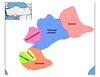 | ||||||||||||||||||||||||||
|
Metropolitan municipalities are bolded. | |||||||||||||||||||||||||||
Coordinates: 36°41′47″N 32°37′13″E / 36.69639°N 32.62028°E
This geographical article about a location in Karaman Province, Turkey is a stub. You can help Wikipedia by . |
Categories:
- Populated places in Karaman Province
- Districts of Karaman Province
- Central Anatolia Region geography stubs