Vesc
Vesc | |
|---|---|
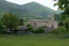 The church in Vesc | |
 Coat of arms | |
show Location of Vesc | |
 Vesc | |
| Coordinates: 44°31′19″N 5°09′04″E / 44.522°N 5.151°ECoordinates: 44°31′19″N 5°09′04″E / 44.522°N 5.151°E | |
| Country | France |
| Region | Auvergne-Rhône-Alpes |
| Department | Drôme |
| Arrondissement | Nyons |
| Canton | Dieulefit |
| Government | |
| • Mayor (2020–2026) | Alain Jeune[1] |
| Area 1 | 40.48 km2 (15.63 sq mi) |
| Population (Jan. 2018)[2] | 249 |
| • Density | 6.2/km2 (16/sq mi) |
| Time zone | UTC+01:00 (CET) |
| • Summer (DST) | UTC+02:00 (CEST) |
| INSEE/Postal code | 26373 /26220 |
| Elevation | 477–1,448 m (1,565–4,751 ft) (avg. 655 m or 2,149 ft) |
| 1 French Land Register data, which excludes lakes, ponds, glaciers > 1 km2 (0.386 sq mi or 247 acres) and river estuaries. | |


Vesc is a commune in the Drôme department in southeastern France.
Population[]
|
|
See also[]
References[]
- ^ "Répertoire national des élus: les maires". data.gouv.fr, Plateforme ouverte des données publiques françaises (in French). 2 December 2020.
- ^ "Populations légales 2018". INSEE. 28 December 2020.
| Wikimedia Commons has media related to Vesc. |
This Drôme geographical article is a stub. You can help Wikipedia by . |
Categories:
- Communes of Drôme
- Drôme geography stubs