Villeneuve-en-Perseigne
Villeneuve-en-Perseigne | |
|---|---|
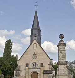 The church of la Trinité, in Roullée | |
show Location of Villeneuve-en-Perseigne | |
 Villeneuve-en-Perseigne | |
| Coordinates: 48°26′52″N 0°15′12″E / 48.4478°N 0.2533°ECoordinates: 48°26′52″N 0°15′12″E / 48.4478°N 0.2533°E | |
| Country | France |
| Region | Pays de la Loire |
| Department | Sarthe |
| Arrondissement | Mamers |
| Canton | Mamers |
| Intercommunality | CU Alençon |
| Area 1 | 86.70 km2 (33.48 sq mi) |
| Population (Jan. 2018)[1] | 2,186 |
| • Density | 25/km2 (65/sq mi) |
| Time zone | UTC+01:00 (CET) |
| • Summer (DST) | UTC+02:00 (CEST) |
| INSEE/Postal code | 72137 /72600 |
| Elevation | 133–296 m (436–971 ft) |
| 1 French Land Register data, which excludes lakes, ponds, glaciers > 1 km2 (0.386 sq mi or 247 acres) and river estuaries. | |


Villeneuve-en-Perseigne is a commune in the Sarthe department in the Pays de la Loire region in north-western France. It was formed on 1 January 2015 by the merger of the former communes La Fresnaye-sur-Chédouet, Chassé, Lignières-la-Carelle, Montigny, Roullée and Saint-Rigomer-des-Bois.[2]
See also[]
- Communes of the Sarthe department
References[]
| Wikimedia Commons has media related to Villeneuve-en-Perseigne. |
- ^ "Populations légales 2018". INSEE. 28 December 2020.
- ^ Arrêté préfectoral 22 September 2014 (in French)
| show Communes of the Sarthe department |
|---|
This Sarthe geographical article is a stub. You can help Wikipedia by . |
Categories:
- Communes of Sarthe
- Sarthe geography stubs