Villers-les-Pots
From Wikipedia, the free encyclopedia
Commune in Bourgogne-Franche-Comté, France
Villers-les-Pots | |
|---|---|
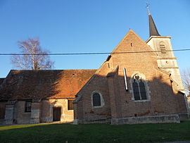 The church in Villers-les-Pots | |
 Coat of arms | |
 Villers-les-Pots  Villers-les-Pots | |
| Coordinates: 47°12′42″N 5°21′17″E / 47.2117°N 5.3547°E / 47.2117; 5.3547Coordinates: 47°12′42″N 5°21′17″E / 47.2117°N 5.3547°E / 47.2117; 5.3547 | |
| Country | France |
| Region | Bourgogne-Franche-Comté |
| Department | Côte-d'Or |
| Arrondissement | Dijon |
| Canton | Auxonne |
| Government | |
| • Mayor (2008–2014) | Christian Seichon |
| Area 1 | 10.43 km2 (4.03 sq mi) |
| Population (Jan. 2018)[1] | 1,158 |
| • Density | 110/km2 (290/sq mi) |
| Time zone | UTC+01:00 (CET) |
| • Summer (DST) | UTC+02:00 (CEST) |
| INSEE/Postal code | 21699 /21130 |
| Elevation | 182–205 m (597–673 ft) (avg. 196 m or 643 ft) |
| 1 French Land Register data, which excludes lakes, ponds, glaciers > 1 km2 (0.386 sq mi or 247 acres) and river estuaries. | |

Villers-les-Pots is a commune in the Côte-d'Or department in eastern France.
Population[]
| Year | Pop. | ±% |
|---|---|---|
| 1962 | 722 | — |
| 1968 | 731 | +1.2% |
| 1975 | 790 | +8.1% |
| 1982 | 763 | −3.4% |
| 1990 | 855 | +12.1% |
| 1999 | 871 | +1.9% |
| 2008 | 1,020 | +17.1% |
Transportation[]
The commune has a railway station, Villers-les-Pots, on the Dijon–Vallorbe line.
See also[]
References[]
- ^ "Populations légales 2018". INSEE. 28 December 2020.
| Wikimedia Commons has media related to Villers-les-Pots. |
| show | |
|---|---|
|
Retrieved from ""
Categories:
- Communes of Côte-d'Or
- Côte-d'Or geography stubs
Hidden categories:
- Articles with short description
- Short description is different from Wikidata
- Infobox mapframe without OSM relation ID on Wikidata
- Coordinates on Wikidata
- Pages using infobox settlement with image map1 but not image map
- Commons category link from Wikidata
- Articles with BNF identifiers
- Articles with MusicBrainz area identifiers
- All stub articles
- Pages using the Kartographer extension