Çiğli
This article needs additional citations for verification. (June 2017) |
Çiğli | |
|---|---|
 | |
 Çiğli | |
| Coordinates: 38°29′N 27°3′E / 38.483°N 27.050°ECoordinates: 38°29′N 27°3′E / 38.483°N 27.050°E | |
| Country | Turkey |
| Province | İzmir |
| Area | |
| • District | 96.93 km2 (37.42 sq mi) |
| Population (2012)[2] | |
| • Urban | 168,599 |
| • District | 168,599 |
| • District density | 1,700/km2 (4,500/sq mi) |

Çiğli (Silleon in Greek) is a metropolitan district of İzmir in western Turkey. It covers the northern end of İzmir Metropolitan Municipality around the mouth of the River Gediz, across the Gulf of İzmir from the main city. The Gediz delta is an Important Bird Area but is under threat from urbanization. IAOIZ, the Izmir Atatürk Organized Industrial Zone, is a significant economic hub and there is a major air force base.
History[]
Çiğ means dew in Turkish, a reference to the delta marshes of the River Gediz which used to cover the entire area. It is a relatively recent settlement created largely by migration from other parts of Turkey, starting with Turkish refugees of the Russo-Turkish War (1877-1878). Turks from the surrounding region took refuge in the marshes during the Greco-Turkish War (1919-1922), and were joined by ethnic Turks from the Greek province of Western Thrace after the war. The population was further increased by survivors of two earthquakes in eastern Anatolia in 1946 and 1966. Economic migration from eastern Anatolia has continued at a steady pace since then and even the mayor was born in Diyarbakır.
Government[]
Çiğli gained village status after the fall of the Ottoman Empire and became a municipality in 1956. It was attached to İzmir's metropolitan area in 1981, first as a dependency of the district of Karşıyaka, and in 1992 it became a distinct entity with its own administrative structures. The district is divided into 23 subdistricts, and also has one separate dependent municipality (Sasalı) and a dependent village (Kaklıç).
Geography[]

Çiğli was built on the delta marshes where the River Gediz flows into the Gulf of İzmir. It lies betweenKarşıyaka, another metropolitan district, to the south and the west, and İzmir's external dependent district of Menemen to the north. The western boundary is formed by the current delta of the River Gediz where the land is under the constant pressure of further urbanization. The future of the delta is among priority issues in Turkey's agenda of the protection of the environment. Many citizens would like to see full protection for the delta assured to preserve its unique fauna and flora along bird migration routes. The delta is an IBA (Important Bird Area) registered with BirdLife International.
Demography[]
The district had a population of 168,599 in 2012. The populations of Sasalı and Kaklıç are roughly the same at around 3000 people.
Economy[]
IAOIZ, the Izmir Atatürk Organized Industrial Zone has 485 factories employing 30,000 people.
Culture and community[]

Ekol Sanat Galerisi is a small privately owned art gallery with regular exhibitions.[3]
Landmarks[]
The İzmir Bird Paradise (Kuş Cenneti) has recorded 205 species of birds, including 63 species that are resident year-round, 54 species of summer migratory birds, 43 species of winter migratory birds, and 30 transient species. 56 species of birds have bred in the park. The sanctuary, which covers 80 square kilometres, was registered as "the protected area for water birds and for their breeding" by the Turkish Ministry of Forestry in 1982. The Sasalı Park of Natural Life (Doğal Yaşam Parkı) is a large open-air zoo established in 2008.
Transport[]

Çiğli Air Base is now used only by the military but served as İzmir's airport until the new Adnan Menderes Airport opened. Çiğli railway station is served by Turkish State Railways and by the new commuter rail line İZBAN.
Education[]
İzmir Kâtip Çelebi University was established in 2010. There was a medical campus of Gediz University, which closed during the 2016 Turkish purges.
Religious sites[]
There are 20 mosques including the Küçük Çiğli Cami, Egekent Cami, Esentepe Cami and İzzet Erişen Cami.
Sport[]
Karşıyaka S.K. run teams in several sports at the nearby Karşıyaka Arena.
Notable people[]
References[]
- ^ "Area of regions (including lakes), km²". Regional Statistics Database. Turkish Statistical Institute. 2002. Retrieved 2013-03-05.
- ^ "Population of province/district centers and towns/villages by districts - 2012". Address Based Population Registration System (ABPRS) Database. Turkish Statistical Institute. Retrieved 2013-02-27.
- ^ "Ekol Sanat Galerisi". Archived from the original on 2014-03-02.
External links[]
- Metropolitan Municipality of Greater İzmir
- Çiğli (in Turkish) by İzmir Chamber of Commerce
Known as Smyrna in English until about 1930 | |||||||
| Settlements |
| ||||||
| History |
| ||||||
| Universities | |||||||
| Museums and Monuments |
| ||||||
| Religious buildings |
| ||||||
| Transportation | |||||||
| Buildings and structures | |||||||
| Squares | |||||||
Çiğli in Izmir Province of Turkey | ||
|---|---|---|
| Districts | 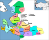 | |
Metropolitan municipalities are bolded. | ||
- Çiğli District
- Populated places in İzmir Province