Ağaçören
Ağaçören | |
|---|---|
District | |
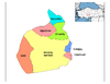
 Location of Ağaçören within Turkey. | |
 Ağaçören Location of Ağaçören within Turkey. | |
| Coordinates: 38°52′N 33°55′E / 38.867°N 33.917°E | |
| Country | |
| Region | Central Anatolia |
| Province | Aksaray |
| Government | |
| • Governor | Saban Arda YAZICI |
| • Mayor | Tuncay ATAK (AKP) |
| Area | |
| • District | 395.02 km2 (152.52 sq mi) |
| Elevation | 1,100 m (3,600 ft) |
| Population (2012)[2] | |
| • Urban | 3,047 |
| • District | 9,379 |
| • District density | 24/km2 (61/sq mi) |
| Time zone | UTC+2 (EET) |
| • Summer (DST) | UTC+3 (EEST) |
| Postal code | 68xxx |
| Area code(s) | 0382 |
| Licence plate | 68 |
| Website | www.agacoren.gov.tr |

Ağaçören, formerly Panlı, is a town and district of Aksaray Province in the Central Anatolia region of Turkey. According to 2000 census, population of the district is 15,869 of which 4,983 live in the town of Ağaçören.[3] The district covers an area of 395 km2 (153 sq mi),[4] and the average elevation is 1,100 m (3,609 ft).
Neighbourhoods[]
- Abalı 38°51′49″N 33°48′37″E / 38.86361°N 33.81028°E
- Abdiuşağı 38°47′00″N 33°56′03″E / 38.78333°N 33.93417°E
- Ahırlı 38°43′36″N 33°48′04″E / 38.72667°N 33.80111°E
- Avşar 38°45′05″N 33°46′33″E / 38.75139°N 33.77583°E
- Camili 38°52′13″N 33°57′00″E / 38.87028°N 33.95000°E
- Çatalçeşme 38°45′21″N 33°56′05″E / 38.75583°N 33.93472°E
- Dadılar 38°49′20″N 34°00′13″E / 38.82222°N 34.00361°E
- Demircili 38°49′47″N 33°47′46″E / 38.82972°N 33.79611°E
- Göllü 38°50′26″N 33°48′48″E / 38.84056°N 33.81333°E
- Göynük 38°44′46″N 33°48′23″E / 38.74611°N 33.80639°E
- Güzelöz 38°53′07″N 33°52′40″E / 38.88528°N 33.87778°E
- Hacıahmetlidavutlu 38°48′13″N 33°49′41″E / 38.80361°N 33.82806°E
- Hacıahmetlitepeköy 38°48′34″N 33°59′00″E / 38.80944°N 33.98333°E
- Hacıismailli 38°47′43″N 33°54′51″E / 38.79528°N 33.91417°E
- Hüsrevköy 38°45′29″N 33°52′02″E / 38.75806°N 33.86722°E
- Kaşıçalık 38°46′41″N 33°53′19″E / 38.77806°N 33.88861°E
- Kederli 38°49′21″N 33°57′30″E / 38.82250°N 33.95833°E
- Kılıçlı 38°47′23″N 33°51′43″E / 38.78972°N 33.86194°E
- Kırımini 38°46′18″N 33°47′10″E / 38.77167°N 33.78611°E
- Kurtini 38°44′14″N 33°51′07″E / 38.73722°N 33.85194°E
- Kütüklü 38°55′20″N 33°55′33″E / 38.92222°N 33.92583°E
- Oymaağaç 38°42′59″N 33°51′55″E / 38.71639°N 33.86528°E
- Sarıağıl 38°48′23″N 33°52′30″E / 38.80639°N 33.87500°E
- Sofular 38°45′54″N 33°50′24″E / 38.76500°N 33.84000°E
- Yağmurhüyüğü 38°45′06″N 33°53′14″E / 38.75167°N 33.88722°E
- Yenice 38°45′07″N 33°54′55″E / 38.75194°N 33.91528°E
- Yenişabanlı 38°52′02″N 33°52′12″E / 38.86722°N 33.87000°E
Notes[]
- ^ "Area of regions (including lakes), km²". Regional Statistics Database. Turkish Statistical Institute. 2002. Retrieved 2013-03-05.
- ^ "Population of province/district centers and towns/villages by districts - 2012". Address Based Population Registration System (ABPRS) Database. Turkish Statistical Institute. Retrieved 2013-02-27.
- ^ Turkish Statistical Institute. "Census 2000, Key statistics for urban areas of Turkey" (in Turkish). Archived from the original (XLS) on 2007-07-22. Retrieved 2008-04-02.
- ^ Statoids. "Statistical information on districts of Turkey". Archived from the original on 2010-05-26. Retrieved 2008-04-19.
References[]
- Falling Rain Genomics, Inc. "Geographical information on Ağaçören, Turkey". Retrieved 2008-04-02.
- Turkish Ministry of Culture and Tourism. "General information on Ağaçören, Aksaray" (in Turkish). Archived from the original on 2016-03-04. Retrieved 2008-04-02.
External links[]
- District governor's official website (in Turkish)
- Aksaray governor's office (in Turkish, English, and French)
| Province |  | |
|---|---|---|
| District | ||
| Towns | ||
Coordinates: 38°52′20″N 33°55′02″E / 38.87222°N 33.91722°E
This geographical article about a location in Aksaray Province, Turkey is a stub. You can help Wikipedia by . |
Categories:
- Ağaçören District
- Aksaray
- Towns in Turkey
- Populated places in Aksaray Province
- Districts of Aksaray Province
- Aksaray Province geography stubs