Abbeville, Louisiana
Abbeville, Louisiana | |
|---|---|
City | |
| City of Abbeville | |
 | |
 Location of Abbeville in Vermilion Parish, Louisiana. | |
 Location of Louisiana in the United States | |
 Abbeville, Louisiana Location of Abbeville in Vermilion Parish, Louisiana. | |
| Coordinates: 29°58′21″N 92°07′45″W / 29.97250°N 92.12917°WCoordinates: 29°58′21″N 92°07′45″W / 29.97250°N 92.12917°W | |
| Country | United States |
| State | Louisiana |
| Parish | Vermilion |
| Incorporated | 1850 |
| Government | |
| Area | |
| • Total | 6.08 sq mi (15.74 km2) |
| • Land | 6.05 sq mi (15.66 km2) |
| • Water | 0.03 sq mi (0.08 km2) |
| Elevation | 16 ft (5 m) |
| Population (2010) | |
| • Total | 12,257 |
| • Estimate (2020)[2] | 11,927 |
| • Density | 1,990.74/sq mi (768.66/km2) |
| Time zone | UTC-6 (CST) |
| • Summer (DST) | UTC-5 (CDT) |
| ZIP code | 70510, 70511 |
| Area code(s) | 337 |
| FIPS code | 22-00100 |
| Website | www |


Abbeville is a city in, and the parish seat of, Vermilion Parish, Louisiana, United States,[3][4] 150 miles (240 km) west of New Orleans and 60 miles (97 km) southwest of Baton Rouge.[5] The population was 12,257 at the 2010 census.[6] At the 2020 population estimates program, the population of the city was 11,927.[7] Abbeville is the principal city of the Abbeville micropolitan statistical area, which includes all of Vermilion Parish. It is also part of the Lafayette metropolitan statistical area and the larger Lafayette–Acadiana combined statistical area.
History[]

Formerly called La Chapelle, the land that became Abbeville was purchased by founding father Père Antoine Désiré Mégret (Père is French for 'Father'), a Capuchin missionary on July 25, 1843 for $900. There are two theories how the town was named. The theory that is generally accepted is Mégret named the town after his home in France. The second theory which also cannot be discounted states that it is a combination of "Abbe" for Abbé Mégret and "ville" the French word for town – thus Abbé's town. Some support for the second theory is found because the town in France is pronounced "Abbville" by its denizens. However, in 1995, Fr. Jean Desobry discovered the diocesan archives of Amiens the proof of Mégret's birthplace. In the archive, the dossier of Fr. Antoine Jacques Désiré Mégret was found, and that he was born on May 23, 1797, at Abbeville and became founder of Abbeville in Louisiana.[8] Dr Mary-Theresa MacCarthy wrote in her article Un Autre Abbeville in the 1996 edition of Bulletin de la Société des Antiquaires de Picardie (translation by Father Herbert),
On February 12, 1844, the pastor gave to his American town the name of the town of his birth. Residents find this name especially fitting because of the French word abbé which means father [or priest] added to the French word ville [which means town]. Their Abbeville is truly la ville de l'abbé [the priest's town].[8]
Settlers were primarily descendants of the Acadians from Nova Scotia that moved to the area around 1766 to 1775. The town was incorporated in 1850.[5] There were two people living on the land at the time, Joseph LeBlanc and his wife Isabelle Broussard, whose former home Father Megret converted into a chapel. The chapel burned in 1854, and in 1910 St. Mary Magdalen Catholic Church, Rectory were built, its and cemetery established, and still stand today.[9][better source needed]
Father Megret modeled his original plan for the village after a French Provincial village. In a map he designed in 1846, the town was 38 to 40 acres (160,000 m2) in size. It was bounded on the north by St. Victor Boulevard, on the south by Lafayette Boulevard, on the east by "the Sisters of Charity", and on the west by Bayou Vermilion. At this point in time the town was called "Abbville".
The center of downtown is Magdalen Square, which is accented by large oak trees, a fountain, and gazebo. A statue in memory of Father Megret stands in the square. In 1856, the Last Island Hurricane destroyed every building in the town.[citation needed]
Geography[]
Abbeville is located at 29°58′31.422″N 92°7′37.7652″W / 29.97539500°N 92.127157000°W[10] and has an elevation of 16 feet (4.9 m).[11] According to the United States Census Bureau, the town has a total area of 5.7 square miles (14.7629 km2), of which 5.7 square miles (15 km2) is land and 0.04 square miles (0.10 km2) (0.53%) is water. Abbeville is located near the southern terminus of U.S. Highway 167. Abbeville Chris Crusta Memorial Airport is in the eastern part of the city. The Vermilion River runs through downtown, and several canals and coulees run through other parts of Abbeville.
Climate[]
| hideClimate data for Abbeville, Louisiana | |||||||||||||
|---|---|---|---|---|---|---|---|---|---|---|---|---|---|
| Month | Jan | Feb | Mar | Apr | May | Jun | Jul | Aug | Sep | Oct | Nov | Dec | Year |
| Average high °F (°C) | 63.9 (17.7) |
65.7 (18.7) |
72.6 (22.6) |
78.7 (25.9) |
84.7 (29.3) |
89.9 (32.2) |
90.5 (32.5) |
91.2 (32.9) |
88.2 (31.2) |
81.7 (27.6) |
72.0 (22.2) |
64.5 (18.1) |
78.6 (25.9) |
| Average low °F (°C) | 43.2 (6.2) |
45.0 (7.2) |
51.8 (11.0) |
58.0 (14.4) |
64.4 (18.0) |
70.8 (21.6) |
72.3 (22.4) |
72.6 (22.6) |
68.1 (20.1) |
57.8 (14.3) |
48.8 (9.3) |
43.8 (6.6) |
58.1 (14.5) |
| Average precipitation inches (mm) | 5.1 (130) |
4.1 (100) |
4.2 (110) |
4.1 (100) |
4.9 (120) |
6.4 (160) |
6.5 (170) |
6.0 (150) |
5.5 (140) |
4.3 (110) |
4.4 (110) |
5.0 (130) |
60.5 (1,540) |
| Source: Weatherbase [12] | |||||||||||||
Demographics[]
| Historical population | |||
|---|---|---|---|
| Census | Pop. | %± | |
| 1870 | 545 | — | |
| 1880 | 255 | −53.2% | |
| 1890 | 637 | 149.8% | |
| 1900 | 1,536 | 141.1% | |
| 1910 | 2,907 | 89.3% | |
| 1920 | 3,461 | 19.1% | |
| 1930 | 4,356 | 25.9% | |
| 1940 | 6,672 | 53.2% | |
| 1950 | 9,338 | 40.0% | |
| 1960 | 10,414 | 11.5% | |
| 1970 | 10,996 | 5.6% | |
| 1980 | 12,391 | 12.7% | |
| 1990 | 11,187 | −9.7% | |
| 2000 | 11,887 | 6.3% | |
| 2010 | 12,257 | 3.1% | |
| 2019 (est.) | 11,927 | [2] | −2.7% |
| U.S. Decennial Census[13] | |||
According to the 2000 U.S. census, there were 11,887 people, 4,698 households, and 3,014 families residing in the city. The population density was 2,027.7 people per square mile (805.2/km2). There were 5,257 housing units at an average density of 907.3 per square mile (350.2/km2).[14][15][16] At the 2020 population estimates program, 11,927 people lived in the city.[7]
In 2000, the racial and ethnic makeup was 54.29% White, 38.56% African American, 0.19% Native American, 5.50% Asian, 0.39% other races, and 1.06% two or more races. Hispanic or Latino Americans of any race were 1.93% of the population. In 2000, 76.0% of the population over the age of five spoke English at home, 16.5% of the population spoke French or Cajun, and 5.5% spoke Vietnamese.[17] The 2019 American Community Survey estimated the racial and ethnic makeup was 49.6% non-Hispanic white, 42.8% African American, 0.5% Native American, 4.8% Asian, 0.9% some other race, and 1.3% two or more races.[18]
The 2010 U.S. census reported there were 4,698 households, of which 60.34% had children under the age of 18 present, 33.35% were married couples living together, 24.44% had a female householder with no husband present, and 36.72% were non-families; 31.55% of all households were made up of individuals, and 12.32% had someone living alone who was 65 years of age or older. The average household size was 2.53 and the average family size was 3.20.[15]
In 2019, the median household income was $38,900. Males had a median income of $46,182 versus $37,958 for females; approximately 30.4% of the population lived at or below the poverty line.[18]
Economy[]
Abbeville is an agricultural trade and processing center for rice, sugarcane, dairy products, locally sold corn, cotton, and seafood, in particular crawfish, alligator, and crab.[19][20] The oil and natural gas fields off the coast in the Gulf of Mexico are serviced by companies throughout the region including Abbeville.[4] Chemical products and consumer goods are manufactured locally.[19] A related tourist attraction is a large open-kettle sugarcane syrup mill.[5][19]
Education[]
The city of Abbeville is served by the Vermilion Parish School District. The following are public and parochial schools in Abbeville:[21]
- Elementary Schools
- Eaton Park Elementary
- Herod Elementary
- Mount Carmel Elementary School (Parochial) (Grades PK–8)
- Middle Schools
- J.H. Williams Middle School
- High Schools
- Abbeville High School
- Vermilion Catholic High School (Parochial)
- Lighthouse Christian Prep. (Parochial)
- James A. Herod High School and Elementary School (Was founded by Reverend James A. Herod for the education of the black population of Vermilion Parish with grades first thru twelfth, he was also a teacher)
Recreation[]
Abbeville is home to several festivals:
- Daylily Festival and Garden Show
- Giant Omelette Celebration
- Les Lumieres du Village d'Abbeville
- Louisiana Cattle Festival
- Vermilion Carousel of Arts
The is a prominent local playhouse in Abbeville. The Acadian Museum is east of the city in nearby Erath, Louisiana. Avery Island, which contains a bird sanctuary, salt dome, and world-famous Tabasco factory is 15 miles southeast of the city.[4]
Historic buildings[]
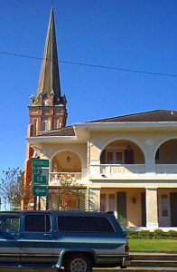
Abbeville is the home of numerous historic buildings that have been added periodically to the National Historic Register. Starting in 1987, the , in the area surrounded by Concord, State, Lafayette, and Jefferson Streets, was added to the register. That same year, the was created between W. Oak, State, Cherry, and the Vermilion River. St. Mary Magdalen Church, Rectory, and the Cemetery were added the following year. In the 1990s, the , , , , and the were all added, in addition to the , which is bounded by State, 1st, Pere Megret, and Concord St and the . Finally, just before the turn of the century, the and the St. Mary Congregational Church were both added. North of Abbeville, was added in 1984.[22]
National Guard[]
Abbeville is the home of HHC (headquarters company), 2nd Battalion, 156th Infantry (mech.), of the Louisiana Army National Guard. The 2nd Battalion served with the 256th Infantry Brigade ("The Tiger Brigade") during Operation Iraqi Freedom in 2004–2005.
Transportation[]
The Louisiana & Delta Railroad has a route through the city, which helped bring freight produced locally to market.[5]
The connects Abbeville to the Gulf of Mexico,[4] and the Intracoastal Waterway runs south of the city.[19]
Films[]
The 1988 remake of the 1958 film The Blob was filmed in Abbeville.
Robert J. Flaherty chose Abbeville in 1948 as his base of operations during the filming of Louisiana Story. He rented a house in the current downtown area for 15 months over 1946–47.
Abbeville is one of the main locations in the first season of the HBO TV series True Detective.
Notable people[]
- George A. Caldwell (1892–1966), building contractor convicted in the Louisiana Hayride scandals of 1939-1940; born in Abbeville.
- Bobby Duhon, (born 1946), professional American football player.[23]
- Bobby Charles Guidry (1938–2010), songwriter and musician, wrote See You Later Alligator & Walking to New Orleans; born in Abbeville.
- Sammy Kershaw, (born 1958), a country music artist, born in nearby Kaplan, resides in Abbeville.
- Dudley J. LeBlanc, (1894–1971), businessman and politician who made a fortune in the 1950s in the patent medicine Hadacol, lived most of his life and died in Abbeville.
- Anthony Levine, (born 1987), professional American football player; born in Abbeville.
- , (born 1944), state senator from Natchitoches; formerly resided in Abbevill
- Brandon Mitchell, (born 1975), former professional American football player; born in Abbeville.
- George Petty (1894–1975), pin-up artist; born in Abbeville.
- Deb Richard, (born 1963), golfer, winner of five LPGA Tour tournaments.
- Sam H. Theriot (born 1954), member of the Louisiana House of Representatives from 1979 to 1996; former Vermilion Parish clerk of court; educator and Abbeville native.
- Koryn Hawthorne (born 1997), contestant and finalist on the season 8 of The Voice
Footnotes[]
- ^ "2019 U.S. Gazetteer Files". United States Census Bureau. Retrieved July 25, 2020.
- ^ Jump up to: a b "Population and Housing Unit Estimates". United States Census Bureau. Retrieved August 10, 2021.
- ^ Anon 2014
- ^ Jump up to: a b c d Hoiberg 2010, p. 11
- ^ Jump up to: a b c d Johnston 1997, p. 8
- ^ Anon 2015
- ^ Jump up to: a b Bureau, US Census. "City and Town Population Totals: 2010-2020". The United States Census Bureau. Retrieved August 10, 2021.
- ^ Jump up to: a b Theall 1996
- ^ Lawson 2015
- ^ U. S. Census Bureau 2015
- ^ Anon 2015a
- ^ Anon 2015b Retrieved on November 24, 2011.
- ^ "Census of Population and Housing". Census.gov. Retrieved June 4, 2015.
- ^ U. S. Census Bureau 2012, pp. 44–45
- ^ Jump up to: a b U. S. Census Bureau 2012, p. 173
- ^ U. S. Census Bureau 2012, p. 284
- ^ Anon 2000
- ^ Jump up to: a b "Geography Profile: Abbeville city, Louisiana". data.census.gov. Retrieved August 10, 2021.
- ^ Jump up to: a b c d Cohen 1998, p. 3
- ^ Lagassé et al. 2000, p. 2
- ^ Anon 2010a
- ^ Anon 2011a
- ^ Anon 2011
References[]
- Anon (2015). "Abbeville (city), Louisiana". quickfacts.census.gov. US Department of Commerce. Archived from the original on March 26, 2015. Retrieved May 11, 2015.
- Anon (April 1, 2015a). "All States 20150401" (Text). United States Board on Geographic Names. United States Department of the Interior. Retrieved May 11, 2015.[permanent dead link]
- Anon (2015b). "Abbeville, Louisiana". Weatherbase. Great Falls, VA: Canty Media. Archived from the original on August 21, 2014. Retrieved May 11, 2015.
- Anon (2015c). "Donald Trahan's Biography". Vote Smart. Project Vote Smart. Archived from the original on May 21, 2015. Retrieved May 20, 2015.
- Anon (2014). "Vermilion Parish, LA". National Association of Counties. Washington, DC: National Association of Counties. Archived from the original on May 31, 2011. Retrieved May 11, 2015.
- Anon (2011). "Bobby Duhon". Pro-Football-Reference.com. Football Encyclopedia of Players. Philadelphia, PA: Sports Reference LLC. Archived from the original on May 21, 2015. Retrieved May 12, 2015.
- Anon (2011a). "Listed Properties as of October 1, 2011". National Register of Historic Places. National Park Service. Archived from the original (XLS) on June 20, 2015. Retrieved May 12, 2015.
- Anon (2010). "Census of Population and Housing". United States Census Bureau. U.S. Department of Commerce. Retrieved May 11, 2015.
- Anon (2010a). "Vermilion Parish School District 2014-2015" (PDF). Vermilion Parish Schools. Archived from the original (PDF) on February 5, 2016. Retrieved May 12, 2015.
- Anon (2000). "Abbeville, Louisiana". Modern Language Association. MLA Language Map Data Center. Modern Language Association. Archived from the original on August 15, 2013. Retrieved May 11, 2015.
- Cohen, Saul B., ed. (1998). "Abbeville". The Columbia Gazetteer of the World. 1: A to G. New York, NY: Columbia University Press. ISBN 0-231-11040-5. LCCN 98071262.
- Hoiberg, Dale H., ed. (2010). "Abbeville". Encyclopædia Britannica. 1: A-ak Bayes (15th ed.). Chicago, IL: Encyclopædia Britannica, Inc. ISBN 978-1-5933-9837-8. LCCN 2008934270.
- Hudson, George Donald, ed. (1959). Encyclopædia Britannica World Atlas. Chicago, IL: Encyclopædia Britannica, Inc.
- Johnston, Bernard, ed. (1997). "Abbeville". Collier's Encyclopedia. I: A to Ameland (1st ed.). New York, NY: P. F. Collier. LCCN 96084127.
- Lagassé, Paul; Goldman, Lora; Hobson, Archie; Norton, Susan R., eds. (2000). "Abbeville". The Columbia Encyclopedia (6th ed.). New York, NY: Columbia University Press. ISBN 0-7876-5015-3. LCCN 00-027927.
- Lawson, Bill (2015). "Abbeville City Historical Markers". Stopping Points. Archived from the original on September 24, 2015. Retrieved May 11, 2015.[better source needed]
- Theall, Gary E. (1996). "The Naming of Abbeville". www.vermilionhistorical.com. Topics in History. Abbeville, LA: Vermilion Historical Society. Archived from the original on June 23, 2016. Retrieved July 9, 2016.
- U. S. Census Bureau (March 24, 2015). "National Places Gazetteer Files (2014)" (Text). United States Census Bureau. Archived from the original on May 18, 2015. Retrieved May 10, 2015.
- U. S. Census Bureau (2015a). "Community Facts: Abbeville City, Louisiana". American FactFinder. U. S. Department of Commerce. Archived from the original on February 14, 2020. Retrieved July 9, 2016.
- U. S. Census Bureau (2014). "Selected Economic Characteristics: Abbeville City, Louisiana". American FactFinder. U. S. Department of Commerce. Archived from the original on February 13, 2020. Retrieved May 11, 2015.
- U. S. Census Bureau (July 2012). Louisiana: 2010: Summary Population and Housing Characteristics, CPH-1-20 (PDF). Washington, DC: U. S. Government Printing Office.
External links[]
| show Municipalities and communities of Vermilion Parish, Louisiana, United States |
|---|


| show Authority control |
|---|
- Abbeville, Louisiana
- Cities in Louisiana
- Cities in Vermilion Parish, Louisiana
- Acadiana
- Parish seats in Louisiana
- Populated places established in 1843
- 1843 establishments in Louisiana
- Cities in Lafayette, Louisiana metropolitan area