Franklin Parish, Louisiana
Franklin Parish | |
|---|---|
Parish | |
| Parish of Franklin | |
 Franklin Parish Courthouse in Winnsboro | |
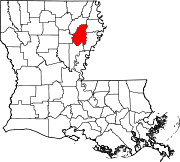
 Location within the U.S. state of Louisiana | |
 Louisiana's location within the U.S. | |
| Coordinates: 32°08′N 91°40′W / 32.14°N 91.67°W | |
| Country | |
| State | |
| Founded | 1843 |
| Named for | Benjamin Franklin |
| Seat | Winnsboro |
| Largest city | Winnsboro |
| Area | |
| • Total | 635 sq mi (1,640 km2) |
| • Land | 625 sq mi (1,620 km2) |
| • Water | 11 sq mi (30 km2) 1.7% |
| Population (2010) | |
| • Total | 20,767 |
| • Estimate (2018) | 20,156 |
| • Density | 33/sq mi (13/km2) |
| Time zone | UTC−6 (Central) |
| • Summer (DST) | UTC−5 (CDT) |
| Congressional district | 5th |


Franklin Parish (French: Paroisse de Franklin) is a parish located in the northeastern part of the U.S. state of Louisiana. As of the 2010 census, the population was 20,767.[1] The parish seat is Winnsboro.[2] The parish was founded in 1843 and named for Benjamin Franklin.[3][4]
Culture[]
Franklin Parish hosts the annual Franklin Parish Catfish Festival with music, attractions and hundreds of vendors. The 2018 festival was attended by over 10,000 people in bad weather but usually the draw is between 15,000 and 20,000. People from across the region are attracted by the relatively high vendor count and this has an important economic contribution for local businesses. In past years the festival has included an antique car show, a zoo exhibit for children and an exhibit about Louisiana's contributions during World War II, along with performances from grammy-winning musical artists Jo-El Sonnier and Jason Crabb.[5]
Geography[]
According to the U.S. Census Bureau, the parish has a total area of 635 square miles (1,640 km2), of which 625 square miles (1,620 km2) is land and 11 square miles (28 km2) (1.7%) is water.[6]
Major highways[]
 Louisiana Highway 4
 Louisiana Highway 15
 Louisiana Highway 17
 U.S. Highway 425
Adjacent parishes[]
- Richland Parish (north)
- Madison Parish (northeast)
- Tensas Parish (southeast)
- Catahoula Parish (south)
- Caldwell Parish (west)
National protected area[]
Demographics[]
| Historical population | |||
|---|---|---|---|
| Census | Pop. | %± | |
| 1850 | 3,251 | — | |
| 1860 | 6,162 | 89.5% | |
| 1870 | 5,078 | −17.6% | |
| 1880 | 6,495 | 27.9% | |
| 1890 | 6,900 | 6.2% | |
| 1900 | 8,890 | 28.8% | |
| 1910 | 11,989 | 34.9% | |
| 1920 | 24,100 | 101.0% | |
| 1930 | 30,530 | 26.7% | |
| 1940 | 32,382 | 6.1% | |
| 1950 | 29,376 | −9.3% | |
| 1960 | 26,088 | −11.2% | |
| 1970 | 23,946 | −8.2% | |
| 1980 | 24,141 | 0.8% | |
| 1990 | 22,387 | −7.3% | |
| 2000 | 21,263 | −5.0% | |
| 2010 | 20,767 | −2.3% | |
| 2018 (est.) | 20,156 | [7] | −2.9% |
| U.S. Decennial Census[8] 1790-1960[9] 1900-1990[10] 1990-2000[11] 2010-2013[1] | |||
As of the census[12] of 2000, there were 21,263 people, 7,754 households, and 5,706 families residing in the parish. The population density was 34 people per square mile (13/km2). There were 8,623 housing units at an average density of 14 per square mile (5/km2). The racial makeup of the parish was 67.16% White, 31.61% Black or African American, 0.27% Native American, 0.19% Asian, 0.15% from other races, and 0.62% from two or more races. 0.75% of the population were Hispanic or Latino of any race.
There were 7,754 households, out of which 33.90% had children under the age of 18 living with them, 53.30% were married couples living together, 16.50% had a female householder with no husband present, and 26.40% were non-families. 23.90% of all households were made up of individuals, and 12.20% had someone living alone who was 65 years of age or older. The average household size was 2.64 and the average family size was 3.13.
In the parish the population was spread out, with 27.90% under the age of 18, 9.10% from 18 to 24, 25.80% from 25 to 44, 21.90% from 45 to 64, and 15.30% who were 65 years of age or older. The median age was 36 years. For every 100 females there were 91.20 males. For every 100 females age 18 and over, there were 86.40 males.
The median income for a household in the parish was $22,964, and the median income for a family was $27,440. Males had a median income of $26,305 versus $16,758 for females. The per capita income for the parish was $12,675. About 23.10% of families and 28.40% of the population were below the poverty line, including 41.40% of those under age 18 and 25.00% of those age 65 or over.
Education[]
Franklin Parish School Board operates local public schools. Franklin Parish High School is the sole public high school in the parish.
The superintendent is John Gullatt.
The parish also hosts two private Christian schools, Franklin Academy in Winnsboro, where Phil Jackson and Leigh Jonson are principal and vice-principal, respectively, and Family Community Christian School, of which Elizabeth Rigdon is the principal.
Communities[]

City[]
- Winnsboro (parish seat and largest municipality)
Town[]
Villages[]
Unincorporated community[]
Notable people[]
- Ralph E. King, Winnsboro physician who represented Catahoula, Franklin, and Richland parishes in the Louisiana State Senate from 1944 to 1952 and again from 1956 to 1960
- Anthony "Booger" McFarland, Winnsboro native; All-American football player at Louisiana State University; played in National Football League for Tampa Bay Buccaneers
- Steve Pylant, former sheriff of Franklin Parish; Republican member of the Louisiana House of Representatives, resides in Franklin Parish near Delhi in Richland Parish.
- , Louisiana farm broadcaster of radio and television; originally from Crowville
- , 2nd Circuit Court of Appeals Judge, former 5th District Chief Judge, inventor and Baskin native.
Politics[]
See also[]
References[]
- ^ Jump up to: a b "State & County QuickFacts". United States Census Bureau. Archived from the original on June 6, 2011. Retrieved August 9, 2013.
- ^ "Find a County". National Association of Counties. Archived from the original on 2011-05-31. Retrieved 2011-06-07.
- ^ "Franklin Parish". Center for Cultural and Eco-Tourism. Retrieved September 4, 2014.
- ^ Gannett, Henry (1905). The Origin of Certain Place Names in the United States. Govt. Print. Off. pp. 131.
- ^ "Annual festival draws large crowd, positively affects local economy". Hanna Newspapers.
- ^ "2010 Census Gazetteer Files". United States Census Bureau. August 22, 2012. Archived from the original on September 28, 2013. Retrieved August 20, 2014.
- ^ "Population and Housing Unit Estimates". Retrieved October 29, 2019.
- ^ "U.S. Decennial Census". United States Census Bureau. Retrieved August 20, 2014.
- ^ "Historical Census Browser". University of Virginia Library. Retrieved August 20, 2014.
- ^ "Population of Counties by Decennial Census: 1900 to 1990". United States Census Bureau. Retrieved August 20, 2014.
- ^ "Census 2000 PHC-T-4. Ranking Tables for Counties: 1990 and 2000" (PDF). United States Census Bureau. Retrieved August 20, 2014.
- ^ "U.S. Census website". United States Census Bureau. Retrieved 2011-05-14.
- ^ Leip, David. "Dave Leip's Atlas of U.S. Presidential Elections". uselectionatlas.org. Retrieved 2018-03-07.
| show Places adjacent to Franklin Parish, Louisiana |
|---|
| show Municipalities and communities of Franklin Parish, Louisiana, United States |
|---|
Coordinates: 32°08′N 91°40′W / 32.14°N 91.67°W
| show Authority control |
|---|
- Louisiana parishes
- Franklin Parish, Louisiana
- 1843 establishments in Louisiana
- Populated places established in 1843