Washington Parish, Louisiana
Washington Parish, Louisiana | |
|---|---|
| Parish of Washington | |
 Bogalusa City Hall | |
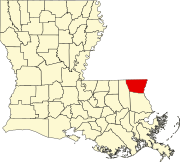
 Location within the U.S. state of Louisiana | |
 Louisiana's location within the U.S. | |
| Country | |
| State | |
| Region | Florida Parishes |
| Founded | 1819 |
| Named for | George Washington |
| Parish seat | Franklinton |
| Largest city | Bogalusa |
| Area | |
| • Total | 1,750 km2 (676 sq mi) |
| • Land | 1,700 km2 (670 sq mi) |
| • Water | 17 km2 (6.4 sq mi) |
| • percentage | 2 km2 (0.9 sq mi) |
| Population (2010) | |
| • Total | 47,168 |
| • Estimate (2018) | 46,582 |
| • Rank | LA: 24th |
| • Density | 27/km2 (70/sq mi) |
| Time zone | UTC-6 (CST) |
| • Summer (DST) | UTC-5 (CDT) |
| Area code | 985 |
| Congressional district | 5th |
| Website | Washington Parish, Louisiana |
Washington Parish (French: Paroisse de Washington) is a parish located in the interior southeast corner of the U.S. state of Louisiana, one of the Florida Parishes. As of the 2010 census, the population was 47,168.[1] Its parish seat is Franklinton.[2] Its largest city is Bogalusa. The parish was founded in 1819.[3]
Washington Parish comprises the Bogalusa, LA Micropolitan Statistical Area, which is included in the New Orleans-Metairie-Hammond, LA-MS Combined Statistical Area.
History[]
Washington Parish was formed in 1819 by splitting off from St. Tammany Parish. Franklinton was designated as the parish seat on February 10, 1821.
Washington Parish is the most northeasterly of what are called the Florida Parishes. Great Britain took over control of this French territory east of the Mississippi River in 1763 after defeating France in the Seven Years' War. But France had also ceded some territory to Spain. This area was under contention, and English and American settlers tried to set up an independent state here in 1810. The United States annexed the territory, later settling with Spain in a treaty. Through much of this period, the French influence remained strong in the region, especially in its former colonial cities.
This area was rural and forested with virgin longleaf pine (Pinus palustris L.) In the early 20th century, entrepreneurial brothers Frank and Charles W. Goodyear, already successful businessmen from Buffalo, New York, purchased hundreds of thousands of acres of forest in this area and in southwestern Mississippi. They established the Great Southern Lumber Company, constructed a huge sawmill (the largest in the world at the time) in the middle of the forest, and developed Bogalusa, Louisiana, as a company mill town. In the early 20th century, there were numerous confrontations as workers attempted to unionize and companies hired private militia to suppress such activities.
The company housing for workers was divided by Jim Crow custom and state laws on racial segregation into sections for "Americans" and another for "colored" and foreign workers. It also built housing for supervisors, and supporting facilities, such as several hotels, churches, a YMCA and YWCA, schools, and other services within a year, opening facilities in 1907. To access the timber and transport processed lumber from the mill to markets, the company built the New Orleans Great Northern Railroad,[4] connecting Bogalusa to the port of New Orleans.
Well before World War II, the virgin forest was harvested. Great Southern Lumber Company closed the sawmill in 1938. Its paper mill and chemical operations continued. Gradually in the late 20th century, these operations declined. As jobs left, the population dropped in such industrial towns. Some people moved to new or emerging industries in New Orleans and other major cities.
Government[]
The Washington Parish Government is a Home Rule Charter or "President-Council" form of Government. Its current President, elected at-large, is Richard N. Thomas, Jr. The seven council members are each elected from single-member districts.
Geography[]
According to the U.S. Census Bureau, the parish has a total area of 676 square miles (1,750 km2), of which 670 square miles (1,700 km2) is land and 6.4 square miles (17 km2) (0.9%) is water.[6]
Adjacent counties and parishes[]
- Pike County, Mississippi (northwest)
- Walthall County, Mississippi (north)
- Marion County, Mississippi (northeast)
- Pearl River County, Mississippi (east)
- St. Tammany Parish (south)
- Tangipahoa Parish (west)
Major highways[]
National protected area[]
State park[]
Demographics[]
| Historical population | |||
|---|---|---|---|
| Census | Pop. | %± | |
| 1820 | 2,517 | — | |
| 1830 | 2,286 | −9.2% | |
| 1840 | 2,649 | 15.9% | |
| 1850 | 3,408 | 28.7% | |
| 1860 | 4,708 | 38.1% | |
| 1870 | 3,330 | −29.3% | |
| 1880 | 5,190 | 55.9% | |
| 1890 | 6,700 | 29.1% | |
| 1900 | 9,628 | 43.7% | |
| 1910 | 18,886 | 96.2% | |
| 1920 | 24,164 | 27.9% | |
| 1930 | 29,904 | 23.8% | |
| 1940 | 34,443 | 15.2% | |
| 1950 | 38,371 | 11.4% | |
| 1960 | 44,015 | 14.7% | |
| 1970 | 41,987 | −4.6% | |
| 1980 | 44,207 | 5.3% | |
| 1990 | 43,185 | −2.3% | |
| 2000 | 43,926 | 1.7% | |
| 2010 | 47,168 | 7.4% | |
| 2018 (est.) | 46,582 | [7] | −1.2% |
| U.S. Decennial Census[8] 1790-1960[9] 1900-1990[10] 1990-2000[11] 2010-2013[1] | |||
As of the census[12] of 2000, there were 43,926 people, 16,467 households, and 11,642 families residing in the parish. The population density was 66 people per square mile (25/km2). There were 19,106 housing units at an average density of 28 per square mile (11/km2). The racial makeup of the parish was 67.42% White, 31.53% Black or African American, 0.23% Native American, 0.17% Asian, 0.11% from other races, and 0.54% from two or more races. 0.76% of the population were Hispanic or Latino of any race.
There were 16,467 households, out of which 32.70% had children under the age of 18 living with them, 49.30% were married couples living together, 17.10% had a female householder with no husband present, and 29.30% were non-families. 26.60% of all households were made up of individuals, and 12.50% had someone living alone who was 65 years of age or older. The average household size was 2.56 and the average family size was 3.09.
In the parish the population was spread out, with 26.80% under the age of 18, 9.50% from 18 to 24, 26.70% from 25 to 44, 22.60% from 45 to 64, and 14.30% who were 65 years of age or older. The median age was 36 years. For every 100 females there were 95.40 males. For every 100 females age 18 and over, there were 92.80 males.
The median income for a household in the parish was $24,264, and the median income for a family was $29,480. Males had a median income of $27,964 versus $17,709 for females. The per capita income for the parish was $12,915. About 19.40% of families and 24.70% of the population were below the poverty line, including 32.20% of those under age 18 and 20.40% of those age 65 or over. Washington Parish has the second highest level of poverty in the state after Orleans Parish.
Economy[]
Washington Parish is currently known for its agriculture, particularly watermelons. Through much of the 20th century, its economy was based on its timber and paper industry.
In 1906, The Great Southern Lumber Company, founded by the Goodyear brothers from New York, purchased huge tracts of forest and established a sawmill in Bogalusa to harvest the local virgin pine forests. This company was the first to introduce reforestation in order to sustain the timber industry locally. Taken over by Crown Zellerbach, it later started a paper mill and chemical businesses in the area.
The local business passed through several hands as the lumber and related industries restructured through the late 20th century. In the 21st century, Temple-Inland Corporation is the largest employer in the parish.
Education[]
Students residing outside of Ward 4 attend Washington Parish School System. Students within Ward 4 attend Bogalusa City Schools.
is located in Bogalusa.
Corrections[]
Louisiana Department of Public Safety and Corrections operates the B.B. "Sixty" Rayburn Correctional Center in an unincorporated section of Washington Parish.[13]
National Guard[]
Bogalusa is home to the headquarters of the 205th Engineer Battalion of the 225th Engineer Brigade. Franklinton is the home of the 843rd Engineer Company.
Communities[]

City[]
- Bogalusa (largest municipality)
Town[]
- Franklinton (parish seat)
Villages[]
Unincorporated communities[]
Notable people[]
- Oneal Moore (1931-1965), US Army veteran and first African-American deputy sheriff in Washington Parish Sheriff's Office; murdered while in uniform in a drive-by shooting, June 2, 1965. Case never solved.
- (born 1945), state representative from Tangipahoa Parish from 1996 to 2008; member of the Louisiana Board of Pardons since 2008
- Weldon Russell (born 1946), former state representative for Tangipahoa and St. Helena parishes; born in Washington Parish
- Malinda Brumfield White (born 1967), state representative for Washington and St. Tammany parishes, effective 2016
- Katherine Haik (born 2000), from Franklinton, named Miss Teen USA 2015 at the age of fifteen
See also[]
- National Register of Historic Places listings in Washington Parish, Louisiana
- Bogue Chitto State Park
References[]
- ^ Jump up to: a b "State & County QuickFacts". United States Census Bureau. Retrieved August 18, 2013.
- ^ "Find a County". National Association of Counties. Retrieved 2011-06-07.
- ^ "Washington Parish". Center for Cultural and Eco-Tourism. Retrieved September 5, 2014.
- ^ Mississippi Rails: New Orleans Great Northern Railroad Retrieved 2013-11-23
- ^ Leip, David. "Dave Leip's Atlas of U.S. Presidential Elections". uselectionatlas.org. Retrieved 2018-03-08.
- ^ "2010 Census Gazetteer Files". United States Census Bureau. August 22, 2012. Archived from the original on September 28, 2013. Retrieved September 2, 2014.
- ^ "Population and Housing Unit Estimates". Retrieved October 26, 2019.
- ^ "U.S. Decennial Census". United States Census Bureau. Retrieved September 2, 2014.
- ^ "Historical Census Browser". University of Virginia Library. Retrieved September 2, 2014.
- ^ "Population of Counties by Decennial Census: 1900 to 1990". United States Census Bureau. Retrieved September 2, 2014.
- ^ "Census 2000 PHC-T-4. Ranking Tables for Counties: 1990 and 2000" (PDF). United States Census Bureau. Retrieved September 2, 2014.
- ^ "U.S. Census website". United States Census Bureau. Retrieved 2008-01-31.
- ^ "B.B. Rayburn Corr. Center Archived 2008-09-15 at the Wayback Machine." Louisiana Department of Public Safety and Corrections. Accessed September 14, 2008.
Sources[]
- "Washington Parish, Louisiana" by Janice M. Berfield, 1968
- "History of Washington Parish", by Hon. Prentiss B. Carter
- Bogalusa Story, by C. W. Goodyear
- Bogalusa, Washington Parish, Louisiana: History, Links, Maps, and Photos
- Bogalusa Daily News
External links[]
- Washington Parish Government
- Washington Parish Assessor
- Washington Parish Clerk of Court
- Washington Parish Free Fair
- The Era-Leader Newspaper, Franklinton
- Washington Parish School System
- Washington Parish Sheriff's Office
- Washington Parish Tourism Bureau
- Washington Economic Development Foundation
- D. A. Varnado Store Museum
- Bogalusa Daily News
- "Bogalusa Story" by C. W. Goodyear
- Explore the History and Culture of Southeastern Louisiana, a National Park Service Discover Our Shared Heritage Travel Itinerary
- Article by Robert Higgs LAGenWeb Washington Parish History Washington Parish Louisiana Wikispace
- Bogalusa, Washington Parish, Louisiana: History, Links, Maps, and Photos
- Some Photos of Hurricane Katrina Damage
Geology
- Heinrich, P. V., R. P. McCulloh, and J. Snead, 2007, Bogalusa 30 x 60 minute geologic quadrangle. Louisiana Geological Survey, Baton Rouge, Louisiana.
| show Places adjacent to Washington Parish, Louisiana |
|---|
| show Municipalities and communities of Washington Parish, Louisiana, United States |
|---|

Coordinates: 30°51′N 90°02′W / 30.85°N 90.04°W

| show Authority control |
|---|
- Washington Parish, Louisiana
- Louisiana parishes
- Parishes in New Orleans metropolitan area
- 1819 establishments in Louisiana
- Populated places established in 1819