Cameron Parish, Louisiana
Cameron Parish | |
|---|---|
Parish | |
| Parish of Cameron | |
 Bald cypress at Lacassine National Wildlife Refuge | |
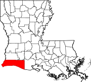
 Location within the U.S. state of Louisiana | |
 Louisiana's location within the U.S. | |
| Coordinates: 29°51′N 93°12′W / 29.85°N 93.2°W | |
| Country | |
| State | |
| Founded | 1870 |
| Named for | Simon Cameron |
| Seat | Cameron |
| Largest community | Grand Lake |
| Area | |
| • Total | 1,937 sq mi (5,020 km2) |
| • Land | 1,285 sq mi (3,330 km2) |
| • Water | 652 sq mi (1,690 km2) 34% |
| Population (2010) | |
| • Total | 6,839 |
| • Estimate (2018)[1] | 6,968 |
| • Density | 3.5/sq mi (1.4/km2) |
| Time zone | UTC−6 (Central) |
| • Summer (DST) | UTC−5 (CDT) |
| Congressional district | 3rd |

Cameron Parish (French: Paroisse de Cameron) is a parish in the southwest corner of the U.S. state of Louisiana. As of the 2010 census, the population was 6,839.[2] The parish seat is Cameron.[3] Although it is the largest parish by area in Louisiana, it has the second-smallest population in the state, ahead of only Tensas.
Cameron Parish is part of the Lake Charles, Metropolitan Statistical Area.
History[]
This was part of La Louisiane, colonized by the French beginning in the 17th and early 18th century. They encountered the Atakapa and Choctaw indigenous peoples, who had occupied this area for thousands of years.
In the late 1700s, after France had ceded New France (Canada) and other holdings east of the Mississippi River to Great Britain following its defeat in 1763 in the Seven Years' War, a number of French-speaking refugee families from Acadia settled in this part of coastal Louisiana. Some had fought against the British with Indian allies during the war in Acadia. Among them were Joseph "Beausoleil" Broussard, his brothers Alexander and Pierre, and their wives and families, who first went to Saint-Domingue (now Haiti) before settling in Louisiana. The British expelled many Acadians for their resistance, particularly their refusal to make loyalty oaths to Great Britain.[4] Numerous other French-speaking families settled here and their descendants populate the smaller towns.
In the 18th century France ceded its holdings in Louisiana and other areas west of the Mississippi River to Spain, and the Spanish colonial government made grants of land to the Acadians. France took control of this territory again at the turn of the nineteenth century for a short period under Napoleon Bonaparte. But in 1803 he sold all the French territory west of the Mississippi River to the United States in the Louisiana Purchase. The US was particularly intent on getting control of New Orleans, an important port for its large agricultural interests in what is now the Midwest.
This territory was historically part of Calcasieu Parish, established by the new Louisiana Territory legislature in 1807. The western part of this coastal area was included in what was called No Man's Land, a disputed area of control between Spain and the US after the Purchase. In the 1806 Neutral Ground agreement, both parties agreed to leave this free of military occupation or civil law enforcement.[5] The area between the Calcasieu River (at the time known to the Spanish as the Arroyo Hondo) on the east and the Sabine River on the west became a hotbed of outlaws, pirates including Jean Lafitte, and other nefarious characters for many years.[5] It was finally acquired by the United States in 1819 under the Adams-Onis Treaty with Spain. (In 1870 these two rivers were designated as the eastern and western boundaries, respectively, of the new Cameron Parish, taken from the southern part of Calcasieu Parish.)
Early Anglo-American settlers after the Louisiana Purchase included John M. Smith, Millege McCall, John William Sweeney, George W. Wakefield, William Doxey, James Hale, James Root, and John M. Miller.[6]
During the American Civil War, loyalties in this area and in the greater coastal area were divided between Unionists and Confederates. Bands of local "Jayhawkers," also known as bushwhackers, were active in the area. There were numerous Unionists near Sabine Lake and Leesburg (now Cameron). Others were located near the mouth of the Calcasieu and near Grand Chenier, then in Vermilion Parish. The Union Navy had forces at Sabine Lake.[5]
The Mermentau Jayhawkers were made up of a band of "200 mounted draft dodgers, bushwhackers, cattle thieves, runaway slaves, and Confederate deserters from Texas and Louisiana."[5] They regularly raided federal supply lines and plundered from the local people, earning the enmity of both Union and Confederate regulars. If caught by Confederate forces, Jayhawker deserters were quickly court martialed and executed. Local forces also organized as Regulators in an effort to protect women and children of local families, and repulse the Jayhawkers. After the end of the war, some of the vigilante Regulators turned to suppressing the blacks and resisting Reconstruction.[5]
Cameron Parish was organized in 1870 during the Reconstruction era and was made up of portions of Calcasieu and Vermilion parishes. It was one of several new parishes organized by the Republican-dominated legislature to create new centers of Republican political strength. Cameron Parish is named for Republican Simon Cameron, a Pennsylvanian who was President Abraham Lincoln's first secretary of war. Today its population is overwhelmingly majority white and Republican in the 21st century realignment.
This is among the largest civil parishes in Louisiana, yet the least populated, owing to the high proportion of land area made up by marsh and wetlands. Cameron Parish comprises a large portion of the Louisiana Chenier Plain; it is home to numerous cheniers, elevated fertile ridges that occur in certain coastal regions, particularly in Louisiana. These were developed for cotton plantations both before and after the Civil War; settlers also raised stock.
20th century to present[]
Some of southwest Louisiana was developed for industrial processing and export of oil products. In some areas, wetlands were drained and bayous dredged for navigation. This has been found to increase erosion of the wetlands and loss to area soils, with loss of coastline. Small farmers and hunters continued to make subsistence livings in some rural areas. There are tourist destinations for hunting and fishing.
From the mid-20th century to the early 21st century, the parish was severely damaged four times and its history marked by hurricanes Audrey, Rita, Ike, and Laura. So much damage was done by the middle two hurricanes that the population dropped in the parish by nearly one third from 2000 to 2010. The hurricanes occurred in 2005 and 2008, respectively.
In the 20th and 21st centuries, Cameron Parish has suffered severe damage from hurricanes. It was devastated by Hurricane Audrey on June 27, 1957, which caused more than 390 deaths. Authors Nola Mae Ross and Susan McFillen Goodson chronicled the stories of many survivors in their book Hurricane Audrey (1997).[7] National press coverage at the time recounted tales of tragedy and heroism.[8] The American Medical Association honored a local Cameron physician, Cecil Clark, as the 'General Practitioner of the Year' in recognition of his dedicated service despite great personal loss.[9] Hurricane Audrey was a defining event for Cameron Parish for nearly 50 years, with local history being divided into "before" and "after" the storm.
Much of the parish was destroyed again by Hurricane Rita on September 24, 2005. The movie Little Chenier was filmed in Southwest Louisiana just prior to Hurricane Rita. It contains some of the only film images of the area before it was destroyed.
In 2008, three years after Rita, Hurricane Ike came ashore at High Island, TX with a 22-foot (6.7 m) storm surge, which was far worse than Rita's 10-foot (3.0 m) surge.[10] Nearly all of the coastline in that area was flooded heavily, with surge and floodwaters reaching 60 miles inland,[11] as far north as Lake Charles.[12] In Cameron Parish the communities of Cameron, Holly Beach, Hackberry, Creole, and Grand Chenier were essentially destroyed.
Twelve years later, in 2020, Hurricane Laura made landfall near Cameron, boasting winds of over 150-mile-per-hour (240 km/h) winds and 9-foot (2.7 m) storm surge early on August 27, with the water reaching northwards towards Lake Charles. Hurricane Delta made landfall in Creole six weeks later as a Category 2 hurricane with 100-mile-per-hour (160 km/h) winds on October 9.
Geography[]
According to the U.S. Census Bureau, the parish has a total area of 1,937 square miles (5,020 km2), of which 1,285 square miles (3,330 km2) is land and 652 square miles (1,690 km2) (34%) is water.[13] It is the third-largest parish in Louisiana by land area and fourth-largest by total area. Most of the water is associated with marsh on the Gulf of Mexico.
Major highways[]
Adjacent counties and parishes[]
- Calcasieu Parish (northwest)
- Jefferson Davis Parish (northeast)
- Vermilion Parish (east)
- Jefferson County, Texas (southwest)
- Orange County, Texas (west)
National protected areas[]
- Cameron Prairie National Wildlife Refuge
- East Cove National Wildlife Refuge
- Lacassine National Wildlife Refuge (part)
- Sabine National Wildlife Refuge
Demographics[]
The population of the parish dropped by nearly one-third in the decade from 2000 to 2010; it was marked in 2005 and 2008 by extensive damage from hurricanes Rita and Ike.
| Historical population | |||
|---|---|---|---|
| Census | Pop. | %± | |
| 1870 | 1,591 | — | |
| 1880 | 2,416 | 51.9% | |
| 1890 | 2,828 | 17.1% | |
| 1900 | 3,952 | 39.7% | |
| 1910 | 4,288 | 8.5% | |
| 1920 | 3,952 | −7.8% | |
| 1930 | 6,054 | 53.2% | |
| 1940 | 7,203 | 19.0% | |
| 1950 | 6,244 | −13.3% | |
| 1960 | 6,909 | 10.7% | |
| 1970 | 8,194 | 18.6% | |
| 1980 | 9,336 | 13.9% | |
| 1990 | 9,260 | −0.8% | |
| 2000 | 9,991 | 7.9% | |
| 2010 | 6,839 | −31.5% | |
| 2018 (est.) | 6,968 | [14] | 1.9% |
| U.S. Decennial Census[15] 1790-1960[16] 1900-1990[17] 1990-2000[18] 2010-2013[2] | |||
As of the 2010 United States Census, there were 6,839 people living in the parish. 95.7% were White, 1.7% Black or African American, 0.5% Native American, 0.1% Asian, 0.8% of some other race and 1.1% of two or more races. 2.3% were Hispanic or Latino (of any race). 46.5% were of French, French Canadian or Cajun ancestry, 18.7% American, 5.8% English and 5.0% Irish ancestry.[19]
As of the census[20] of 2000, there were 9,991 people, 3,592 households, and 2,704 families living in the parish. The population density was 8 people per square mile (3/km2). There were 5,336 housing units at an average density of 4 per square mile (2/km2). The racial makeup of the parish was 93.65% White, 3.88% Black or African American, 0.37% Native American, 0.44% Asian, 0.02% Pacific Islander, 0.94% from other races, and 0.69% from two or more races. 2.15% of the population were Hispanic or Latino of any race. 11.57% reported speaking French or Cajun French at home, while 1.83% speak Spanish.[21]
There were 3,592 households, out of which 39.00% had children under the age of 18 living with them, 62.20% were married couples living together, 9.00% had a female householder with no husband present, and 24.70% were non-families. 20.90% of all households were made up of individuals, and 8.60% had someone living alone who was 65 years of age or older. The average household size was 2.76 and the average family size was 3.21.
In the parish the population was spread out, with 28.40% under the age of 18, 9.40% from 18 to 24, 29.60% from 25 to 44, 21.90% from 45 to 64, and 10.60% who were 65 years of age or older. The median age was 35 years. For every 100 females there were 100.90 males. For every 100 females age 18 and over, there were 99.40 males.
The median income for a household in the parish was $34,232, and the median income for a family was $39,663. Males had a median income of $31,167 versus $19,113 for females. The per capita income for the parish was $15,348. About 9.10% of families and 12.30% of the population were below the poverty line, including 13.10% of those under age 18 and 14.80% of those age 65 or over.
Education[]
Cameron Parish School Board operates local public schools.
Cameron Parish is in the service area of Sowela Technical Community College.[22]
Cameron Parish Public Library is a public library system in Cameron Parish. All of the libraries are located in unincorporated areas.
The main Cameron Parish Library is at 469 Marshall Street in the Cameron CDP.[23]
The system operates six branches:[24]
- Creole Branch at 184C East Creole Highway in the Creole area
- Grand Chenier Branch at 2867 Grand Chenier Highway in the Grand Chenier area
- Grand Lake Branch at 10200 Highway 384 in the Grand Lake area
- Hackberry Branch at 983 Main Street in the Hackberry CDP
- Johnson Bayou Branch at 4586 Gulf Beach Highway in the Johnson Bayou area
- Lowry Branch at 460 Lowry Highway in the area
Communities[]

There are no incorporated communities in Cameron Parish.
Census-designated places[]
Unincorporated communities[]
Notable people[]
- Gilbert Franklin Hennigan, represented Cameron Parish in the Louisiana State Senate from 1944 to 1956; he resided at the time in DeRidder in Beauregard Parish.
- Doug Kershaw, musician, was born in Cameron Parish on January 24, 1936.
- , Lake Charles native, represented Calcasieu and Cameron parishes in the Louisiana House from 1964 to 1988[25]
Politics[]
Cameron Parish, once solidly Democratic, has trended sharply Republican in recent years. The Republican nominee has won upwards of 80% of the vote in every presidential election since 2008. In 2020, Republican Donald Trump won nearly 91% of the vote in Cameron Parish, his strongest showing in Louisiana.
See also[]
References[]
- ^ https://www.census.gov/quickfacts/fact/table/cameronparishlouisiana/PST045217
- ^ Jump up to: a b "State & County QuickFacts". United States Census Bureau. Archived from the original on July 8, 2011. Retrieved August 20, 2013.
- ^ "Find a County". National Association of Counties. Archived from the original on 2011-05-31. Retrieved 2011-06-07.
- ^ Nola Mae Ross, "Broussard family traced back to roots in France", Cameron Parish Pilot (Cameron, LA), 24 May 2012; retrieved 4 January 2017
- ^ Jump up to: a b c d e W.T. Block, "CALCASIEU PARISH, LA: HOTBED OF THE CIVIL WAR JAYHAWKERS", W.T. Block website and blog, 1988-2016
- ^ Perrin, W.H. (1891) Southwest Louisiana Biographical and Historical, Reprinted 1971. Baton Rouge, Louisiana: Claitor's Publishing Division
- ^ Ross, N.M. and S.M. Goodson. 1997. Hurricane Audrey. Wise Publications, Sulphur, Louisiana. ISBN 1-887144-08-0.
- ^ "Hurricane season starts early - and it's deadly.", Life magazine (1957) 43(2):8-13.
- ^ "The General Practitioner's Award." 1957. J Am Med Assoc. 165(16):2089.
- ^ Margaret Saizan. "A Visual Story of Hurricane Rita". New York Review. Archived from the original on August 14, 2007. Retrieved June 26, 2007.
- ^ "Mega Surge". dallasnews.com. Retrieved 14 April 2018.
- ^ "Surge floodwaters". dallasnews.com. Retrieved 14 April 2018.
- ^ "2010 Census Gazetteer Files". United States Census Bureau. August 22, 2012. Archived from the original on September 28, 2013. Retrieved August 27, 2014.
- ^ "Population and Housing Unit Estimates". Retrieved October 29, 2019.
- ^ "U.S. Decennial Census". United States Census Bureau. Retrieved August 27, 2014.
- ^ "Historical Census Browser". University of Virginia Library. Retrieved August 27, 2014.
- ^ "Population of Counties by Decennial Census: 1900 to 1990". United States Census Bureau. Retrieved August 27, 2014.
- ^ "Census 2000 PHC-T-4. Ranking Tables for Counties: 1990 and 2000" (PDF). United States Census Bureau. Retrieved August 27, 2014.
- ^ ""American FactFinder"". Archived from the original on 2015-01-08. Retrieved 2015-01-08.
- ^ "U.S. Census website". United States Census Bureau. Retrieved 2008-01-31.
- ^ "Language Map Data Center". www.mla.org. Retrieved 14 April 2018.
- ^ "Our Colleges". Louisiana's Technical and Community Colleges. Retrieved 2021-06-03.
- ^ "Louisiana Library Directory." State Library of Louisiana. Accessed September 22, 2008.
- ^ ""CAMERON PARISH LIBRARY BRANCHES."". Archived from the original on 2005-04-06. Retrieved 2008-09-22.CS1 maint: bot: original URL status unknown (link) Cameron Parish Public Library. April 6, 2005.
- ^ "Biographical Sketch". Archived from the original on March 5, 2016. Retrieved July 13, 2015.
- ^ Leip, David. "Dave Leip's Atlas of U.S. Presidential Elections". uselectionatlas.org. Retrieved 14 April 2018.
External links[]
| Wikimedia Commons has media related to Cameron Parish, Louisiana. |
- Images from Cameron Parish[permanent dead link]
- Cameron Parish Sheriff's Office
Geology
- Heinrich, P. V., 2005, Lake Charles 30 x 60 minute geologic quadrangle. Louisiana Geological Survey, Baton Rouge, Louisiana.
- Heinrich, P. V., 2006, White Lake 30 x 60 minute geologic quadrangle. Louisiana Geological Survey, Baton Rouge, Louisiana.
- Heinrich, P. V., J. Snead, and R. P. McCulloh, 2002, Lake Charles 30 x 60 minute geologic quadrangle. Louisiana Geological Survey, Baton Rouge, Louisiana.
- Heinrich, P. V., J. Snead, and R. P. McCulloh, 2003, Crowley 30 x 60 minute geologic quadrangle. Louisiana Geological Survey, Baton Rouge, Louisiana.
| show Places adjacent to Cameron Parish, Louisiana |
|---|
| show Municipalities and communities of Cameron Parish, Louisiana, United States |
|---|
Coordinates: 29°51′N 93°12′W / 29.85°N 93.20°W
| show Authority control |
|---|
- Louisiana parishes
- Cameron Parish, Louisiana
- Parishes in Acadiana
- Acadiana
- County in the Lake Charles metropolitan area
- 1870 establishments in Louisiana
- Populated places established in 1870