Caddo Parish, Louisiana
Caddo Parish, Louisiana | |
|---|---|
| Parish of Caddo | |
 Caddo Parish Courthouse in Shreveport | |
 Flag  Seal | |
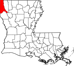 Location within the U.S. state of Louisiana | |
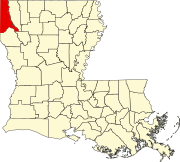
 Louisiana's location within the U.S. | |
| Country | |
| State | |
| Region | North |
| Founded | January 18, 1838 |
| Named for | Caddo Native Americans |
| Parish seat (and largest city) | Shreveport |
| Incorporated municipalities | |
| Area | |
| • Total | 2,430 km2 (937 sq mi) |
| • Land | 2,280 km2 (879 sq mi) |
| • Water | 150 km2 (58 sq mi) |
| • percentage | 16 km2 (6.2 sq mi) |
| Population (2020) | |
| • Total | 237,848 |
| • Density | 98/km2 (250/sq mi) |
| Time zone | UTC-6 (CST) |
| • Summer (DST) | UTC-5 (CDT) |
| Area code | 318 |
| Congressional district | 4th |
| Website | official website |

Caddo Parish (French: Paroisse de Caddo) is a parish located in the northwest corner of the U.S. state of Louisiana. At the 2010 census, the population was 254,969,[1] and 237,848 in 2020.[2] The parish seat is Shreveport, which developed along the Red River.[3] Caddo Parish is included in the Shreveport–Bossier City metropolitan statistical area.
History[]
In 1838, Caddo Parish was created by territory taken from Natchitoches Parish; the legislature named it for the indigenous Caddo Indians who had lived in the area. Most were forced out during Indian Removal in the 1830s.
The parish was initially a center of cotton plantations, developed by planters along the waterways and worked by thousands of enslaved African American laborers. Shreveport, the parish seat, became a center of government, trade and law.
An armory was constructed in Shreveport before the American Civil War. This city served as the state capital after Union forces had seized Baton Rouge, Louisiana. Locals have referred to the armory as "Fort Humbug".
After the Civil War, and particularly after Reconstruction, whites in the parish used violence and intimidation against blacks to suppress Republican voting and re-establish white supremacy. The parishes in northwest Louisiana had a high rate of violence and lynchings. From 1877 through the early 20th century, there were 48 lynchings of African Americans in Caddo Parish; this was the second-highest total in the state after Lafourche Parish, and nearly twice as high as the lowest parishes among the top six.[4] The victims included Jennie Steers, a domestic servant hanged by a white lynch mob in July 1903, for allegedly poisoning her employer's daughter.[5]
In 1920 the Daughters of the Confederacy, who were memorializing the Civil War, designated the armory as "Fort Turnball". During World War II, the government used it as a mobilization site for men who had been drafted and recruited.
In the early twentieth century, the oil industry developed here, with a concentration of related businesses in Shreveport. Numerous oil wells were constructed across southern Arkansas and northern Louisiana.[6]
Geography[]
According to the U.S. Census Bureau, the parish has a total area of 937 square miles (2,430 km2), of which 978 square miles (2,530 km2) is land and 58 square miles (150 km2) (6.2%) is water.[7]
Major highways[]
Adjacent counties and parishes[]
- Miller County, Arkansas (north)
- Lafayette County, Arkansas (northeast)
- Bossier Parish (east)
- Red River Parish (southeast)
- De Soto Parish (south)
- Panola County, Texas (southwest)
- Harrison County, Texas (west)
- Marion County, Texas (west)
- Cass County, Texas (northwest)
National protected area[]
Communities[]
City[]
- Shreveport (parish seat and largest municipality)
Towns[]
- Blanchard (suburb of Shreveport)
- Greenwood (suburb of Shreveport)
- Mooringsport
- Oil City
- Vivian
Villages[]
Unincorporated areas[]
Census-designated places[]
- Lakeview (suburb of Shreveport)
Other unincorporated communities[]
- Bethany (partly in Panola County, Texas)
- Conn
- Dixie
- Forbing
- Keithville (suburb of Shreveport)
- Zylks
Demographics[]
| Historical population | |||
|---|---|---|---|
| Census | Pop. | %± | |
| 1840 | 5,282 | — | |
| 1850 | 8,884 | 68.2% | |
| 1860 | 12,140 | 36.7% | |
| 1870 | 21,714 | 78.9% | |
| 1880 | 26,296 | 21.1% | |
| 1890 | 31,555 | 20.0% | |
| 1900 | 44,499 | 41.0% | |
| 1910 | 58,200 | 30.8% | |
| 1920 | 83,265 | 43.1% | |
| 1930 | 124,670 | 49.7% | |
| 1940 | 150,203 | 20.5% | |
| 1950 | 176,547 | 17.5% | |
| 1960 | 223,859 | 26.8% | |
| 1970 | 230,184 | 2.8% | |
| 1980 | 252,358 | 9.6% | |
| 1990 | 248,253 | −1.6% | |
| 2000 | 252,161 | 1.6% | |
| 2010 | 254,969 | 1.1% | |
| 2020 | 237,848 | −6.7% | |
| U.S. Decennial Census[8] 1790-1960[9] 1900-1990[10] 1990-2000[11] 2010-2019[1] | |||
At the 2010 U.S. census, there were 254,969 people, 119,502 households, and 68,900 families residing in the parish. According to 2012 U.S. Census Bureau estimates, the Caddo Parish population was 257,093. In 2020, the parish population declined to 237,848.[2] As of 2010, the population density was 286 people per square mile (110/km2).
At the 2019 American Community Survey, the racial and ethnic makeup of the parish was 49.9% Black or African American, 44.3% non-Hispanic or Latino white, 0.4% Native American, 1.2% Asian, 0.2% Native Hawaiian and other Pacific Islander, 0.3% some other race, 1.8% two or more races, and 2.9% Hispanic or Latin American of any race.[12] In 2010, the racial makeup of the parish was 49.1% White, 40.0% Black or African American, 1.2% Native American, 1.8% Asian, 0.1% Native Hawaiian and Pacific Islander, 0.82% from other races, and 1.8% from two or more races; 5.4% of the population were Hispanic or Latin American.
In 2010, there were 119,502 households, out of which 30.90% had children under the age of 18 living with them, 42.20% were married couples living together, 19.80% had a female householder with no husband present, and 33.70% were non-families. 28.90% of all households were made up of individuals, and 10.50% had someone living alone who was 65 years of age or older. The average household size was 2.51 and the average family size was 3.11. In 2019, there were 92,589 households spread throughout 113,578 housing units; 59.8% of housing units were owner-occupied. The median gross rent was $810.[12]
At the 2010 census, the parish the population was spread out, with 26.80% under the age of 18, 10.20% from 18 to 24, 27.40% from 25 to 44, 22.00% from 45 to 64, and 13.70% who were 65 years of age or older. The median age was 35 years. For every 100 females there were 89.70 males. For every 100 females age 18 and over, there were 84.90 males. At the 2019 American Community Survey, 76.1% were aged 18 and older, and 6.8% of the population were age 5 and under. The median age was 38.8.
Economy[]
The parish includes some of the poorest areas in the state by ZIP code. Statistics from 2014 show:[13]
- West Shreveport (71103) was the poorest ZIP code in the state with a per capita income of just $22,267.
- Queensborough, Shreveport (71109) was the fourth-poorest with $24,966.
- Caddo Heights/South Highlands (71108) was the fifth-poorest with $25,334.
- Rodessa (71069) was the twenty-fourth-poorest with $34,346.
The largest employers in the region are:[14]
| Employer | Employees | Note | |
|---|---|---|---|
| 1 | Caddo Parish Public Schools (CPPS) | 9,416 | |
| 2 | Willis-Knighton Medical Center | 6,732 | |
| 3 | University Health | 6,372 | |
| 4 | LSU Health Shreveport | 2,762 | |
| 5 | City of Shreveport | 2,569 |
Law and government[]
As parish seat, Shreveport is the site of the parish courthouse. Caddo Parish comprises the 1st Judicial District. Located downtown on Texas Street, the courthouse contains both civil and criminal courts. The current elected judges are: Ramon Lafitte, Craig O. Marcotte, Michael A. Pitman, Karelia R. Stewart, Robert P. Waddell, Erin Leigh W. Garrett, Katherine C. Dorroh, John Mosely, Jr., Brady O'Callaghan, Ramona Emanuel, Charles G. Tutt, and Roy Brun. The Clerk of Court is Mike Spence. Caddo Parish like all parishes in Louisiana utilizes Justices of the Peace and Constables particularly when civil suits below $5000 or an eviction has been filed.
Politics[]
Since the late 20th century, most conservative whites in Louisiana have shifted into the Republican Party. Politics largely follows ethnic patterns, as most African Americans have supported national Democratic candidates since regaining the power to vote and other civil rights under Democratic national administrations. Some urban liberal whites also vote Democratic. Since 1980, Caddo Parish has voted for the overall national popular vote winner in presidential campaigns. Notably the city of Shreveport is the base for Democratic strength, while surrounding white-majority suburban areas are aligned with the Republican Party.[15]
In the 2004 presidential election, Republican George W. Bush won Caddo Parish. He received 51% of the vote and 54,292 votes. Democrat John F. Kerry received 48% of the vote and 51,739 votes.
In 2008, Democrat Barack Obama won 51% of the vote and 55,536 votes in the parish. John McCain trailed with 48% and 52,228 votes. Other candidates received about 1% of the vote. McCain carried the state of Louisiana.
In the U.S. Senate election in 2008, Democrat Mary Landrieu, who survived a hard challenge from Republican John Neely Kennedy, received 58% of the vote in Caddo Parish and 60,558 votes. John Kennedy won 40% of the vote and 41,348 votes. Other candidates received 2% of the vote.
In the 2016 US Senate election, Republican John Neely Kennedy defeated Democrat Foster Campbell in Caddo Parish. Kennedy also won the general statewide election, giving Louisiana two Republican senators.
Education[]
The Caddo Parish School Board operates public schools. The parish also has fourteen private schools.[17]
It is in the service area of Bossier Parish Community College.[18]
Correction center[]
The Louisiana Department of Public Safety & Corrections operated the Forcht-Wade Correctional Center in Keithville, an unincorporated section of Caddo Parish.[19] As the state succeeded in reducing the number of prisoners, it closed this facility in July 2012.[20]
The Caddo Correctional Center is a full-service parish jail rated at a capacity of 1,500 beds. Constructed in 1994, this facility was designed to successfully manage a large number of inmates with a minimum of personnel. The Caddo Correctional Center is the largest jail in the Ark-La-Tex and the only "direct supervision" facility in the state.[citation needed]
National Guard[]
This section does not cite any sources. (January 2013) |
The 2nd Squadron of the 108th Cavalry Regiment (formerly 1-156 Armor Battalion until September 2006) is headquartered in Shreveport at the armory at the intersection of Stoner Avenue and Youree Drive. This facility was built before the Civil War. This unit has served two tours of duty in Iraq (2004–05 & 2010) as part of the 256th Infantry Brigade of the Louisiana National Guard.
See also[]
- National Register of Historic Places listings in Caddo Parish, Louisiana
- USS Caddo Parish (LST-515)
- Steve Prator, sheriff of Caddo Parish since 2000
- Jasper K. Smith, former member of the Louisiana House of Representatives 1944–1948 and 1952–1964, and former city attorney of Vivian
References[]
- ^ Jump up to: a b "State & Parish QuickFacts". United States Census Bureau. Archived from the original on July 7, 2011. Retrieved August 20, 2013.
- ^ Jump up to: a b "QuickFacts: Caddo Parish, Louisiana". U.S. Census Bureau. Retrieved August 19, 2021.
- ^ "Find a County". National Association of Counties. Archived from the original on 2011-05-31. Retrieved 2011-06-07.
- ^ Lynching in America, Third Edition: Supplement by County Archived 2017-10-23 at the Wayback Machine, p. 6, Equal Justice Initiative, Mobile, AL, 2017
- ^ Michael James Pfeifer, Rough Justice: Lynching and American Society, 1874-1947, University of Illinois Press, 2004, p. 198, Footnote #104
- ^ Fairclough (1999), pp. 7-8
- ^ "2010 Census Gazetteer Files". United States Census Bureau. August 22, 2012. Archived from the original on September 28, 2013. Retrieved August 27, 2014.
- ^ "U.S. Decennial Census". United States Census Bureau. Archived from the original on April 26, 2015. Retrieved August 27, 2014.
- ^ "Historical Census Browser". University of Virginia Library. Retrieved August 27, 2014.
- ^ "Population of Counties by Decennial Census: 1900 to 1990". United States Census Bureau. Retrieved August 27, 2014.
- ^ "Census 2000 PHC-T-4. Ranking Tables for Counties: 1990 and 2000" (PDF). United States Census Bureau. Retrieved August 27, 2014.
- ^ Jump up to: a b "Geography Profile: Caddo Parish, Louisiana". data.census.gov. Retrieved 2021-08-19.
- ^ "The 50 poorest places in Louisiana, by ZIP code". New Orleans Times-Picciune. 15 March 2017. Retrieved 13 December 2017.
- ^ "Leading Employers in Caddo Parish". North Louisiana Economic Partnership. Retrieved 15 December 2017.
- ^ [1]
- ^ Leip, David. "Dave Leip's Atlas of U.S. Presidential Elections". uselectionatlas.org. Retrieved 2018-03-07.
- ^ "Caddo Parish, LA Private Schools". Private School Review. Retrieved 28 January 2018.
- ^ "Our Colleges". Louisiana's Technical and Community Colleges. Retrieved 2021-06-03.
- ^ "Forcht-Wade Corr. Center Archived 2008-09-15 at the Wayback Machine." Louisiana Department of Public Safety and Corrections. Accessed September 14, 2008.
- ^ "Forcht-Wade Correctional Center Archived 2012-11-02 at the Wayback Machine." (Archive) Louisiana Department of Public Safety & Corrections. Retrieved on October 23, 2012.
External links[]
| show Places adjacent to Caddo Parish, Louisiana |
|---|
| show Municipalities and communities of Caddo Parish, Louisiana, United States |
|---|
Coordinates: 32°35′N 93°53′W / 32.58°N 93.88°W

| show Authority control |
|---|
- Caddo Parish, Louisiana
- Louisiana parishes
- Parishes in Shreveport – Bossier City metropolitan area
- Geography of Shreveport, Louisiana
- 1838 establishments in Louisiana
- Populated places established in 1838