Hosston, Louisiana
Hosston, Louisiana | |
|---|---|
Village | |
| Village of Hosston | |
 Hosston branch of Caddo Parish Library | |
 Location of Hosston in Caddo Parish, Louisiana. | |
 Location of Louisiana in the United States | |
| Coordinates: 32°53′12″N 93°52′53″W / 32.88667°N 93.88139°WCoordinates: 32°53′12″N 93°52′53″W / 32.88667°N 93.88139°W | |
| Country | United States |
| State | Louisiana |
| Parish | Caddo |
| Area | |
| • Total | 2.78 sq mi (7.20 km2) |
| • Land | 2.67 sq mi (6.92 km2) |
| • Water | 0.11 sq mi (0.28 km2) |
| Elevation | 220 ft (70 m) |
| Population (2010) | |
| • Total | 318 |
| • Estimate (2019)[2] | 299 |
| • Rank | CD: 7th |
| • Density | 111.90/sq mi (43.21/km2) |
| Time zone | UTC-6 (CST) |
| • Summer (DST) | UTC-5 (CDT) |
| Area code(s) | 318 |
| FIPS code | 22-36150 |

Hosston is a village in Caddo Parish, Louisiana, United States. The population was 318 at the 2010 census.[3] It is part of the Shreveport–Bossier City Metropolitan Statistical Area.
Geography[]
Hosston is located in northern Caddo Parish at 32°53′12″N 93°52′53″W / 32.88667°N 93.88139°W (32.886777, -93.881364),[4] 3 miles (5 km) west of the Red River and 1 mile (1.6 km) east of Black Bayou Lake. U.S. Route 71 runs through the center of the village, leading south 28 miles (45 km) to Shreveport and north 9 miles (14 km) to the Arkansas line at Ida. Louisiana Highway 2 runs west from Hosston 7 miles (11 km) to Vivian and east 11 miles (18 km) to Plain Dealing.
According to the United States Census Bureau, Hosston has a total area of 2.8 square miles (7.2 km2), of which 2.7 square miles (6.9 km2) is land and 0.1 square miles (0.3 km2), or 3.94%, is water.[3]
Climate[]
The climate in this area is characterized by hot, humid summers and generally mild to cool winters. According to the Köppen Climate Classification system, Hosston has a humid subtropical climate, abbreviated "Cfa" on climate maps.[5]
Demographics[]
| Historical population | |||
|---|---|---|---|
| Census | Pop. | %± | |
| 1970 | 428 | — | |
| 1980 | 480 | 12.1% | |
| 1990 | 417 | −13.1% | |
| 2000 | 387 | −7.2% | |
| 2010 | 318 | −17.8% | |
| 2019 (est.) | 299 | [2] | −6.0% |
| U.S. Decennial Census[6] | |||
As of the census[7] of 2000, there were 387 people, 152 households, and 101 families residing in the village. The population density was 144.9 inhabitants per square mile (56.0/km2). There were 175 housing units at an average density of 65.5 per square mile (25.3/km2). The racial makeup of the village was 77.00% White, 22.48% African American, 0.26% Asian, and 0.26% from two or more races. Hispanic or Latino of any race were 0.26% of the population.
There were 152 households, out of which 29.6% had children under the age of 18 living with them, 53.3% were married couples living together, 10.5% had a female householder with no husband present, and 32.9% were non-families. 28.3% of all households were made up of individuals, and 15.1% had someone living alone who was 65 years of age or older. The average household size was 2.55 and the average family size was 3.20.
In the village, the population was spread out, with 26.6% under the age of 18, 5.7% from 18 to 24, 26.4% from 25 to 44, 21.4% from 45 to 64, and 19.9% who were 65 years of age or older. The median age was 41 years. For every 100 females, there were 97.4 males. For every 100 females age 18 and over, there were 94.5 males.
The median income for a household in the village was $22,500, and the median income for a family was $26,250. Males had a median income of $25,179 versus $18,125 for females. The per capita income for the village was $12,282. About 24.1% of families and 27.8% of the population were below the poverty line, including 36.7% of those under age 18 and 15.3% of those age 65 or over.
Gallery[]

Hosston Village Hall at the intersection of Louisiana State Highway 2 and U.S. Highway 71

Hosston Methodist Church


References[]
- ^ "2019 U.S. Gazetteer Files". United States Census Bureau. Retrieved July 25, 2020.
- ^ a b "Population and Housing Unit Estimates". United States Census Bureau. May 24, 2020. Retrieved May 27, 2020.
- ^ a b "Geographic Identifiers: 2010 Demographic Profile Data (G001): Hosston village, Louisiana". U.S. Census Bureau, American Factfinder. Archived from the original on February 12, 2020. Retrieved August 14, 2014.
- ^ "US Gazetteer files: 2010, 2000, and 1990". United States Census Bureau. 2011-02-12. Retrieved 2011-04-23.
- ^ Climate Summary for Hosston, Louisiana
- ^ "Census of Population and Housing". Census.gov. Retrieved June 4, 2015.
- ^ "U.S. Census website". United States Census Bureau. Retrieved 2008-01-31.
Municipalities and communities of Caddo Parish, Louisiana, United States | ||
|---|---|---|
Parish seat: Shreveport | ||
| City | 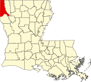 | |
| Towns | ||
| Villages | ||
| CDP | ||
| Other communities |
| |
| Ghost town | ||
| Footnotes | ‡This populated place also has portions in an adjacent parish or parishes | |
| ||

- Villages in Caddo Parish, Louisiana
- Villages in Louisiana
- Villages in Shreveport – Bossier City metropolitan area