Harvey, Louisiana
Harvey, Louisiana | |
|---|---|
Census-designated place | |
 Jefferson Parish Sheriff's Office, Harvey | |
 Harvey, Louisiana Location of Harvey in Louisiana | |
| Coordinates: 29°53′28″N 90°04′09″W / 29.89111°N 90.06917°WCoordinates: 29°53′28″N 90°04′09″W / 29.89111°N 90.06917°W | |
| Country | United States |
| State | Louisiana |
| Parish | Jefferson |
| Area | |
| • Total | 7.1 sq mi (18 km2) |
| • Land | 6.6 sq mi (17 km2) |
| • Water | 0.5 sq mi (1 km2) |
| Elevation | 3 ft (0.9 m) |
| Population (2020) | |
| • Total | 22,236 |
| • Density | 3,100/sq mi (1,200/km2) |
| Time zone | UTC-6 (CST) |
| • Summer (DST) | UTC-5 (CDT) |
| ZIP Code | 70058 |
| Area code(s) | 504 |
| FIPS code | 22-33245 |

Harvey is a census-designated place (CDP) in Jefferson Parish, Louisiana, United States. Harvey is on the south side (referred to as the "West Bank") of the Mississippi River, within the New Orleans–Metairie–Kenner metropolitan statistical area. The majority-minority population was 20,348 at the 2010 census,[1] down from 22,226 at the 2000 census. The 2020 census determined 22,236 people lived in the CDP.[2]
History[]
During the French colonial era, the first owner of this land was Jean-Baptiste d'Estrehan de Beaupre,[3] royal treasurer and comptroller for the French Louisiana colony. He established a plantation here. He used his slaves to dig the ditch that would become the Harvey Canal, cutting south from the banks of the Mississippi River to the back of , to provide better access.
Years later, d'Estrehan paid German settlers in the area to work on widening the ditch; they used wooden shovels. He paid them with small parcels of land located downriver in Mechanicsham, now the city of Gretna. D'Estrehan built his home where the ditch met the river banks, naming the settlement "Cosmopolite City".[4]
Harvey was founded as a company town at its founding, developed by Joseph Hale Harvey (born March 7, 1816). During this time, Joseph Harvey would rename Cosmopolite City after his family surname. Harvey's wife, née Louise Destrehan (1827-1903),[5] was a great-granddaughter of Jean Baptiste d'Estrehan. She was the daughter of Nicolas Noel d'Estrehan and granddaughter of Jean Noel Destréhan.
Harvey and Destrehan initiated construction of the canal locks leading to the Mississippi. Their son, Horace Harvey (c. 1860-1938), carried on development of the canal and its surroundings.[4][6]
21st-century legal case[]
In 2003, Harvey resident Patrick O'Neal Kennedy was sentenced to death after being convicted of violently raping his eight-year-old stepdaughter. His case was appealed and ultimately reached the U.S. Supreme Court. It ruled in Kennedy v. Louisiana (2008), that the death penalty for rape, even of a child, constituted cruel and unusual punishment under the Eighth Amendment to the Constitution. They argued that the child or adult victim had not lost their life. By 2008, few states in the United States still had death penalty statutes that authorized capital punishment for rape.
Geography[]
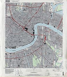
Harvey is located east of the Intracoastal Canal on the Mississippi River, at coordinates 29°53′28″N 90°04′09″W / 29.89111°N 90.06917°W. It is bordered to the east by Gretna, to the west by Marrero, to the southwest by Woodmere, and to the north, across the Mississippi, by New Orleans. The closest highway crossing of the river is the Crescent City Connection 4 miles (6 km) northeast of Harvey.
According to the United States Census Bureau, the Harvey CDP has a total area of 7.1 square miles (18.3 km2), of which 6.6 sq mi (17.0 km2) are land and 0.5 sq mi (1.3 km2), or 7.16%, are water.[1]
Demographics[]
| Historical population | |||
|---|---|---|---|
| Census | Pop. | %± | |
| 1970 | 6,347 | — | |
| 1980 | 22,709 | 257.8% | |
| 1990 | 21,222 | −6.5% | |
| 2000 | 22,226 | 4.7% | |
| 2010 | 20,348 | −8.4% | |
| 2020 | 22,236 | 9.3% | |
| source:[7] | |||
At the 2020 U.S. census, there were 22,236 people in Harvey.[2] At the 2019 American Community Survey, there were 21,054 people living in the CDP.[8] The racial and ethnic makeup was 34.2% non-Hispanic white, 51.6% African American, 0.2% Native American, 4.9% Asian, 4.1% some other race, 1.3% two or more races, and 9.5% Hispanic or Latin American of any race. The median household income was $41,559 and 16.6% of the population lived at or below the poverty line.
As of the census[9] of 2010, there were 20,348 people, 7,544 households, and 5,160 families residing in the CDP. There were 8,895 housing units, of which 1,351, or 15.2%, were vacant. The racial makeup of the CDP was 43.5% White, 41.1% African American, 0.4% Native American, 6.8% Asian, 0.1% Pacific Islander, 5.6% some other race, and 2.5% from two or more races. Hispanic or Latino of any race were 13.4% of the population.[10]
Of the 7,544 households, 35.6% had children under the age of 18 living with them, 40.5% were married couples living together, 20.9% had a female householder with no husband present, and 31.6% were non-families. 25.0% of all households were made up of individuals, and 7.1% were someone living alone who was 65 years of age or older. The average household size was 2.67, and the average family size was 3.17.[10]
In the CDP, 24.3% of the population were under the age of 18, 10.0% were from 18 to 24, 28.1% from 25 to 44, 26.3% from 45 to 64, and 11.3% were 65 years of age or older. The median age was 35.6 years. For every 100 females, there were 94.4 males. For every 100 females age 18 and over, there were 92.2 males.[10]
For the period 2012-2016, the median annual income for a household in the CDP was $37,058, and the median income for a family was $52,173. Male full-time workers had a median income of $40,205 versus $32,500 for females. The per capita income for the CDP was $22,344. About 17.4% of families and 21.5% of the population were below the poverty line, including 29.4% of those under age 18 and 19.4% of those age 65 or over.[11]
Government and infrastructure[]
The Louisiana Office of Juvenile Justice operates the New Orleans Metro Office in Harvey.[12]
The United States Postal Service operates the Harvey Post Office.[13]
Education[]

Harvey's public schools are operated by the Jefferson Parish Public School System, which has its headquarters in Harvey.[14][15]
Public high schools:[16]
Some residents are zoned to Gretna Middle School in Gretna, and some are zoned to Marrero Middle School in Marrero.[17]
Woodland West Elementary School is in Harvey.[18] Ella C. Pittman Elementary School is in Marrero, adjacent to Harvey and serving portions of Harvey.[15][18] Other schools outside of Harvey serving portions: Gretna Park and McDonogh #26 in Gretna, Cox Elementary in Timberlane, Collins Elementary (formerly Ames) in Marrero.[18] Woodmere Elementary in Woodmere is nearby,[19] but its attendance zone does not cover the Harvey CDP.[18]
Public kindergartens:
- Harvey Kindergarten Center
In regards to advanced studies academies, residents are zoned to the Gretna Academy.[20]
Previously Homedale Elementary in Harvey served portions of the city.[21] In 2012 Homedale Elementary closed.[22] A plan called for Homedale students to be rezoned to McDonogh 26 Elementary in Gretna.[23]
Private schools
- St. Ville Academy for High School Preparation
- Homedale School
- St Rosalie Elementary School
Jefferson Parish Library operates the Jane O'Brien Chatelain West Bank Regional Library in Harvey.[15][24] The 35,000-square-foot (3,300 m2) facility opened in 1990 and is the largest public library in the West Bank of Jefferson Parish.[24]
Notable people[]
| Wikimedia Commons has media related to Harvey, Louisiana. |
- Zaila Avant-garde, winner of the 2021 Scripps National Spelling Bee
- Ja'Marr Chase, wide receiver in the NFL. Currently playing for the Cincinnati Bengals.
- Patrick Connick, the District 84 Republican state representative, practices law in Marrero and resides in Harvey.[25]
- Fats Domino, rock and roll singer and pianist
- , former state representative for District 87 in Jefferson Parish; contractor in Harvey[26]
- Patrick O'Neal Kennedy (plaintiff in Kennedy v. Louisiana)[27]
- Greg Monroe, NBA player
- Laremy Tunsil, NFL player, currently playing for the Houston Texans.
- , Democratic member since 2013 of the Louisiana House of Representatives for District 87, resides in Harvey.[28]
References[]
- ^ Jump up to: a b "Geographic Identifiers: 2010 Census Summary File 1 (G001): Harvey CDP, Louisiana". American Factfinder. U.S. Census Bureau. Archived from the original on February 13, 2020. Retrieved July 2, 2018.
- ^ Jump up to: a b "QuickFacts: Harvey CDP, Louisiana". U.S. Census Bureau.
- ^ Dictionary of Louisiana Biography online, 2008 Archived October 20, 2017, at the Wayback Machine, accessed September 22, 2015.
- ^ Jump up to: a b Reeves, William D. (William Dale), Harvey: The Canal, the Family, the Community; The Times-Picayune; date: April 17, 1949; page 97; location: New Orleans, Louisiana.
- ^ Louise Destrehan Harvey on Find a Grave, accessed September 22, 2015.
- ^ Ray Samuel, "Grand Canal of an Oil Empire", New Orleans States Magazine, pp. 5-7, The Times-Picayune
- ^ "CENSUS OF POPULATION AND HOUSING (1790-2000)". U.S. Census Bureau. Retrieved July 17, 2010.
- ^ "Geography Profile: Harvey CDP, Louisiana". data.census.gov. Retrieved August 12, 2021.
- ^ "U.S. Census website". United States Census Bureau. Retrieved January 31, 2008.
- ^ Jump up to: a b c "Profile of General Population and Housing Characteristics: 2010 Census Summary File 1 (DP-1): Harvey CDP, Louisiana". American Factfinder. U.S. Census Bureau. Archived from the original on February 13, 2020. Retrieved July 2, 2018.
- ^ "Selected Economic Characteristics: 2012-2016 American Community Survey 5-Year Estimates (DP03): Harvey CDP, Louisiana". American Factfinder. U.S. Census Bureau. Archived from the original on February 13, 2020. Retrieved July 2, 2018.
- ^ "Regional offices." Louisiana Office of Juvenile Justice. Retrieved on December 26, 2017. "2150 Westbank Expressway, Harvey, LA, United States"
- ^ "HARVEY." United States Postal Service. Retrieved on December 26, 2017. "2801 MANHATTAN BLVD HARVEY, LA 70058-9998"
- ^ Home page Archived March 26, 2013, at the Wayback Machine. Jefferson Parish Public Schools. Retrieved on December 23, 2009.
- ^ Jump up to: a b c "2010 CENSUS - CENSUS BLOCK MAP (INDEX): Harvey CDP, LA" (Archive). U.S. Census Bureau. Retrieved on May 18, 2014.
- ^ "High School Districts 2012-2013 West Bank of Jefferson Parish Louisiana Archived 2013-09-05 at the Wayback Machine" (Archive). Jefferson Parish Public Schools. Retrieved on May 18, 2014.
- ^ "Middle School Districts 2012-2013 West Bank of Jefferson Parish Louisiana Archived 2013-09-05 at the Wayback Machine" (Archive). Jefferson Parish Public Schools. Retrieved on May 18, 2014.
- ^ Jump up to: a b c d "Elementary School Districts 2012-2013 West Bank of Jefferson Parish Louisiana Archived 2013-09-05 at the Wayback Machine" (Archive). Jefferson Parish Public Schools. Retrieved on May 18, 2014.
- ^ Bickham, Shaniece. "Woodmere Elementary in Harvey starts school year with new principal." The Times Picayune. August 9, 2013. Retrieved on May 18, 2014.
- ^ "Westbank Advanced Studies Academies Attendance Zones Archived 2013-09-05 at the Wayback Machine" (Archive). Jefferson Parish Public Schools. Retrieved on May 18, 2014.
- ^ "Elementary School Districts 2009-2010 West Bank of Jefferson Parish Louisiana." (Archive) Jefferson Parish Public School System. Retrieved on September 26, 2010.
- ^ Waller, Mark. "Group of schools shuts down as Jefferson Parish adjourns for the summer." The Times-Picayune. May 25, 2012. Retrieved on April 4, 2013.
- ^ Waller, Mark. "Parents speak out to defend Homedale Elementary in Harvey from closure." The Times-Picayune. May 2, 2012. Retrieved on April 4, 2013.
- ^ Jump up to: a b "Jane O'Brien Chatelain West Bank Regional Library." Jefferson Parish Library. Retrieved on September 29, 2010.
- ^ "Representative Patrick Connick". pledgeyourvote.net. Retrieved September 21, 2011.
- ^ "Rep. Jackson, III, Girod (D)". louisianagovernmentalstudies.com. Retrieved May 8, 2015.
- ^ Purpura, Paul. "Patrick Kennedy, whose conviction led to ban on executing child rapists, to remain in prison during appeal." The New Orleans Times-Picayune. December 20, 2013. Retrieved on March 16, 2014.
- ^ "Ebony T. Woodruff". intelius.com. Retrieved May 3, 2015.
| show Municipalities and communities of Jefferson Parish, Louisiana, United States |
|---|


| Authority control |
|
|---|
- Census-designated places in Louisiana
- Census-designated places in Jefferson Parish, Louisiana
- Census-designated places in New Orleans metropolitan area
- Louisiana populated places on the Mississippi River