Oberlin, Louisiana
Oberlin, Louisiana | |
|---|---|
Town | |
 Downtown Oberlin with the Allen Parish Courthouse in the background | |
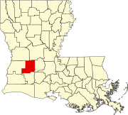
 Location of Oberlin in Allen Parish, Louisiana. | |
 Location of Louisiana in the United States | |
| Coordinates: 30°37′10″N 92°45′51″W / 30.61944°N 92.76417°WCoordinates: 30°37′10″N 92°45′51″W / 30.61944°N 92.76417°W | |
| Country | United States |
| State | Louisiana |
| Parish | Allen |
| Government | |
| • Mayor | Joseph "Moochie" Manuel (D) (first elected 2014) |
| Area | |
| • Total | 4.38 sq mi (11.35 km2) |
| • Land | 4.38 sq mi (11.35 km2) |
| • Water | 0.00 sq mi (0.01 km2) |
| Elevation | 69 ft (21 m) |
| Population (2010) | |
| • Total | 1,770 |
| • Estimate (2019)[2] | 1,730 |
| • Density | 394.89/sq mi (152.46/km2) |
| Time zone | UTC-6 (CST) |
| • Summer (DST) | UTC-5 (CDT) |
| ZIP Code | 70655 |
| Area code(s) | 337 |
| FIPS code | 22-57450 |

Oberlin is a town in and the parish seat of Allen Parish, Louisiana, United States.[3] The population was 1,770 at the 2010 census.[4] The town is named after Johann Friedrich Oberlin.
Oberlin was the home of , a Democratic member of the Louisiana State Senate and, later, the Louisiana Public Service Commission. He ran unsuccessfully in 1944 for governor of Louisiana.
Geography[]
Oberlin is located at 30°37′10″N 92°45′51″W / 30.61944°N 92.76417°W (30.619560, -92.764058).[5] According to the United States Census Bureau, the town has a total area of 4.4 square miles (11.4 km2), all land.[4] Oberlin is located on U.S. Route 165 at LA 26.
Climate[]
| hideClimate data for Oberlin, Louisiana (1991–2020 normals, extremes 1953–present) | |||||||||||||
|---|---|---|---|---|---|---|---|---|---|---|---|---|---|
| Month | Jan | Feb | Mar | Apr | May | Jun | Jul | Aug | Sep | Oct | Nov | Dec | Year |
| Record high °F (°C) | 82 (28) |
85 (29) |
89 (32) |
93 (34) |
99 (37) |
102 (39) |
102 (39) |
106 (41) |
108 (42) |
96 (36) |
90 (32) |
83 (28) |
108 (42) |
| Average high °F (°C) | 59.2 (15.1) |
63.4 (17.4) |
70.2 (21.2) |
76.7 (24.8) |
83.3 (28.5) |
88.5 (31.4) |
90.3 (32.4) |
91.1 (32.8) |
86.9 (30.5) |
78.6 (25.9) |
68.6 (20.3) |
61.3 (16.3) |
76.5 (24.7) |
| Daily mean °F (°C) | 49.2 (9.6) |
53.3 (11.8) |
60.0 (15.6) |
66.3 (19.1) |
73.5 (23.1) |
79.1 (26.2) |
81.1 (27.3) |
81.3 (27.4) |
76.9 (24.9) |
67.6 (19.8) |
57.8 (14.3) |
51.4 (10.8) |
66.5 (19.2) |
| Average low °F (°C) | 39.2 (4.0) |
43.3 (6.3) |
49.7 (9.8) |
56.0 (13.3) |
63.7 (17.6) |
69.8 (21.0) |
71.9 (22.2) |
71.5 (21.9) |
66.9 (19.4) |
56.5 (13.6) |
47.1 (8.4) |
41.5 (5.3) |
56.4 (13.6) |
| Record low °F (°C) | 9 (−13) |
16 (−9) |
21 (−6) |
31 (−1) |
39 (4) |
49 (9) |
56 (13) |
56 (13) |
40 (4) |
28 (−2) |
20 (−7) |
8 (−13) |
8 (−13) |
| Average precipitation inches (mm) | 6.42 (163) |
4.66 (118) |
4.09 (104) |
5.10 (130) |
5.12 (130) |
5.75 (146) |
5.57 (141) |
5.08 (129) |
5.06 (129) |
4.58 (116) |
4.81 (122) |
5.51 (140) |
61.75 (1,568) |
| Average snowfall inches (cm) | 0.0 (0.0) |
0.0 (0.0) |
0.0 (0.0) |
0.0 (0.0) |
0.0 (0.0) |
0.0 (0.0) |
0.0 (0.0) |
0.0 (0.0) |
0.0 (0.0) |
0.0 (0.0) |
0.0 (0.0) |
0.1 (0.25) |
0.1 (0.25) |
| Average precipitation days (≥ 0.01 in) | 10.8 | 9.3 | 8.3 | 7.5 | 7.8 | 11.1 | 10.6 | 10.3 | 8.8 | 6.9 | 7.8 | 10.1 | 109.3 |
| Average snowy days (≥ 0.1 in) | 0.0 | 0.0 | 0.0 | 0.0 | 0.0 | 0.0 | 0.0 | 0.0 | 0.0 | 0.0 | 0.0 | 0.1 | 0.1 |
| Source: NOAA[6][7] | |||||||||||||
Demographics[]
| Historical population | |||
|---|---|---|---|
| Census | Pop. | %± | |
| 1900 | 213 | — | |
| 1910 | 232 | 8.9% | |
| 1920 | 623 | 168.5% | |
| 1930 | 790 | 26.8% | |
| 1940 | 962 | 21.8% | |
| 1950 | 1,544 | 60.5% | |
| 1960 | 1,794 | 16.2% | |
| 1970 | 1,857 | 3.5% | |
| 1980 | 1,764 | −5.0% | |
| 1990 | 1,808 | 2.5% | |
| 2000 | 1,853 | 2.5% | |
| 2010 | 1,770 | −4.5% | |
| 2019 (est.) | 1,730 | [2] | −2.3% |
| U.S. Decennial Census[8] | |||
As of the census[9] of 2000, there were 1,853 people, 702 households, and 464 families residing in the town. The population density was 602.0 people per square mile (232.3/km2). There were 789 housing units at an average density of 256.3 per square mile (98.9/km2).
The racial makeup of the town was 60.28% White, 37.61% African American, 0.76% Native American, 0.27% Asian, 0.16% from other races, and 0.92% from two or more races. Hispanic or Latino of any race were 0.70% of the population.
There were 702 households, out of which 34.5% had children under the age of 18 living with them, 45.0% were married couples living together, 17.7% had a female householder with no husband present, and 33.8% were non-families. 31.3% of all households were made up of individuals, and 13.0% had someone living alone who was 65 years of age or older. The average household size was 2.43 and the average family size was 3.06.
In the town, the population was spread out, with 26.4% under the age of 18, 8.0% from 18 to 24, 25.1% from 25 to 44, 24.5% from 45 to 64, and 16.0% who were 65 years of age or older. The median age was 38 years. For every 100 females, there were 90.1 males. For every 100 females age 18 and over, there were 83.8 males.
The median income for a household in the town was $23,333, and the median income for a family was $30,583. Males had a median income of $28,558 versus $16,923 for females. The per capita income for the town was $12,050. About 18.3% of families and 25.5% of the population were below the poverty line, including 30.3% of those under age 18 and 31.1% of those age 65 or over.
Education[]
Allen Parish School Board operates and Oberlin Elementary School in Oberlin.[10]
Notable people[]
- Hoyle Granger- and Mississippi State University alumni. Fullback for the Houston Oilers and New Orleans Saints from 1966-72. Member of Louisiana Sports Hall of Fame and Mississippi Sports Hall of Fame.
References[]
- ^ "2019 U.S. Gazetteer Files". United States Census Bureau. Retrieved July 25, 2020.
- ^ Jump up to: a b "Population and Housing Unit Estimates". United States Census Bureau. May 24, 2020. Retrieved May 27, 2020.
- ^ "Find a County". National Association of Counties. Archived from the original on May 31, 2011. Retrieved 2011-06-07.
- ^ Jump up to: a b "Geographic Identifiers: 2010 Demographic Profile Data (G001): Oberlin town, Louisiana". U.S. Census Bureau, American Factfinder. Archived from the original on February 12, 2020. Retrieved May 14, 2013.
- ^ "US Gazetteer files: 2010, 2000, and 1990". United States Census Bureau. 2011-02-12. Retrieved 2011-04-23.
- ^ "NowData - NOAA Online Weather Data". National Oceanic and Atmospheric Administration. Retrieved August 27, 2021.
- ^ "Station: Oberlin Fire TWR, LA". U.S. Climate Normals 2020: U.S. Monthly Climate Normals (1991-2020). National Oceanic and Atmospheric Administration. Retrieved August 27, 2021.
- ^ "Census of Population and Housing". Census.gov. Retrieved June 4, 2015.
- ^ "U.S. Census website". United States Census Bureau. Retrieved 2008-01-31.
- ^ Home page. Oberlin Elementary School. Retrieved on December 10, 2016.
External links[]
 Media related to Oberlin, Louisiana at Wikimedia Commons
| show Municipalities and communities of Allen Parish, Louisiana, United States |
|---|

| show Authority control |
|---|
- Towns in Louisiana
- Towns in Allen Parish, Louisiana
- Parish seats in Louisiana