Many, Louisiana
Many, Louisiana | |
|---|---|
Town | |
| Town of Many | |
 Louisiana Route 6 in central Many, facing west (2013) | |
 Location of Many in Sabine Parish, Louisiana. | |
 Location of Louisiana in the United States | |
| Coordinates: 31°37′04″N 93°28′40″W / 31.61778°N 93.47778°WCoordinates: 31°37′04″N 93°28′40″W / 31.61778°N 93.47778°W | |
| Country | United States |
| State | Louisiana |
| Parish | Sabine |
| Government | |
| • Type | Kenneth Freeman (D)[1][2] |
| Area | |
| • Total | 3.48 sq mi (9.01 km2) |
| • Land | 3.48 sq mi (9.01 km2) |
| • Water | 0.00 sq mi (0.00 km2) |
| Elevation | 276 ft (84 m) |
| Population (2010) | |
| • Total | 2,853 |
| • Estimate (2019)[4] | 2,690 |
| • Density | 772.77/sq mi (298.40/km2) |
| Time zone | UTC-6 (CST) |
| • Summer (DST) | UTC-5 (CDT) |
| ZIP Code | 71449 |
| Area code(s) | 318 |
| FIPS code | 22-48470 |

Many is a town in, and the parish seat of, Sabine Parish in western Louisiana. The population was 2,853 at the 2010 census, a decrease of 183 or 6 percent from 2000.
History[]
The community has the name of one Colonel Many, an officer who had been stationed at nearby Fort Jesup.[5]
Geography[]
Many is located at 31°34′4″N 93°28′40″W / 31.56778°N 93.47778°W (31.567769, -93.477721).[6] According to the United States Census Bureau, the town has a total area of 3.1 square miles (8.0 km2), all land.
Climate[]
Climate is characterized by relatively high temperatures and evenly distributed precipitation throughout the year. According to the Köppen Climate Classification system, Many has a humid subtropical climate, abbreviated "Cfa" on climate maps.[7]
| hideClimate data for Many, Louisiana | |||||||||||||
|---|---|---|---|---|---|---|---|---|---|---|---|---|---|
| Month | Jan | Feb | Mar | Apr | May | Jun | Jul | Aug | Sep | Oct | Nov | Dec | Year |
| Average high °C (°F) | 14 (58) |
17 (62) |
21 (69) |
25 (77) |
29 (84) |
32 (90) |
34 (93) |
34 (93) |
31 (88) |
26 (79) |
20 (68) |
16 (61) |
25 (77) |
| Average low °C (°F) | 1 (34) |
3 (38) |
7 (44) |
11 (52) |
16 (61) |
19 (67) |
21 (70) |
21 (69) |
18 (64) |
11 (51) |
6 (43) |
2 (36) |
11 (52) |
| Average precipitation cm (inches) | 13 (5) |
12 (4.6) |
12 (4.6) |
10 (4.1) |
13 (5) |
11 (4.5) |
10 (4) |
9.4 (3.7) |
9.1 (3.6) |
9.9 (3.9) |
11 (4.4) |
14 (5.5) |
130 (53) |
| Source: Weatherbase [8] | |||||||||||||
Demographics[]
| Historical population | |||
|---|---|---|---|
| Census | Pop. | %± | |
| 1880 | 143 | — | |
| 1890 | 133 | −7.0% | |
| 1900 | 354 | 166.2% | |
| 1910 | 683 | 92.9% | |
| 1920 | 668 | −2.2% | |
| 1930 | 1,239 | 85.5% | |
| 1940 | 1,474 | 19.0% | |
| 1950 | 1,681 | 14.0% | |
| 1960 | 3,164 | 88.2% | |
| 1970 | 3,112 | −1.6% | |
| 1980 | 3,988 | 28.1% | |
| 1990 | 3,112 | −22.0% | |
| 2000 | 2,889 | −7.2% | |
| 2010 | 2,853 | −1.2% | |
| 2019 (est.) | 2,690 | [4] | −5.7% |
| U.S. Decennial Census[9] | |||
As of the 2010 United States Census, there were 2,853 people living in the town. The racial makeup of the town was 48.1% Black, 44.3% White, 1.5% Native American, 0.7% Asian and 2.6% from two or more races. 2.8% were Hispanic or Latino of any race.
The population density was 923.4 people per square mile (356.4/km2). There were 1,272 housing units at an average density of 406.5 per square mile (156.9/km2). The racial makeup of the town was 48.18% White, 47.42% African American, 1.70% Native American, 0.48% Asian, 0.03% Pacific Islander, 0.28% from other races, and 1.90% from two or more races. Hispanic or Latino of any race were 1.70% of the population.
There were 1,073 households, out of which 32.2% had children under the age of 18 living with them, 34.6% were married couples living together, 23.9% had a female householder with no husband present, and 38.3% were non-families. 34.8% of all households were made up of individuals, and 15.6% had someone living alone who was 65 years of age or older. The average household size was 2.41 and the average family size was 3.14.
In the town, the population was spread out, with 26.5% under the age of 18, 10.8% from 18 to 24, 23.7% from 25 to 44, 20.9% from 45 to 64, and 18.0% who were 65 years of age or older. The median age was 36 years. For every 100 females, there were 82.4 males. For every 100 females age 18 and over, there were 76.3 males.
The median income for a household in the town was $20,000, and the median income for a family was $24,329. Males had a median income of $28,500 versus $15,870 for females. The per capita income for the town was $12,153. About 28.4% of families and 35.5% of the population were below the poverty line, including 46.7% of those under age 18 and 26.3% of those age 65 or over.
Culture[]
- Hodges Gardens, Park and Wilderness Area
Education[]
Public schools in Sabine Parish are operated by the Sabine Parish School Board. The town of Many is zoned to Many Elementary School (Grades PK-3), Many Junior High School (Grades 4-8), and Many High School (Grades 9-12).
Many also has a Sabine Valley Vocational-Technical School.
Media[]
Newspaper[]
Radio[]
All of the radio stations in Many are in the Natchitoches Market.
| Frequency | Callsign | Format | Owner |
|---|---|---|---|
| 89.3 | KAVK | Religious | American Family Association |
| 99.9 | KTEZ | Adult contemporary | Baldridge-Dumas Communications |
| 107.1 | KWLV | Country | Baldridge-Dumas Communications |
Notable people[]
- , former Louisiana state representative and the "father of Toledo Bend Reservoir", was on the faculty of Many High School from 1948-1967.[10]
- , former football coach at Many High School who served in both houses of the Louisiana State Legislature between 1944 and 1960[11]
- U.S. Representative Ed Gossett was born 1902 in a sawmill camp known as Yellow Pine, near Many.
- Charlie Joiner, former National Football League wide receiver and member of the Pro Football Hall of Fame, was born in Many.[12]
- Frances (Poppy) Northcutt, the first female engineer to work in NASA's Mission Control during Apollo 8.[13]
- , state representative 1968 to 1972, 11th Judicial District Court judge 1972 to 1990, school board member of Sabine Parish School Board[14]
- , state representative from Red River Parish from 1920 to 1928, was living in Many in the 1930 United States Census[15]
Gallery[]
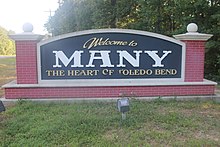
Many welcome sign

Downtown Many facing east

Many City Hall
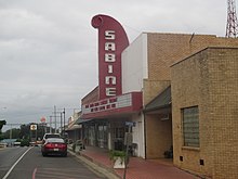
Sabine Theater

Sabine State Bank


References[]
- ^ More Than 500 Elected Officials Across Louisiana Say 'I'm With Mary,' And Endorse Landrieu For Reelection; marylandrieu.com Archived 2014-09-13 at the Wayback Machine
- ^ Q&A with Kenneth Freeman; thetowntalk.com Archived 2014-09-13 at archive.today
- ^ "2019 U.S. Gazetteer Files". United States Census Bureau. Retrieved July 25, 2020.
- ^ Jump up to: a b "Population and Housing Unit Estimates". United States Census Bureau. May 24, 2020. Retrieved May 27, 2020.
- ^ Moyer, Armond; Moyer, Winifred (1958). The origins of unusual place-names. Keystone Pub. Associates. p. 82.
- ^ "US Gazetteer files: 2010, 2000, and 1990". United States Census Bureau. 2011-02-12. Retrieved 2011-04-23.
- ^ Climate Summary for Many, Louisiana
- ^ "Weatherbase.com". Weatherbase. 2013. Retrieved on August 3, 2013.
- ^ "Census of Population and Housing". Census.gov. Retrieved June 4, 2015.
- ^ "Clifton R. "Cliff" Ammons". findagrave.com. Retrieved December 24, 2010.
- ^ "Cole, Frank Estes". A Dictionary of Louisiana Biography (lahistory.org). Archived from the original on February 25, 2012. Retrieved December 19, 2010.
- ^ "Charlie Joiner". Pro Football Hall of Fame. Retrieved 27 May 2011.
- ^ Barteski, Ed (Editor) (2014). MAKERS Women in Space (Motion picture). Washington D.C.: Kunhardt McGee Productions.
- ^ "John S. Pickett, Jr". warrenmeadows.com. February 6, 2014. Retrieved October 30, 2014.
- ^ "Milam Judson Teekell". findagrave.com. Retrieved October 18, 2014.
External links[]
| show Municipalities and communities of Sabine Parish, Louisiana, United States |
|---|


| show Authority control |
|---|
- Towns in Sabine Parish, Louisiana
- Towns in Louisiana
- Parish seats in Louisiana
- Populated places established in 1843
- 1843 establishments in Louisiana