Akçakent
Akçakent | |
|---|---|
District | |
 Village of Büyükabdiuşağı | |
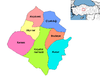
 Location of Akçakent within Turkey. | |
 Akçakent Location of Akçakent within Turkey. | |
| Coordinates: 39°37′N 34°05′E / 39.617°N 34.083°E | |
| Country | |
| Province | Kırşehir |
| Government | |
| • Mayor | Bekir Türkay (DP) |
| Area | |
| • District | 585.31 km2 (225.99 sq mi) |
| Elevation | 1,404 m (4,606 ft) |
| Population (2012)[2] | |
| • Urban | 969 |
| • District | 4,533 |
| • District density | 7.7/km2 (20/sq mi) |
| Time zone | UTC+2 (EET) |
| • Summer (DST) | UTC+3 (EEST) |
| Postal code | 40xxx |
| Area code(s) | 0386 |
| Licence plate | 40 |
| Website | www.akcakent.gov.tr |

Akçakent is a district of Kırşehir Province in the Central Anatolia region of Turkey. According to 2000 census, population of the district is 7,700 of which 1,268 live in the town of Akçakent.[3]
Notes[]
- ^ "Area of regions (including lakes), km²". Regional Statistics Database. Turkish Statistical Institute. 2002. Retrieved 2013-03-05.
- ^ "Population of province/district centers and towns/villages by districts - 2012". Address Based Population Registration System (ABPRS) Database. Turkish Statistical Institute. Retrieved 2013-02-27.
- ^ Turkish Statistical Institute. "Census 2000, Key statistics for urban areas of Turkey" (in Turkish). Archived from the original (XLS) on 2007-07-22. Retrieved 2008-03-19.
References[]
- Falling Rain Genomics, Inc. "Geographical information on Akçakent, Turkey". Retrieved 2008-03-16.
External links[]
| Wikimedia Commons has media related to Akçakent. |
- District governor's official website (in Turkish)
Coordinates: 39°37′22″N 34°05′45″E / 39.62278°N 34.09583°E
This geographical article about a location in Kırşehir Province, Turkey is a stub. You can help Wikipedia by . |
Categories:
- Towns in Turkey
- Populated places in Kırşehir Province
- Districts of Kırşehir Province
- Central Anatolia Region geography stubs