Araban
Araban | |
|---|---|
 Araban | |
| Coordinates: 37°25′29″N 37°41′34″E / 37.42472°N 37.69278°ECoordinates: 37°25′29″N 37°41′34″E / 37.42472°N 37.69278°E | |
| Country | |
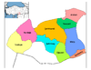
| Province | Gaziantep |
| Government | |
| • Mayor | Mehmet Özdemir (AKP) |
| • Kaymakam | Orhan Balcı |
| Area | |
| • District | 568.42 km2 (219.47 sq mi) |
| Elevation | 610 m (2,000 ft) |
| Population (2012)[2] | |
| • Urban | 10,063 |
| • District | 32,091 |
| • District density | 56/km2 (150/sq mi) |
| Post code | 27550 |
| Website | www.araban.bel.tr |

Araban (Kurdish: Qale)[3] is a district and city[4] of Gaziantep Province of Turkey. The population is 9,863 as of 2010.
See also[]
References[]
- ^ "Area of regions (including lakes), km²". Regional Statistics Database. Turkish Statistical Institute. 2002. Retrieved 2013-03-05.
- ^ "Population of province/district centers and towns/villages by districts - 2012". Address Based Population Registration System (ABPRS) Database. Turkish Statistical Institute. Retrieved 2013-02-27.
- ^ Adem Avcıkıran (2009). Kürtçe Anamnez Anamneza bi Kurmancî (PDF) (in Turkish and Kurdish). p. 55. Retrieved 17 December 2019.
- ^ "Gaziantep (Turkey): Districts, Cities, Towns and Villages - Population Statistics, Charts and Map".
This article about a Southeastern Anatolia Region of Turkey location is a stub. You can help Wikipedia by . |
Categories:
- Populated places in Gaziantep Province
- Districts of Gaziantep Province
- Kurdish settlements in Turkey
- Southeastern Anatolia Region geography stubs