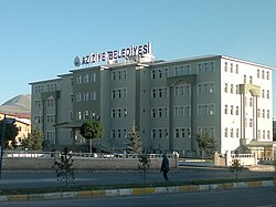
Aziziye
Aziziye | |
|---|---|
District | |
 | |
 Aziziye Location in Turkey | |
| Coordinates: 39°57′N 41°06′E / 39.950°N 41.100°ECoordinates: 39°57′N 41°06′E / 39.950°N 41.100°E | |
| Country | |
| Province | Erzurum Province |
| Government | |
| • Body | İlçe (district) |
| • Mayor | Muhammed Cevdet Orhan (AKP) |
| Elevation | 1,760 m (3,770 ft) |
| Population (2012)[1] | |
| • Urban | 41,069 |
| • District | 51,532 |
| Time zone | UTC+2 (EET) |
| • Summer (DST) | UTC+3 (EEST) |
| Postal code | 25xxx |
| Area code(s) | 0442 |
| Climate | Dfb |
Aziziye is a municipality and governed district in Greater Erzurum, Turkey. Erzurum is one of 30 metropolitan centers in Turkey having more than one municipality within its city borders. Erzurum has three second-level municipalities within the city in addition to the municipality of Greater Erzurum (büyükşehir). Aziziye lies in the western part of Erzurum at 39°57′N 41°06′E / 39.950°N 41.100°E. The population of the district center was 41,069[3] as of 2013. Erzurum was declared a metropolitan center in 1993. The municipality of Aziziye was established in 1993 by merging Ilıca and Dadaşkent.[4] The corresponding district governorate was established in 2008. The district center is famous for thermal springs (39.40C)
Neighbourhoods[]
- Ağcakent
- Ahırcık
- Akdağ
- Akyazı
- Alaca
- Alaybeyi
- Aşağıcanören
- Atlıkonak
- Aynalıkale
- Başçakmak
- Başkent
- Başkurtdere
- Başovacık
- Bingöze
- Çamlıca
- Çatak
- Çavdarlı
- Çavuşoğlu
- Çıkrıklı
- Çiğdemli
- Dağdagül
- Eğerti
- Elmalı
- Emrecik
- Eskipolat
- Eşkinkaya
- Gelinkaya
- Geyik
- Güllüce
- Halilkaya
- Kabaktepe
- Kapılı
- Karakale
- Kavaklıdere
- Kızılkale
- Kumluyazı
- Kuzgun
- Kuzuluk
- Ocak
- Paşayurdu
- Rizekent
- Sarıyazla
- Sırlı
- Sorkunlu
- Söğütlü
- Taşpınar
- Tebrizcik
- Toprakkale
- Üçköşe
- Yeşilova
- Yeşilvadi
- Yoncalık
- Yukarıcanören
References and notes[]
- ^ "Population of province/district centers and towns/villages by districts - 2012". Address Based Population Registration System (ABPRS) Database. Turkish Statistical Institute. Retrieved 2013-02-27.
- ^ "Area of regions (including lakes), km²". Regional Statistics Database. Turkish Statistical Institute. 2002. Retrieved 2013-03-05.
- ^ Statistical Institute
- ^ Mayor's page (in Turkish) Archived April 27, 2012, at the Wayback Machine

This geographical article about a location in Erzurum Province, Turkey is a stub. You can help Wikipedia by . |
- Populated places in Erzurum Province
- Districts of Erzurum Province
- Hot springs of Turkey
- Erzurum Province geography stubs