Ballore
Ballore | |
|---|---|
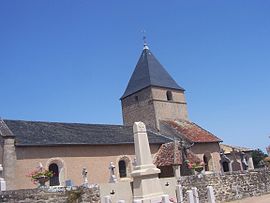 The church in Ballore | |
show Location of Ballore | |
 Ballore | |
| Coordinates: 46°32′09″N 4°22′09″E / 46.5358°N 4.3692°ECoordinates: 46°32′09″N 4°22′09″E / 46.5358°N 4.3692°E | |
| Country | France |
| Region | Bourgogne-Franche-Comté |
| Department | Saône-et-Loire |
| Arrondissement | Charolles |
| Canton | Charolles |
| Government | |
| • Mayor (2020–2026) | Paul Dumontet[1] |
| Area 1 | 10.75 km2 (4.15 sq mi) |
| Population (Jan. 2018)[2] | 94 |
| • Density | 8.7/km2 (23/sq mi) |
| Time zone | UTC+01:00 (CET) |
| • Summer (DST) | UTC+02:00 (CEST) |
| INSEE/Postal code | 71017 /71220 |
| Elevation | 312–391 m (1,024–1,283 ft) (avg. 319 m or 1,047 ft) |
| 1 French Land Register data, which excludes lakes, ponds, glaciers > 1 km2 (0.386 sq mi or 247 acres) and river estuaries. | |


Ballore is a commune in the Saône-et-Loire department in the region of Bourgogne-Franche-Comté in eastern France.
Geography[]
The Arconce flows southwest through the commune.
Population[]
|
|
See also[]
References[]
- ^ "Répertoire national des élus: les maires". data.gouv.fr, Plateforme ouverte des données publiques françaises (in French). 2 December 2020.
- ^ "Populations légales 2018". INSEE. 28 December 2020.
| Wikimedia Commons has media related to Ballore. |
| show Authority control |
|---|
This Saône-et-Loire geographical article is a stub. You can help Wikipedia by . |
Categories:
- Communes of Saône-et-Loire
- Saône-et-Loire geography stubs