Binalonan
This article needs additional citations for verification. (November 2012) |
Binalonan | |
|---|---|
| Municipality of Binalonan | |
 Town hall | |
 Flag  Seal | |
 Map of Pangasinan with Binalonan highlighted | |
show OpenStreetMap | |
 Binalonan Location within the Philippines | |
| Coordinates: 16°03′N 120°36′E / 16.05°N 120.6°ECoordinates: 16°03′N 120°36′E / 16.05°N 120.6°E | |
| Country | Philippines |
| Region | Ilocos Region |
| Province | Pangasinan |
| District | 5th district |
| Founded | February 18, 1872 |
| Barangays | 24 (see Barangays) |
| Government | |
| • Type | Sangguniang Bayan |
| • Mayor | Ramon N. Guico Jr. |
| • Vice Mayor | Melicio F. Patague II |
| • Representative | Ramon V. Guico III |
| • Municipal Council | show
Members |
| • Electorate | 36,727 voters (2019) |
| Area | |
| • Total | 47.57 km2 (18.37 sq mi) |
| Elevation | 40 m (130 ft) |
| Highest elevation | 149 m (489 ft) |
| Lowest elevation | 23 m (75 ft) |
| Population (2020 census) [3] | |
| • Total | 56,382 |
| • Density | 1,200/km2 (3,100/sq mi) |
| • Households | 12,655 |
| Economy | |
| • Income class | 1st municipal income class |
| • Poverty incidence | 8.82% (2015)[4] |
| • Revenue | ₱154,540,126.71 (2016) |
| Service provider | |
| • Electricity | Pangasinan 3 Electric Cooperative (PANELCO 3) |
| Time zone | UTC+8 (PST) |
| ZIP code | 2436 |
| PSGC | |
| IDD : area code | +63 (0)75 |
| Climate type | tropical monsoon climate |
| Native languages | Pangasinan Ilocano Tagalog |
| Website | www |


Binalonan, officially the Municipality of Binalonan (Pangasinan: Baley na Binalonan; Ilocano: Ili ti Binalonan; Tagalog: Bayan ng Binalonan), is a 1st class municipality in the province of Pangasinan, Philippines. According to the 2020 census, it has a population of 56,382 people. [3]
One of Binalonan's natives is the Filipino-American writer Carlos Bulosan, who wrote brief descriptions of the town's history and people in his semi-autobiographical novel entitled America is in the Heart. The town has a memorial and street named after him just north of the municipal hall and town market. It is also the hometown of Evangelina de la Cruz Macaraeg Macapagal, spouse of 9th President Diosdado Macapagal, and mother of 14th President Gloria Macapagal Arroyo.[5]
Geography[]
Binalonan is located in the eastern part of the province of Pangasinan. The municipality is bordered on the north by the municipalities of Pozorrubio and Sison, on the south by Urdaneta, on the east by San Manuel and Asingan and on the west by Laoac.
It is 51 kilometres (32 mi) from Lingayen and 190 kilometres (120 mi) from Manila.
Land classification[]
The municipality's total land area, estimated at 8,400 hectares (84 km2), is classified as alienable and disposable land.
Soil type[]
There are 5 types of soil which can be found in Binalonan: the San Manuel fine sandy loam, San Manuel loam, San Manuel sandy loam, San Manuel clay, and Umingan sandy loam.
Rivers[]
Binalonan has 2 major rivers: the Aloragat River and Tagamusing River. It also has minor rivers, including the San Pablo Creek, Tuboy River, Palma Creek, the Camambogan Creek and Balisa Creek.
Barangays[]
Binalonan is subdivided into 24 barangays.
- Balangobong
- Bued
- Bugayong
- Camangaan
- Canarvacanan
- Capas
- Cili
- Dumayat
- Linmansangan
- Mangcasuy
- Moreno
- Pasileng Norte
- Pasileng Sur
- Poblacion
- San Felipe Central
- San Felipe Sur
- San Pablo
- Santa Catalina
- Santa Maria Norte
- Santiago
- Santo Niño
- Sumabnit
- Tabuyoc
- Vacante
Climate[]
| hideClimate data for Binalonan, Pangasinan | |||||||||||||
|---|---|---|---|---|---|---|---|---|---|---|---|---|---|
| Month | Jan | Feb | Mar | Apr | May | Jun | Jul | Aug | Sep | Oct | Nov | Dec | Year |
| Average high °C (°F) | 31 (88) |
31 (88) |
32 (90) |
34 (93) |
35 (95) |
34 (93) |
32 (90) |
32 (90) |
32 (90) |
32 (90) |
32 (90) |
31 (88) |
32 (90) |
| Average low °C (°F) | 22 (72) |
22 (72) |
22 (72) |
24 (75) |
24 (75) |
24 (75) |
24 (75) |
24 (75) |
24 (75) |
23 (73) |
23 (73) |
22 (72) |
23 (74) |
| Average precipitation mm (inches) | 13.6 (0.54) |
10.4 (0.41) |
18.2 (0.72) |
15.7 (0.62) |
178.4 (7.02) |
227.9 (8.97) |
368 (14.5) |
306.6 (12.07) |
310.6 (12.23) |
215.7 (8.49) |
70.3 (2.77) |
31.1 (1.22) |
1,766.5 (69.56) |
| Average rainy days | 3 | 2 | 2 | 4 | 14 | 16 | 23 | 21 | 24 | 15 | 10 | 6 | 140 |
| Source: World Weather Online[6] | |||||||||||||
Demographics[]
| Year | Pop. | ±% p.a. |
|---|---|---|
| 1903 | 14,603 | — |
| 1918 | 17,392 | +1.17% |
| 1939 | 19,736 | +0.60% |
| 1948 | 23,361 | +1.89% |
| 1960 | 25,651 | +0.78% |
| 1970 | 32,441 | +2.37% |
| 1975 | 34,726 | +1.37% |
| 1980 | 35,574 | +0.48% |
| 1990 | 43,839 | +2.11% |
| 1995 | 44,490 | +0.28% |
| 2000 | 48,967 | +2.08% |
| 2007 | 52,722 | +1.02% |
| 2010 | 52,832 | +0.08% |
| 2015 | 54,555 | +0.61% |
| 2020 | 56,382 | +0.65% |
| Source: Philippine Statistics Authority [7] [8] [9][10] | ||
The urban population is recorded at 7,634 while the rural population is at 45,088. The urban-rural population ratio is estimated at 15/100. The male-to-female ratio is 1.029.
Economy[]
| Poverty Incidence of Binalonan | |
| Source: Philippine Statistics Authority[11][12][13][14][15][16] | |
History[]
According to historians, the town's name is an evolution of the Pangasinan Language term balon, which means "packed lunch", or in Tagalog, baon.
In a traditional story, which now plays an important role in the town's history, the area was originally owned by a Spaniard named Don Salvador. It was told that he instructed his men to put up crude wooden fences along the property to establish his ownership. During the course of their work, Don Salvador's men used to have their lunch and rest under Camachile trees located in the center of the land mainly due to its breezy shades.
Don Salvador offered his pastureland to several immigrants from Ilocos. When they asked Don Salcador how they were going to find the said land, the owner answered: "It is the place where people bring their balon to eat". Hence the term Binnalonan, which in Ilocano and Pangasinan means "a place where people bring and eat their baon", was born. At present, the town is called Binalonan while its people are known as Binalonians.[17]
Ilocano herdsmen and laborers composed the first town which was founded in 1838, in San Felipe, which was later transferred to Santa Catalina, then returned to the present site.
Local government[]
Binalonan's Chief Executive is Mayor .
Municipal seal[]

The topmost structure depicted on the municipal seal is an image of the municipality's Municipal Hall. Below it on the left is a depiction of the antenna of Digital Communications, the center of communications for Regions I, II and CAR.
Beside the antenna is a representation of a subsidiary source of income in Binalonan: the raising of chickens and hogs. At the bottom, the left image is that of rice stalks, the municipality's main product. Beside it is the picture of a sugar cane, which is the main ingredient for Binalonan's top products — basi, suka and muskuvado (brown sugar). The shield encasing these images means that Binalonan is under the province of Pangasinan.
Tourism[]
Binalonan Rock Garden defines the town with century-old acacia trees guarding the walking pavements, benches, Balikbayan Hall, basketball court and the pathway towards the historic Santo Nino Parish Church.
The town's interesting points include:
- The Santo Nino Parish Church is the town's landmark and Spanish colonial architectural legacy
- Mount Paldingan Stations of the Cross in Barangay Santa Catalina[5]
- The town has a central transport terminal, a Bagsakan Center (wholesale trade) library and community eCenter
- The New Market Shed and Food Terminal were opened on 27 September 2012
- The Binalonan Airfield and Binalonan airport
- Balon-Balon Festival and Fiesta
- Rupertos Inland Resort
- Balangobong field
- Binalonan Fiesta - vibrant festival with various activities and street performers
- Razons Binalonan owned by Edna "Perlita" Tink
Parish of the Holy Child Church[]

The 1841 (19th century architecture) Santo Niño Parish Church, in under the jurisdiction of the Roman Catholic Archdiocese of Lingayen-Dagupan, Roman Catholic Diocese of Urdaneta. Its Feast Day is 3rd Sunday of January, with Parish Priest, Father Elisar Christopher M. Itchon and Parochial Vicar, Father Jun G. Laya and Vicar Forane, Father Elpidio F. Silva Jr.[18][19][20][21]
Fr. Julian Izaga founded San Felipe, the origin of the Church and town freed from Manaoag since 1834, and moved to Santa Catalina, where he built church and a convent of light materials. Fr. Ramon Fernandez transferred the town in 1938 to the present site..
The Dominicans founded Binalonan Parish in 1841, under Kura Paroko, Fr. Domingo Llue and then, by Fr,. Policarpio Illana who began construction of the Church in 1842.
Fr. Antonio Vinelas erected in 1855 a bigger church, with Fr. Ruperto Alarcon's construction in 1861. Fr. Juan Fernandez (1861-1865) built a provisional church. In 1866–1873, Fr. Felix Cantador added old convent walls, while Fr. P.del Campo finished the Church. In 1879,
The October 19, 1881 typhoon destroyed the 1879 Church. Father Silvestre Fernandez added the 3 naves rehabilitation due to the earthquake of 1882. The Church was placed under the ecclesiastical jurisdiction of El Santisimo Nombre de Jesus. In the Hispano-American War the church was destroyed.
After the 1898 Revolution, Fr. Mariano Pacis became the Pastor of Manaoag and Binalonan, but it was Fr. Pio Mabutas who finished the Church in 1930. The Japanese destroyed the Church except the miraculous image of Santo Nino.
Fr. Pablo Evangelista rehabilitated the Church in 1946 and Fr. Leon Bitanga reconstructed in until 1961, founding the Holy Child Academy.
It was only on January 30, 2008, that the Church's marker was imposed upon generous donations of New York and New Jersey Binalonans (Joey and Remy Castelo-Sellona and Drs. Jose and Violy Quintos. (Source: Church marker, 2008).[21] [22][23][24][25][26]
Infrastructure[]
Healthcare[]
- Hospitals:
- Rural Health Unit/Centers: 8
- Barangay Health Stations: 24
- Malnutrition Rate: 9.06%
- Severely Underweight: 1.17%
- Moderately Underweight: 7.88%
- No. of Day Care Workers: 29
- No. of Day Care Centers: 29
- No. of Day Care Children: 544
- Contraceptive Prevalence Rate: 51%
Sanitation[]
Surveys show that 8,238 homes in Binalonan have water-sealed sewer/septic tank toilets which are used exclusively by members of the household.
Garbage is disposed of through burning.

Education (SY 2009 to 2009)[]
| Elementary | Secondary | |
|---|---|---|
| Number of schools | ||
| Government | 22 | 6 |
| Private | 6 | 2 |
| Total enrollment | ||
| Government | 7,376 | 3,729 |
| Private | 919 | 113 |
| Number of teachers | 287 | 169 |
| Number of classrooms | 295 | 109 |
Other education centers include the WCC Aeronautical and Technological College (World Citi Colleges, (WCC) Aviation Company), an expansive facility which contains the Binalonan Airfield), St. Michael de Archangel College, Manantan Technical School, Holy Child Academy parochial school and .
WCC Aeronautical and Technological College, the aeronautical school that sits at the heart of Binalonan, Pangasinan.[27] It also has the College of Engineering and Aviation Technology, College of Arts and Sciences, College of Tourism, and Flight Attendant Course. It offers the Flight Navigator Trainers Procedure II with MRO facilities, including its Airbus A320 full flight simulator.[28]
Portrayals of Binalonan in literature and media[]
Binalonan figures prominently in the novel America is in the Heart by Filipino-American writer Carlos Bulosan, who was born in Binalonan. The first part of the semi-autobiographical novel features the struggles of Allos, the novel's main character, as he grows up as the son of a peasant farmer in Binalonan. The town has a memorial and street named after Bulosan just north of the municipal hall and town market.
Notable people[]
Notable people who either were born or resided in Binalonan include:
- Carlos Bulosan, Filipino-American writer best known for the novel America is in the Heart
- Evangelina de la Cruz Macaraeg Macapagal, spouse of 9th President Diosdado Macapagal, and mother of 14th President Gloria Macapagal Arroyo.[5]
Image gallery[]

1960 Gate and the Town Hall

Most beautiful Park, 1968
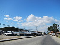
Highway

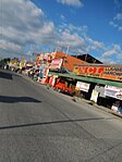
Public Market
Business Center


References[]
- ^ Municipality of Binalonan | (DILG)
- ^ "2015 Census of Population, Report No. 3 – Population, Land Area, and Population Density" (PDF). Philippine Statistics Authority. Quezon City, Philippines. August 2016. ISSN 0117-1453. Archived (PDF) from the original on May 25, 2021. Retrieved July 16, 2021.
- ^ Jump up to: a b Census of Population (2020). "Region I (Ilocos Region)". Total Population by Province, City, Municipality and Barangay. PSA. Retrieved 8 July 2021.
- ^ https://psa.gov.ph/sites/default/files/City%20and%20Municipal-level%20Small%20Area%20Poverty%20Estimates_%202009%2C%202012%20and%202015_0.xlsx; publication date: 10 July 2019; publisher: Philippine Statistics Authority.
- ^ Jump up to: a b c Binalonan, the next university town
- ^ "Binalonan, Pangasinan: Average Temperatures and Rainfall". World Weather Online. Retrieved 26 September 2015.
- ^ Census of Population (2015). "Region I (Ilocos Region)". Total Population by Province, City, Municipality and Barangay. PSA. Retrieved 20 June 2016.
- ^ Census of Population and Housing (2010). "Region I (Ilocos Region)". Total Population by Province, City, Municipality and Barangay. NSO. Retrieved 29 June 2016.
- ^ Censuses of Population (1903–2007). "Region I (Ilocos Region)". Table 1. Population Enumerated in Various Censuses by Province/Highly Urbanized City: 1903 to 2007. NSO.
- ^ "Province of Pangasinan". Municipality Population Data. Local Water Utilities Administration Research Division. Retrieved 17 December 2016.
- ^ "Poverty incidence (PI):". Philippine Statistics Authority. Retrieved 28 December 2020.
- ^ https://psa.gov.ph/sites/default/files/NSCB_LocalPovertyPhilippines_0.pdf; publication date: 29 November 2005; publisher: Philippine Statistics Authority.
- ^ https://psa.gov.ph/sites/default/files/2003%20SAE%20of%20poverty%20%28Full%20Report%29_1.pdf; publication date: 23 March 2009; publisher: Philippine Statistics Authority.
- ^ https://psa.gov.ph/sites/default/files/2006%20and%202009%20City%20and%20Municipal%20Level%20Poverty%20Estimates_0_1.pdf; publication date: 3 August 2012; publisher: Philippine Statistics Authority.
- ^ https://psa.gov.ph/sites/default/files/2012%20Municipal%20and%20City%20Level%20Poverty%20Estima7tes%20Publication%20%281%29.pdf; publication date: 31 May 2016; publisher: Philippine Statistics Authority.
- ^ https://psa.gov.ph/sites/default/files/City%20and%20Municipal-level%20Small%20Area%20Poverty%20Estimates_%202009%2C%202012%20and%202015_0.xlsx; publication date: 10 July 2019; publisher: Philippine Statistics Authority.
- ^ "Binalonan | The Official Website of the Province of Pangasinan and its People". Archived from the original on 2017-03-02. Retrieved 2012-12-20.
- ^ "Archived copy". Archived from the original on 2014-10-06. Retrieved 2012-12-20.CS1 maint: archived copy as title (link)
- ^ Capital of Pangasinan: All Churches in Pangasinan
- ^ Santo Niño Parish Church
- ^ Jump up to: a b List of Catholic Dioceses in Asia | Asian Catholic Directory | Ucanews Archived September 4, 2012, at the Wayback Machine
- ^ Archdiocese of Lingayen-Dagupan Archived February 2, 2014, at the Wayback Machine
- ^ "Archdiocese of Lingayen-Dagupan: Vicariate of Santo Tomas de Aquino". Archived from the original on 2016-03-10. Retrieved 2012-12-20.
- ^ "Archdiocese of Lingayen-Dagupan". Archived from the original on 2016-05-15. Retrieved 2012-12-20.
- ^ Cathedral of Our Lady of the Immaculate Conception, Urdaneta City, Pangasinan, Philippines
- ^ "Diocese of Urdaneta". Archived from the original on 2004-03-27. Retrieved 2012-12-20.
- ^ [1]
- ^ Town mayor leads dynamic business with heart for public service | Business As Usual, Business Features, The Philippine Star | philstar.com
External links[]
| Wikimedia Commons has media related to Binalonan. |
- Official website
- Binalonan Profile at PhilAtlas.com
- Municipal Profile at the National Competitiveness Council of the Philippines
- Binalonan at the Pangasinan Government Website Archived 2017-03-02 at the Wayback Machine
- Local Governance Performance Management System
- Philippine Standard Geographic Code
- Philippine Census Information
| show Places adjacent to Binalonan |
|---|
| show |
|---|
| Authority control |
|
|---|
- Municipalities of Pangasinan