Santa Maria, Pangasinan
Santa Maria | |
|---|---|
| Municipality of Santa Maria | |
 Municipal plaza | |
 Seal | |
 Map of Pangasinan with Santa Maria highlighted | |
OpenStreetMap  | |
 Santa Maria Location within the Philippines | |
| Coordinates: 15°58′51″N 120°42′01″E / 15.98083°N 120.70028°ECoordinates: 15°58′51″N 120°42′01″E / 15.98083°N 120.70028°E | |
| Country | Philippines |
| Region | Ilocos Region |
| Province | Pangasinan |
| District | 6th district |
| Barangays | 23 (see Barangays) |
| Government | |
| • Type | Sangguniang Bayan |
| • Mayor | Julius C. Ramos |
| • Vice Mayor | Teodoro A. Ramos |
| • Representative | Tyrone D. Agabas |
| • Municipal Council | Members |
| • Electorate | 21,777 voters (2019) |
| Area | |
| • Total | 69.50 km2 (26.83 sq mi) |
| Elevation | 45 m (148 ft) |
| Highest elevation | 68 m (223 ft) |
| Lowest elevation | 32 m (105 ft) |
| Population (2020 census) [3] | |
| • Total | 34,220 |
| • Density | 490/km2 (1,300/sq mi) |
| • Households | 7,371 |
| Economy | |
| • Income class | 4th municipal income class |
| • Poverty incidence | 11.77% (2015)[4] |
| • Revenue | ₱134,288,269.22 (2020) |
| • Assets | ₱356,452,922.78 (2020) |
| • Expenditure | ₱122,504,624.72 (2020) |
| • Liabilities | ₱25,269,202.22 (2020) |
| Service provider | |
| • Electricity | Dagupan Electric Corporation (DECORP) |
| Time zone | UTC+8 (PST) |
| ZIP code | 2440 |
| PSGC | |
| IDD : area code | +63 (0)75 |
| Native languages | Pangasinan Ilocano Tagalog |
| Website | www |

Santa Maria, officially the Municipality of Santa Maria (Pangasinan: Baley na Santa Maria; Ilocano: Ili ti Santa Maria; Tagalog: Bayan ng Santa Maria), is a 4th class municipality in the province of Pangasinan, Philippines. According to the 2020 census, it has a population of 34,220 people. [3]
Barangays[]
Santa Maria is politically subdivided into 23 barangays.
- Bal-loy
- Bantog
- Caboluan
- Cal-litang
- Capandanan
- Cauplasan
- Dalayap
- Libsong
- Namagbagan
- Paitan
- Pataquid
- Pilar
- Poblacion East
- Poblacion West
- Pugot
- Samon
- San Alejandro
- San Mariano
- San Pablo
- San Patricio
- San Vicente
- Santa Cruz
- Santa Rosa
Climate[]
| Climate data for Santa Maria, Pangasinan | |||||||||||||
|---|---|---|---|---|---|---|---|---|---|---|---|---|---|
| Month | Jan | Feb | Mar | Apr | May | Jun | Jul | Aug | Sep | Oct | Nov | Dec | Year |
| Average high °C (°F) | 29 (84) |
29 (84) |
30 (86) |
32 (90) |
33 (91) |
33 (91) |
33 (91) |
33 (91) |
33 (91) |
32 (90) |
31 (88) |
29 (84) |
31 (88) |
| Average low °C (°F) | 21 (70) |
21 (70) |
22 (72) |
23 (73) |
24 (75) |
24 (75) |
24 (75) |
24 (75) |
23 (73) |
23 (73) |
22 (72) |
21 (70) |
23 (73) |
| Average precipitation mm (inches) | 127.5 (5.02) |
115.8 (4.56) |
129.7 (5.11) |
141.1 (5.56) |
248.2 (9.77) |
165 (6.5) |
185.3 (7.30) |
161.9 (6.37) |
221.4 (8.72) |
299.5 (11.79) |
199 (7.8) |
188.7 (7.43) |
2,183.1 (85.93) |
| Average rainy days | 17 | 17 | 17 | 15 | 20 | 19 | 19 | 20 | 21 | 20 | 17 | 19 | 221 |
| Source: World Weather Online[5] | |||||||||||||
Demographics[]
| Year | Pop. | ±% p.a. |
|---|---|---|
| 1903 | 7,628 | — |
| 1918 | 7,362 | −0.24% |
| 1939 | 10,295 | +1.61% |
| 1948 | 12,802 | +2.45% |
| 1960 | 14,230 | +0.89% |
| 1970 | 16,296 | +1.36% |
| 1975 | 18,766 | +2.87% |
| 1980 | 19,018 | +0.27% |
| 1990 | 23,793 | +2.27% |
| 1995 | 25,278 | +1.14% |
| 2000 | 27,860 | +2.11% |
| 2007 | 30,721 | +1.36% |
| 2010 | 31,091 | +0.44% |
| 2015 | 33,038 | +1.16% |
| 2020 | 34,220 | +0.69% |
| Source: Philippine Statistics Authority [6] [7] [8][9] | ||
Economy[]
| Poverty Incidence of Santa Maria | |
| Source: Philippine Statistics Authority[10][11][12][13][14][15] | |
History[]
This section does not cite any sources. (November 2012) |
Santa Maria was formerly a barrio of the municipality of Tayug.
Santa Maria was founded on January 10, 1855, and was governed by a Captain until 1863. In 1864 Santa Maria was incorporated into the municipality of Tayug due to Santa Maria's inability to maintain its financial stability. In 1877 the inhabitants of Santa Maria applied for separation, as a distinct municipality, from the municipality of Tayug. The application was granted and Santa Maria, again became a town under the governance of Captain Eugenio Vinluan.
In 1903, the Americans arrived in Santa Maria and their rule began. In 1901 there was an election for the president of Santa Maria. This was during the United States military government of the islands. The President was given a two years term, due to his good administration.
Again, in 1903, Santa Maria was incorporated into the town of Tayug. for financial reasons, as before, but in 1907 a special election was held for the purpose of returning all small municipalities that had incorporated with bigger towns. Don Alejandro Gonzales was then elected president and served until 1910 when he was succeeded by Don Mariano de Guzman who served to 1912. From this date, to the present, the different successions of presidents, alcaldes and mayors had occurred all over the islands.
For many years, during the Spanish Regime, religion was the basis of educating the masses. From time to time missionaries of different orders were sent out to Santa Maria to carry out religious services as required of them. It was during the routine visit of a certain priest from the town of Asingan, which was then the most eastern town of the province of Pangasinan, who had extended his mission farther into the east and came to a village. The village was located on a plain in which the Agno River ran and which with a little effort could be irrigated. The missionary believed that the village could be developed into a prosperous community. Finding the residents to be hospitable, he chatted with them and, in the course of conversation, he thought of giving the place a name. Since it was the Virgin Mary's Day, he called the people of the village to him and with a simple but impressive solemnity proclaimed this place as Santa Maria on this, the Virgin Mary's day.
In the course of time prominent people improved the locality and transferred the town site from Namagbagan, which is now a barrio of the municipality, to its present site near a clay promontory where it formed an impregnable defense against the yearly erosion of the Agno, thus annexing "De Pila" to the original name and making Santa Maria de Pila its final name, a name which is known beyond the confines of the province of Pangasinan.
The town much progressive due to close proximity to Rosales and Tayug.
Image gallery[]
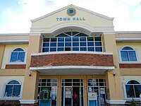
Santa Maria Town Hall

Public Market road to municipal hall and public park

Public market

Part of Agno River flowing near Barangay San Vicente, Santa Maria Pangasinan. A faint image of Narciso Ramos Bridge can be seen at a distance.


References[]
- ^ Municipality of Santa Maria | (DILG)
- ^ "2015 Census of Population, Report No. 3 – Population, Land Area, and Population Density" (PDF). Philippine Statistics Authority. Quezon City, Philippines. August 2016. ISSN 0117-1453. Archived (PDF) from the original on May 25, 2021. Retrieved July 16, 2021.
- ^ a b Census of Population (2020). "Region I (Ilocos Region)". Total Population by Province, City, Municipality and Barangay. PSA. Retrieved 8 July 2021.
- ^ https://psa.gov.ph/sites/default/files/City%20and%20Municipal-level%20Small%20Area%20Poverty%20Estimates_%202009%2C%202012%20and%202015_0.xlsx; publication date: 10 July 2019; publisher: Philippine Statistics Authority.
- ^ "Santa Maria, Pangasinan: Average Temperatures and Rainfall". World Weather Online. Retrieved 31 October 2015.
- ^ Census of Population (2015). "Region I (Ilocos Region)". Total Population by Province, City, Municipality and Barangay. PSA. Retrieved 20 June 2016.
- ^ Census of Population and Housing (2010). "Region I (Ilocos Region)". Total Population by Province, City, Municipality and Barangay. NSO. Retrieved 29 June 2016.
- ^ Censuses of Population (1903–2007). "Region I (Ilocos Region)". Table 1. Population Enumerated in Various Censuses by Province/Highly Urbanized City: 1903 to 2007. NSO.
- ^ "Province of Pangasinan". Municipality Population Data. Local Water Utilities Administration Research Division. Retrieved 17 December 2016.
- ^ "Poverty incidence (PI):". Philippine Statistics Authority. Retrieved 28 December 2020.
- ^ https://psa.gov.ph/sites/default/files/NSCB_LocalPovertyPhilippines_0.pdf; publication date: 29 November 2005; publisher: Philippine Statistics Authority.
- ^ https://psa.gov.ph/sites/default/files/2003%20SAE%20of%20poverty%20%28Full%20Report%29_1.pdf; publication date: 23 March 2009; publisher: Philippine Statistics Authority.
- ^ https://psa.gov.ph/sites/default/files/2006%20and%202009%20City%20and%20Municipal%20Level%20Poverty%20Estimates_0_1.pdf; publication date: 3 August 2012; publisher: Philippine Statistics Authority.
- ^ https://psa.gov.ph/sites/default/files/2012%20Municipal%20and%20City%20Level%20Poverty%20Estima7tes%20Publication%20%281%29.pdf; publication date: 31 May 2016; publisher: Philippine Statistics Authority.
- ^ https://psa.gov.ph/sites/default/files/City%20and%20Municipal-level%20Small%20Area%20Poverty%20Estimates_%202009%2C%202012%20and%202015_0.xlsx; publication date: 10 July 2019; publisher: Philippine Statistics Authority.
External links[]
| Wikimedia Commons has media related to Santa Maria, Pangasinan. |
- Santa Maria Profile at PhilAtlas.com
- Municipal Profile at the National Competitiveness Council of the Philippines
- Santa Maria at the Pangasinan Government Website
- Local Governance Performance Management System
- Philippine Standard Geographic Code
- Philippine Census Information
- Official Website of Santa Maria Pangasinan
Places adjacent to Santa Maria, Pangasinan | ||||||||||||||||
|---|---|---|---|---|---|---|---|---|---|---|---|---|---|---|---|---|
| ||||||||||||||||
Lingayen (capital) | |
| Municipalities |
|
| Component cities | |
| Independent component city |
|
| Barangays | |
- Municipalities of Pangasinan
- Populated places on the Agno River