Mangatarem
Mangatarem | |
|---|---|
| Municipality of Mangatarem | |
 | |
 Seal | |
| Etymology: lit. Mango Orchard | |
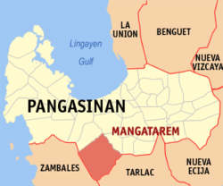 Map of Pangasinan with Mangatarem highlighted | |
OpenStreetMap  | |
 Mangatarem Location within the Philippines | |
| Coordinates: 15°47′15″N 120°17′32″E / 15.7874°N 120.2921°ECoordinates: 15°47′15″N 120°17′32″E / 15.7874°N 120.2921°E | |
| Country | Philippines |
| Region | Ilocos Region |
| Province | Pangasinan |
| District | 2nd district |
| Founded | 1837 |
| Barangays | 82 (see Barangays) |
| Government | |
| • Type | Sangguniang Bayan |
| • Mayor | Ramil P. Ventenilla |
| • Vice Mayor | Michael Mon R. Punzal |
| • Representative | Jumel Anthony I. Espino |
| • Municipal Council | Members |
| • Electorate | 51,150 voters (2019) |
| Area | |
| • Total | 317.50 km2 (122.59 sq mi) |
| Elevation | 29 m (95 ft) |
| Highest elevation | 291 m (955 ft) |
| Lowest elevation | 8 m (26 ft) |
| Population (2020 census) [3] | |
| • Total | 79,323 |
| • Density | 250/km2 (650/sq mi) |
| • Households | 16,231 |
| Economy | |
| • Income class | 1st municipal income class |
| • Poverty incidence | 14.66% (2015)[4] |
| • Revenue | ₱259,944,968.56 (2020) |
| • Assets | ₱571,286,491.35 (2020) |
| • Expenditure | ₱263,246,673.37 (2020) |
| • Liabilities | ₱137,635,095.79 (2020) |
| Service provider | |
| • Electricity | Central Pangasinan Electric Cooperative (CENPELCO) |
| Time zone | UTC+8 (PST) |
| ZIP code | 2413 |
| PSGC | |
| IDD : area code | +63 (0)75 |
| Native languages | Pangasinan Ilocano Tagalog |

Mangatarem, officially the Municipality of Mangatarem (Pangasinan: Baley na Mangatarem; Ilocano: Ili ti Mangatarem; Tagalog: Bayan ng Mangatarem), is a 1st class municipality in the province of Pangasinan, Philippines. According to the 2020 census, it has a population of 79,323 people. [3]
Mangatarem is a Pangasinan word for "mango plantation". The town's name also came from the Ilocano Phrase “mangga ken tirem” which means "mango and oyster".[5]
The municipality is home to the Manleluag Hot Spring Protected Landscape located in Barangay Malabobo near the southern boundary of the municipality.
In terms of economic activities, Mangatarem is primarily driven by agriculture. The municipality has the biggest land area in the entire Pangasinan province. A big percentage of its households also have family members who are working or have migrated abroad.
The town's poblacion area continues to attract major food, retail, and service establishments from Metro Manila and nearby cities within the province of Pangasinan. The more popular retail and food include Magic Group of Companies (Magic Mall), CSI Supermarket, Puregold, McDonald's, Jollibee, Mang Inasal, 7-Eleven, and Mercury Drug, among many others. Service establishments include banks, courier, pawnshops, auto/motorcycle service shops, These include Metrobank, Land Bank of the Philippines, and many others.
The town's public market serves not only the local residents but also the residents and farmers or entrepreneurs from the adjoining towns of Urbiztondo, Aguilar, and San Clemente (Tarlac), especially on weekends. This is one of the reasons that major commercial establishments started to take notice of the municipality and decided to set up their branches here.
Barangays[]
Mangatarem is politically subdivided into 82 barangays.
- Andangin
- Arellano Street (Poblacion)
- Bantay
- Bantocaling
- Baracbac
- Peania Pedania (Bedania)
- Bogtong Bolo
- Bogtong Bunao
- Bogtong Centro
- Bogtong Niog
- Bogtong Silag
- Buaya
- Buenlag
- Bueno
- Bunagan
- Bunlalacao
- Burgos Street (Poblacion)
- Cabaluyan 1st
- Cabaluyan 2nd
- Cabarabuan
- Cabaruan
- Cabayaoasan
- Cabayugan
- Cacaoiten
- Calumboyan Norte
- Calumboyan Sur
- Calvo (Poblacion)
- Casilagan
- Catarataraan
- Caturay Norte
- Caturay Sur
- Caviernesan
- Dorongan Ketaket
- Dorongan Linmansangan
- Dorongan Punta
- Dorongan Sawat
- Dorongan Valerio
- General Luna (Poblacion)
- Historia
- Lawak Langka
- Linmansangan
- Lopez (Poblacion)
- Mabini (Poblacion)
- Macarang
- Malabobo
- Malibong
- Malunec(original)
- Maravilla (Poblacion)
- Maravilla-Arellano Ext. (Pob)
- Muelang
- Naguilayan East
- Naguilayan West
- Nancasalan
- Cabison-Bulaney-Niog
- Olegario-Caoile (Poblacion)
- Olo Cacamposan
- Olo Cafabrosan
- Olo Cagarlitan
- Osmeña (Poblacion)
- Pacalat
- Pampano
- Parian
- Paul
- Pogon-Aniat (with Sitio Pinera)
- Pogon-Lomboy (Poblacion)
- Ponglo-Baleg
- Ponglo-Muelag
- Quetegan (Pogon-Baleg)
- Quezon (Poblacion)
- Salavante
- Sapang
- Sonson Ongkit
- Suaco
- Tagac
- Takipan
- Talogtog
- Tococ Barikir
- Torre 1st
- Torre 2nd
- Torres Bugallon (Poblacion)
- Umangan
- Zamora (Poblacion)
Climate[]
| Climate data for Mangatarem, Pangasinan | |||||||||||||
|---|---|---|---|---|---|---|---|---|---|---|---|---|---|
| Month | Jan | Feb | Mar | Apr | May | Jun | Jul | Aug | Sep | Oct | Nov | Dec | Year |
| Average high °C (°F) | 31 (88) |
32 (90) |
33 (91) |
34 (93) |
33 (91) |
33 (91) |
31 (88) |
30 (86) |
31 (88) |
32 (90) |
32 (90) |
31 (88) |
32 (90) |
| Average low °C (°F) | 22 (72) |
23 (73) |
24 (75) |
25 (77) |
25 (77) |
25 (77) |
25 (77) |
25 (77) |
24 (75) |
24 (75) |
24 (75) |
23 (73) |
24 (75) |
| Average precipitation mm (inches) | 9 (0.4) |
11.4 (0.45) |
11.1 (0.44) |
5.4 (0.21) |
258 (10.2) |
315.6 (12.43) |
463.1 (18.23) |
663.2 (26.11) |
479.7 (18.89) |
121.9 (4.80) |
75.8 (2.98) |
16.8 (0.66) |
2,431 (95.8) |
| Average rainy days | 4 | 3 | 2 | 2 | 12 | 15 | 19 | 21 | 18 | 12 | 9 | 5 | 122 |
| Source: World Weather Online[6] | |||||||||||||
Demographics[]

| Year | Pop. | ±% p.a. |
|---|---|---|
| 1903 | 12,895 | — |
| 1918 | 15,971 | +1.44% |
| 1939 | 18,658 | +0.74% |
| 1948 | 20,425 | +1.01% |
| 1960 | 28,931 | +2.94% |
| 1970 | 35,080 | +1.94% |
| 1975 | 37,604 | +1.40% |
| 1980 | 40,582 | +1.54% |
| 1990 | 47,714 | +1.63% |
| 1995 | 53,603 | +2.20% |
| 2000 | 60,943 | +2.79% |
| 2007 | 65,366 | +0.97% |
| 2010 | 69,969 | +2.51% |
| 2015 | 73,241 | +0.87% |
| 2020 | 79,323 | +1.58% |
| Source: Philippine Statistics Authority [7] [8] [9][10] | ||
Economy[]
| Poverty Incidence of Mangatarem | |
| Source: Philippine Statistics Authority[11][12][13][14][15][16] | |
Tourism[]
- St. Raymond of Peñafort Parish Church (Mangatarem)
- Resort & Protected Landscape
- Immaltar Hot Spring
- Kanding Waterfalls (Canding Falls)
- Tangguyob Waterfalls (Timangguyob Falls)
- Pacalat Impounding Dam
- Daang Kalikasan
Mangatarem's tourist attractions are mostly natural (hot springs, waterfalls). These are frequented by local tourists during weekends and especially during summer. A number of local property owners have also developed their own pocket resorts outside of the poblacion area and opened these to the general public.
References[]
- ^ Municipality of Mangatarem | (DILG)
- ^ "2015 Census of Population, Report No. 3 – Population, Land Area, and Population Density" (PDF). Philippine Statistics Authority. Quezon City, Philippines. August 2016. ISSN 0117-1453. Archived (PDF) from the original on May 25, 2021. Retrieved July 16, 2021.
- ^ a b Census of Population (2020). "Region I (Ilocos Region)". Total Population by Province, City, Municipality and Barangay. PSA. Retrieved 8 July 2021.
- ^ https://psa.gov.ph/sites/default/files/City%20and%20Municipal-level%20Small%20Area%20Poverty%20Estimates_%202009%2C%202012%20and%202015_0.xlsx; publication date: 10 July 2019; publisher: Philippine Statistics Authority.
- ^ "Mangatarem". Cities and Municipalities. Province of Pangasinan. Archived from the original on 21 October 2013. Retrieved 26 November 2012.
- ^ "Mangatarem, Pangasinan: Average Temperatures and Rainfall". World Weather Online. Retrieved 12 October 2015.
- ^ Census of Population (2015). "Region I (Ilocos Region)". Total Population by Province, City, Municipality and Barangay. PSA. Retrieved 20 June 2016.
- ^ Census of Population and Housing (2010). "Region I (Ilocos Region)". Total Population by Province, City, Municipality and Barangay. NSO. Retrieved 29 June 2016.
- ^ Censuses of Population (1903–2007). "Region I (Ilocos Region)". Table 1. Population Enumerated in Various Censuses by Province/Highly Urbanized City: 1903 to 2007. NSO.
- ^ "Province of Pangasinan". Municipality Population Data. Local Water Utilities Administration Research Division. Retrieved 17 December 2016.
- ^ "Poverty incidence (PI):". Philippine Statistics Authority. Retrieved 28 December 2020.
- ^ https://psa.gov.ph/sites/default/files/NSCB_LocalPovertyPhilippines_0.pdf; publication date: 29 November 2005; publisher: Philippine Statistics Authority.
- ^ https://psa.gov.ph/sites/default/files/2003%20SAE%20of%20poverty%20%28Full%20Report%29_1.pdf; publication date: 23 March 2009; publisher: Philippine Statistics Authority.
- ^ https://psa.gov.ph/sites/default/files/2006%20and%202009%20City%20and%20Municipal%20Level%20Poverty%20Estimates_0_1.pdf; publication date: 3 August 2012; publisher: Philippine Statistics Authority.
- ^ https://psa.gov.ph/sites/default/files/2012%20Municipal%20and%20City%20Level%20Poverty%20Estima7tes%20Publication%20%281%29.pdf; publication date: 31 May 2016; publisher: Philippine Statistics Authority.
- ^ https://psa.gov.ph/sites/default/files/City%20and%20Municipal-level%20Small%20Area%20Poverty%20Estimates_%202009%2C%202012%20and%202015_0.xlsx; publication date: 10 July 2019; publisher: Philippine Statistics Authority.
External links[]
| Wikimedia Commons has media related to Mangatarem. |
- Mangatarem Profile at PhilAtlas.com
- Municipal Profile at the National Competitiveness Council of the Philippines
- Mangatarem at the Pangasinan Government Website
- Local Governance Performance Management System
- Philippine Standard Geographic Code
- Philippine Census Information
Places adjacent to Mangatarem | ||||||||||||||||
|---|---|---|---|---|---|---|---|---|---|---|---|---|---|---|---|---|
| ||||||||||||||||
Lingayen (capital) | |
| Municipalities |
|
| Component cities | |
| Independent component city |
|
| Barangays | |
- Municipalities of Pangasinan
- Populated places on the Agno River