Boğazlıyan
Boğazlıyan | |
|---|---|
District | |
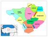
 Location of Boğazlıyan within Turkey. | |
 Boğazlıyan Location of Boğazlıyan within Turkey. | |
| Coordinates: 39°12′N 35°15′E / 39.200°N 35.250°E | |
| Country | |
| Province | Yozgat |
| Government | |
| • Mayor | Gökhan Coşar (AKP) |
| Area | |
| • District | 1,638.00 km2 (632.44 sq mi) |
| Elevation | 1,091 m (3,579 ft) |
| Population (2012)[2] | |
| • Urban | 16,092 |
| • District | 36,157 |
| • District density | 22/km2 (57/sq mi) |
| Time zone | UTC+2 (EET) |
| • Summer (DST) | UTC+3 (EEST) |
| Postal code | 66400 |
| Area code(s) | 0354 |
| Licence plate | 66 |
| Website | www.bogazliyan.gov.tr |

Boğazlıyan is a town and district of Yozgat Province in the Central Anatolia region of Turkey. Neighbouring districts are Sarıkaya on the north, Yenifakılı on the west, Çandır and Çayıralan on the east. According to 2000 census, population of the district is 67,184 of which 29,719 live in the town of Boğazlıyan.[3][4]
Notes[]
- ^ "Area of regions (including lakes), km²". Regional Statistics Database. Turkish Statistical Institute. 2002. Retrieved 2013-03-05.
- ^ "Population of province/district centers and towns/villages by districts - 2012". Address Based Population Registration System (ABPRS) Database. Turkish Statistical Institute. Retrieved 2013-02-27.
- ^ Turkish Statistical Institute. "Census 2000, Key statistics for urban areas of Turkey" (in Turkish). Archived from the original (XLS) on 2007-09-27. Retrieved 2008-03-19.
- ^ GeoHive. "Statistical information on Turkey's administrative units". Retrieved 2008-03-19.
References[]
- Falling Rain Genomics, Inc. "Geographical information on Boğazlıyan, Turkey". Retrieved 2008-03-18.
External links[]
- District governor's official website (in Turkish)
- District municipality's official website (in Turkish)
- General information on Boğazlıyan (in Turkish)
- Image gallery of Boğazlıyan (in Turkish)
- Bogazliyan Anatolia Highschool Website (in Turkish)
| show Boğazlıyan in Yozgat Province of Turkey |
|---|
| show Authority control |
|---|
Coordinates: 39°11′39″N 35°14′50″E / 39.19417°N 35.24722°E
This geographical article about a location in Yozgat Province, Turkey is a stub. You can help Wikipedia by . |
Categories:
- Districts of Yozgat Province
- Populated places in Yozgat Province
- Central Anatolia Region geography stubs