Saraykent
Saraykent | |
|---|---|
District | |
 Location of Saraykent within Turkey. | |
 Saraykent Location of Saraykent within Turkey. | |
| Coordinates: 39°42′N 35°31′E / 39.700°N 35.517°E | |
| Country | |
| Province | Yozgat |
| Government | |
| • Mayor | İdris Öğel (MHP) |
| Area | |
| • District | 189.35 km2 (73.11 sq mi) |
| Elevation | 1,149 m (3,770 ft) |
| Population (2012)[2] | |
| • Urban | 6,515 |
| • District | 15,620 |
| • District density | 82/km2 (210/sq mi) |
| Time zone | UTC+2 (EET) |
| • Summer (DST) | UTC+3 (EEST) |
| Postal code | 66xxx |
| Area code(s) | 0354 |
| Licence plate | 66 |
| Website | www.saraykent.gov.tr |

Saraykent is a town and district of Yozgat Province in the Central Anatolia region of Turkey. The former name of the town is Karamağara.[3] According to 2000 census, population of the district is 26,077 of which 9,224 live in the town of Saraykent.[4]
Notes[]
- ^ "Area of regions (including lakes), km²". Regional Statistics Database. Turkish Statistical Institute. 2002. Retrieved 2013-03-05.
- ^ "Population of province/district centers and towns/villages by districts - 2012". Address Based Population Registration System (ABPRS) Database. Turkish Statistical Institute. Retrieved 2013-02-27.
- ^ Sezen, Tahir. 2017. Osmanlı yer adları. p.423
- ^ Turkish Statistical Institute. "Census 2000, Key statistics for urban areas of Turkey" (in Turkish). Archived from the original (XLS) on 2007-09-27. Retrieved 2008-03-21.
References[]
- Falling Rain Genomics, Inc. "Geographical information on Saraykent, Turkey". Archived from the original on 2012-10-25. Retrieved 2008-03-21.
External links[]
- District governor's official website (in Turkish)
- District municipality's official website (in Turkish)
- General information on Saraykent (in Turkish)
Saraykent in Yozgat Province of Turkey | |||||||||||||||||||||||||||
|---|---|---|---|---|---|---|---|---|---|---|---|---|---|---|---|---|---|---|---|---|---|---|---|---|---|---|---|
| Districts | 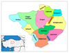 | ||||||||||||||||||||||||||
|
Metropolitan municipalities are bolded. | |||||||||||||||||||||||||||
Coordinates: 39°41′37″N 35°30′40″E / 39.69361°N 35.51111°E
This geographical article about a location in Yozgat Province, Turkey is a stub. You can help Wikipedia by . |
Categories:
- Populated places in Yozgat Province
- Districts of Yozgat Province
- Central Anatolia Region geography stubs