Bozkurt, Denizli
Bozkurt | |
|---|---|
Town | |
 One of the crater lakes in Karagöl near Bozkurt | |
 Location of Bozkurt (district), Denizli within Turkey. | |
 Bozkurt Location of Bozkurt (district), Denizli within Turkey. | |
| Coordinates: 37°49′N 29°37′E / 37.817°N 29.617°ECoordinates: 37°49′N 29°37′E / 37.817°N 29.617°E | |
| Country | |
| Region | Aegean |
| Province | Denizli |
| Area | |
| • District | 359.00 km2 (138.61 sq mi) |
| Elevation | 867 m (2,844 ft) |
| Population (2012)[2] | |
| • Urban | 5,592 |
| • District | 12,353 |
| • District density | 34/km2 (89/sq mi) |
| Time zone | UTC+2 (EET) |
| • Summer (DST) | UTC+3 (EEST) |
| Postal code | 20x xx |
| Licence plate | 20 |
| Website | www.bozkurt.bel.tr |

Bozkurt is a town and a rural district of Denizli Province in the Aegean Region of Turkey. The town is situated on a plain 52 km (32 mi) east of the city of Denizli. The altitude of the town is 866.8 m, and the district area is around 400 km2 (150 sq mi). The population (2000 census) is 11,738 of which 4,589 live in the small town of Bozkurt itself (with the remainder in surrounding countryside). It is quite close to the Lake Acıgöl and the neighboring town of Çardak and İnceler Kasabası
This is high country inland from the Aegean and Mediterranean, and has hot, dry summers and cold, wet winters.
During the Russo-Turkish War (1877–1878) refugees from Bulgaria were settled on the plain, which was then known as Hanabat after a Seljuk Turkish caravanserai that stands within the boundaries of the present-day neighboring district of Çardak. Immigration from Bulgaria continued until recent times.
This is an agricultural district, with irrigation systems currently being constructed.
Karagöl, literally "the black lake", is situated on top of the mountain on the slopes of which the town of Bozkurt is located. Karagöl is at an altitude of 1,250m and is an area of dense forests centered on several small crater lakes which are also fed by streams.
References[]
- ^ "Area of regions (including lakes), km²". Regional Statistics Database. Turkish Statistical Institute. 2002. Retrieved 2013-03-05.
- ^ "Population of province/district centers and towns/villages by districts - 2012". Address Based Population Registration System (ABPRS) Database. Turkish Statistical Institute. Retrieved 2013-02-27.
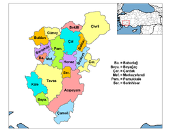
Bozkurt, Denizli in Denizli Province of Turkey | |||||||||||||||||||||||||||
|---|---|---|---|---|---|---|---|---|---|---|---|---|---|---|---|---|---|---|---|---|---|---|---|---|---|---|---|
| Districts |  | ||||||||||||||||||||||||||
|
Metropolitan municipalities are bolded. | |||||||||||||||||||||||||||
This geographical article about a location in Denizli Province, Turkey is a stub. You can help Wikipedia by . |
- Denizli
- Populated places in Denizli Province
- Districts of Denizli Province
- Denizli Province geography stubs