Castillon (Canton of Lembeye)
Castillon (Canton of Lembeye) | |
|---|---|
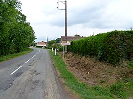 The road into Castillon | |
show Location of Castillon (Canton of Lembeye) | |
 Castillon (Canton of Lembeye) | |
| Coordinates: 43°28′52″N 0°07′37″W / 43.4811°N 0.1269°WCoordinates: 43°28′52″N 0°07′37″W / 43.4811°N 0.1269°W | |
| Country | France |
| Region | Nouvelle-Aquitaine |
| Department | Pyrénées-Atlantiques |
| Arrondissement | Pau |
| Canton | Terres des Luys et Coteaux du Vic-Bilh |
| Intercommunality | Nord-Est Béarn |
| Government | |
| • Mayor (2020–2026) | Robert Gaye[1] |
| Area 1 | 4.72 km2 (1.82 sq mi) |
| Population (Jan. 2018)[2] | 69 |
| • Density | 15/km2 (38/sq mi) |
| Time zone | UTC+01:00 (CET) |
| • Summer (DST) | UTC+02:00 (CEST) |
| INSEE/Postal code | 64182 /64350 |
| Elevation | 154–307 m (505–1,007 ft) (avg. 296 m or 971 ft) |
| 1 French Land Register data, which excludes lakes, ponds, glaciers > 1 km2 (0.386 sq mi or 247 acres) and river estuaries. | |


show This article may be expanded with text translated from the corresponding article in French. (December 2008) Click [show] for important translation instructions. |
Castillon (officially Castillon (Canton de Lembeye), sometimes referred to as Castillon-de-Lembeye) is a commune in the Pyrénées-Atlantiques department in south-western France.
See also[]
References[]
- ^ "Répertoire national des élus: les maires". data.gouv.fr, Plateforme ouverte des données publiques françaises (in French). 2 December 2020.
- ^ "Populations légales 2018". INSEE. 28 December 2020.
| Wikimedia Commons has media related to Castillon (Canton de Lembeye). |
This Pyrénées-Atlantiques geographical article is a stub. You can help Wikipedia by . |
Categories:
- Communes of Pyrénées-Atlantiques
- Pyrénées-Atlantiques geography stubs