Cherokee County, South Carolina
Cherokee County | |
|---|---|
U.S. county | |
 Limestone College at Limestone Springs Historic District in Gaffney. | |
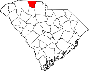 Location within the U.S. state of South Carolina | |
 South Carolina's location within the U.S. | |
| Coordinates: 35°03′N 81°37′W / 35.05°N 81.62°W | |
| Country | |
| State | |
| Founded | 1897 |
| Seat | Gaffney |
| Largest city | Gaffney |
| Area | |
| • Total | 397 sq mi (1,030 km2) |
| • Land | 393 sq mi (1,020 km2) |
| • Water | 4.5 sq mi (12 km2) 1.1% |
| Population (2010) | |
| • Total | 55,342 |
| • Estimate (2020) | 57,316 |
| • Density | 140/sq mi (54/km2) |
| Time zone | UTC−5 (Eastern) |
| • Summer (DST) | UTC−4 (EDT) |
| Congressional district | 5th |
| Website | www |

Cherokee County is a county located in the U.S. state of South Carolina. As of the 2010 census, the population was 55,342.[1] The county seat is Gaffney.[2] The county was formed in 1897 from parts of York, Union, and Spartanburg Counties. It was named for the Cherokee people who historically occupied this area prior to European encounter.[3]
Cherokee County comprises the Gaffney, SC Micropolitan Statistical Area, which is also included in the Greenville-Spartanburg-Anderson, SC Combined Statistical Area.
History[]
This area was occupied for thousands of years by indigenous peoples and by the historic Cherokee people before European encounter.
When European traders and settlers entered the area, they used the existing Native American paths: called collectively the Trading Path. The Upper Road and Lower Cherokee Traders Path were paths that passed through the piedmont. The former connected to Fredericksburg, Virginia, leading from the Virginia Tidewater into the Piedmont and to the South. The Lower Cherokee Traders Path especially connected areas in present-day western North Carolina, northern South Carolina and northeastern Georgia. In the mid-18th century, waves of British migrants and immigrants, an estimated 250,000 people, traveled by these paths into Cherokee and neighboring counties in the piedmont. This backcountry area was initially settled especially by immigrant Ulster Scots people, Germans and Anglo-Americans migrating into the area.
In later years, some plantations were developed and African-American slaves were brought into the area as labor.
The Battle of Cowpens, a decisive engagement of the American Revolution's southern theatre, was fought on January 17, 1781, in northwestern Cherokee County, north of the town of Cowpens.
Geography[]
According to the U.S. Census Bureau, the county has a total area of 397 square miles (1,030 km2), of which 393 square miles (1,020 km2) is land and 4.5 square miles (12 km2) (1.1%) is water.[4] It is the third-smallest county in South Carolina by land area and fourth-smallest by total area.
Mountain peaks[]
Draytonville Mountain is known to locals as McKown's Mountain, named for a farmer who owned much of the land in that area.
Adjacent counties[]
- Cleveland County, North Carolina - north
- York County - east
- Union County - south
- Spartanburg County - west
- Rutherford County, North Carolina - northwest
National protected area[]
Demographics[]
| Historical population | |||
|---|---|---|---|
| Census | Pop. | %± | |
| 1900 | 21,359 | — | |
| 1910 | 26,179 | 22.6% | |
| 1920 | 27,570 | 5.3% | |
| 1930 | 32,201 | 16.8% | |
| 1940 | 33,290 | 3.4% | |
| 1950 | 34,992 | 5.1% | |
| 1960 | 35,205 | 0.6% | |
| 1970 | 36,791 | 4.5% | |
| 1980 | 40,983 | 11.4% | |
| 1990 | 44,506 | 8.6% | |
| 2000 | 52,537 | 18.0% | |
| 2010 | 55,342 | 5.3% | |
| 2020 (est.) | 57,316 | [5] | 3.6% |
| U.S. Decennial Census[6] 1790-1960[7] 1900-1990[8] 1990-2000[9] 2010-2013[1] | |||
2000 census[]
As of the census[10] of 2000, there were 52,537 people, 20,495 households, and 14,612 families residing in the county. The population density was 134 people per square mile (52/km2). There were 22,400 housing units at an average density of 57 per square mile (22/km2). The racial makeup of the county was 76.92% White, 20.56% Black or African American, 0.20% Native American, 0.31% Asian, 0.02% Pacific Islander, 1.16% from other races, and 0.84% from two or more races. 2.08% of the population were Hispanic or Latino of any race. 39.1% were of "American", 6.8% Irish, 5.8% English and 5.6% German ancestry according to Census 2000. Most of those claiming "American" ancestry are of Scots-Irish and/or English descent, but have family who have been in the country for so long, that they no longer differentiate such national origins and choose to identify simply as "American".[11][12][13][14][15]
There were 20,495 households, out of which 32.70% had children under the age of 18 living with them, 51.30% were married couples living together, 15.40% had a female householder with no husband present, and 28.70% were non-families. 25.00% of all households were made up of individuals, and 9.40% had someone living alone who was 65 years of age or older. The average household size was 2.53 and the average family size was 3.01.
In the county, the population was spread out, with 25.80% under the age of 18, 9.00% from 18 to 24, 29.60% from 25 to 44, 23.20% from 45 to 64, and 12.40% who were 65 years of age or older. The median age was 35 years. For every 100 females there were 93.80 males. For every 100 females age 18 and over, there were 90.70 males.
The median income for a household in the county was $33,787, and the median income for a family was $39,393. Males had a median income of $30,984 versus $21,298 for females. The per capita income for the county was $16,421. About 11.00% of families and 23.90% of the population were below the poverty line, including 16.90% of those under age 18 and 15.20% of those age 65 or over.[16]
2010 census[]
As of the 2010 United States Census, there were 55,342 people, 21,519 households, and 14,941 families residing in the county.[17] The population density was 140.9 inhabitants per square mile (54.4/km2). There were 23,997 housing units at an average density of 61.1 per square mile (23.6/km2).[18] The racial makeup of the county was 75.0% white, 20.4% black or African American, 0.6% Asian, 0.4% American Indian, 2.2% from other races, and 1.4% from two or more races. Those of Hispanic or Latino origin made up 3.7% of the population.[17] In terms of ancestry, 14.7% were American, 9.7% were Irish, 6.6% were English, and 6.5% were German.[19]
Of the 21,519 households, 35.1% had children under the age of 18 living with them, 46.2% were married couples living together, 17.4% had a female householder with no husband present, 30.6% were non-families, and 25.8% of all households were made up of individuals. The average household size was 2.54 and the average family size was 3.03. The median age was 38.3 years.[17]
The median income for a household in the county was $34,132 and the median income for a family was $46,164. Males had a median income of $39,048 versus $27,390 for females. The per capita income for the county was $17,862. About 14.3% of families and 19.5% of the population were below the poverty line, including 27.5% of those under age 18 and 11.0% of those age 65 or over.[20]
Transportation[]
This section does not cite any sources. (December 2011) |
The lifeline of Cherokee County, I-85, runs through the city limits of Gaffney. It carries traffic and trade contributing to the business development along Floyd Baker Blvd, the county's main thoroughfare, which bisects I-85. Much of the county's growth occurs along I-85.
The county is also served by US 29, which preceded I-85 and today is mostly used for local traffic. The major road in the downtown area of Gaffney was made part of US 29. Several of the major South Carolina highways that serve the county are: SC Highway 11, SC Highway 150, SC Highway 105, SC Highway 18 serve the Gaffney area. SC Highway 5 serves the Blacksburg area.
With no airports of its own, Cherokee County is served by Charlotte/Douglas International Airport and Greenville-Spartanburg International Airport. A study to determine the feasibility of building an airport in the county revealed that an airport is desperately needed by businesses. Previous studies have determined the structure of the airport and possible airport sites have been narrowed down to two sites - one located just south of Gaffney and one located outside of Blacksburg. A major economic feasibility study is now being conducted, as required for funding by the federal government. If the airport is economically viable, the government could contribute 95% of the funds needed to construct the airport, if the project is authorized by Congress. If the study fails, then no federal funding will be provided.
Healthcare[]
Gaffney is home to several healthcare institutions:
Cherokee Medical Center[]
Cherokee Medical Center, a division of Spartanburg Regional Healthcare System, is a 125-bed acute care facility located in Gaffney, S.C., that services Cherokee County and the surrounding areas.[21] The hospital provides services including emergency, medical, surgical and imaging. Formerly Gaffney Medical Center, the hospital joined Mary Black Health System in 2015 and became Mary Black Health System — Gaffney. Mary Black facilities became part of Spartanburg Regional Healthcare System in 2019.[22]
Gibbs Cancer Center & Research Institute at Gaffney[]
Based in Spartanburg, Gibbs Cancer Center & Research Institute provides comprehensive cancer care to the Upstate South Carolina community and beyond. One of four locations, Gibbs at Gaffney opened in September 2011 with the mission of providing oncology services to the Cherokee County community.
Gibbs at Gaffney provides medical oncology and infusion services.[23]
Immediate Care Center – Gaffney[]
Located on Floyd Baker Boulevard, Immediate Care Center – Gaffney provides a hybrid of urgent and primary care.[24]
Medical Group of the Carolinas[]
A network of more than 100 practices in Upstate South Carolina, Medical Group of the Carolinas includes several medical practices in Cherokee County. The local offices include family and internal medicine, cardiology, orthopaedics, hematology oncology, urology and women's care.[25]
Entertainment[]
This section does not cite any sources. (December 2011) |
Cherokee County is the only county to have three national parks within its boundaries: the Overmountain Victory National Historic Trail, Kings Mountain National Military Park and Cowpens National Battlefield. Several historic homes dot the landscape of Cherokee County. While many are not generally open to the public, several annual tours of these homes take place.
Gaffney Little Theatre and Limestone College serve theater enthusiasts, offering plays and musicals ten to twelve times a year.
A major shopping center is Prime Outlets-Gaffney, which attracts almost 3,000,000 visitors per year, and contains over 80 retail outlets. Floyd Baker Boulevard is one of the fastest-growing commercial areas in Cherokee County, with a traffic count of almost 40,000 cars per day. It has numerous stores and restaurants. Uptown Gaffney offers many upscale boutiques, shops and cafes.[citation needed]
The area's newest attraction is the Cherokee County History and Arts Museum. It is located at the old Central School. Cherokee County's history, its contributions to the arts, and its role in shaping the culture of the southeast are explored.
Nuclear power plant[]
In 2002, the President George W. Bush administration initiated the Nuclear Power 2010 Program, to encourage development of nuclear power plants to meet energy needs. The program developed streamlining of approval processes for licensing and had subsidies. Additional incentives were authorized under the Nuclear Power Act of 2005.
On March 16, 2006 Duke Power announced that a Cherokee County site had been selected for a potential new nuclear power plant, to be called the William States Lee III Nuclear Generating Station, informally known as Lee Station. The site is jointly owned by Duke Power and Southern Company. Duke plans to develop the site for two Westinghouse Electric Company AP1000 (advanced passive) pressurized water reactors. Each reactor is capable of producing approximately 1,117 megawatts. (See Nuclear Power 2010 Program.) This site is adjacent to the old Cherokee Nuclear Power Plant site, which was never completed and ultimately abandoned. It was used by James Cameron as a set for the 1989 film The Abyss.
On December 14, 2007 Duke Power submitted a Combined Construction and Operating License to the Nuclear Regulatory Commission, with an announcement that it will spend $160 million in 2008 on the plant with a total cost of 5-6 billion dollars.[26] Due to a slowdown in licensing and increase in costs, a federal license for what is estimated to be an $11 billion plant is not expected until 2016. Duke Energy will decide after that point whether to go forward with construction.[27] In August 2017 Duke Energy announced that construction plans at the site had been put on an indefinite hold. But the company retains the rights to restart construction in the future.[28]
Communities[]
Cities[]
Towns[]
- Blacksburg
- Smyrna (mostly in York County)
Census-designated place[]
Other unincorporated communities[]
Politics[]
See also[]
- National Register of Historic Places listings in Cherokee County, South Carolina
- Tryon County, North Carolina
References[]
- ^ Jump up to: a b "State & County QuickFacts". United States Census Bureau. Archived from the original on June 10, 2006. Retrieved November 22, 2013.
- ^ "Find a County". National Association of Counties. Archived from the original on 2015-05-09. Retrieved 2011-06-07.
- ^ Federal Writers' Project (1941). Palmetto Place Names. Sloane Printing Co. p. 13.
- ^ "2010 Census Gazetteer Files". United States Census Bureau. August 22, 2012. Retrieved March 16, 2015.
- ^ "Population and Housing Unit Estimates". Retrieved May 5, 2021.
- ^ "U.S. Decennial Census". United States Census Bureau. Retrieved March 16, 2015.
- ^ "Historical Census Browser". University of Virginia Library. Retrieved March 16, 2015.
- ^ Forstall, Richard L., ed. (March 27, 1995). "Population of Counties by Decennial Census: 1900 to 1990". United States Census Bureau. Retrieved March 16, 2015.
- ^ "Census 2000 PHC-T-4. Ranking Tables for Counties: 1990 and 2000" (PDF). United States Census Bureau. April 2, 2001. Retrieved March 16, 2015.
- ^ "U.S. Census website". United States Census Bureau. Retrieved 2011-05-14.
- ^ Sharing the Dream: White Males in a Multicultural America By Dominic J. Pulera.
- ^ Reynolds Farley, 'The New Census Question about Ancestry: What Did It Tell Us?', Demography, Vol. 28, No. 3 (August 1991), pp. 414, 421.
- ^ Stanley Lieberson and Lawrence Santi, 'The Use of Nativity Data to Estimate Ethnic Characteristics and Patterns', Social Science Research, Vol. 14, No. 1 (1985), pp. 44-6.
- ^ Stanley Lieberson and Mary C. Waters, 'Ethnic Groups in Flux: The Changing Ethnic Responses of American Whites', Annals of the American Academy of Political and Social Science, Vol. 487, No. 79 (September 1986), pp. 82-86.
- ^ Mary C. Waters, Ethnic Options: Choosing Identities in America (Berkeley: University of California Press, 1990), p. 36.
- ^ "Archived copy". Archived from the original on 2011-09-17. Retrieved 2017-12-05.CS1 maint: archived copy as title (link)
- ^ Jump up to: a b c "DP-1 Profile of General Population and Housing Characteristics: 2010 Demographic Profile Data". United States Census Bureau. Archived from the original on 2020-02-13. Retrieved 2016-03-09.
- ^ "Population, Housing Units, Area, and Density: 2010 - County". United States Census Bureau. Archived from the original on 2020-02-13. Retrieved 2016-03-09.
- ^ "DP02 SELECTED SOCIAL CHARACTERISTICS IN THE UNITED STATES – 2006-2010 American Community Survey 5-Year Estimates". United States Census Bureau. Archived from the original on 2020-02-13. Retrieved 2016-03-09.
- ^ "DP03 SELECTED ECONOMIC CHARACTERISTICS – 2006-2010 American Community Survey 5-Year Estimates". United States Census Bureau. Archived from the original on 2020-02-13. Retrieved 2016-03-09.
- ^ "Cherokee Medical Center - Spartanburg Regional Healthcare System". www.spartanburgregional.com. Retrieved 2019-01-28.
- ^ Reports, Staff (2018-12-31). "Spartanburg Regional completes Mary Black acquisition". DiscoverHealth.org. Archived from the original on 2019-01-29. Retrieved 2019-01-28.
- ^ "Cancer Treatment at Gibbs Cancer Center - Spartanburg Regional Healthcare System". www.spartanburgregional.com. Retrieved 2019-01-28.
- ^ "Immediate Care Centers - Spartanburg Regional Healthcare System". www.spartanburgregional.com. Retrieved 2019-01-28.
- ^ "Medical Group of the Carolinas". www.medicalgroupofthecarolinas.com. Archived from the original on 2019-01-29. Retrieved 2019-01-28.
- ^ "UPDATE 1-Duke Energy files to build new nuclear power plant". Reuters. 13 December 2007.
- ^ "Duke Energy won't buy into SC nuclear plant [Santee Cooper]" Archived December 29, 2014, at the Wayback Machine, Charlotte Observer, 27 January 2014, accessed 28 December 2014
- ^ "Duke Seeks To Cancel William States Lee Nuclear Power Project - News - Nuclear Power News - Nuclear Street - Nuclear Power Plant News, Jobs, and Careers". nuclearstreet.com. Retrieved 27 August 2017.
- ^ Leip, David. "Dave Leip's Atlas of U.S. Presidential Elections". uselectionatlas.org. Retrieved 2018-03-13.
External links[]
- Cherokee County Government official website
- Cherokee County Development Board
- Cherokee County Historical & Preservation Society
- Cherokee County Chamber of Commerce
- Cherokee County School District
- County Population Information[permanent dead link]
- South Carolina Transportation Information
- Cherokee County history and images
| show Municipalities and communities of Cherokee County, South Carolina, United States |
|---|


- South Carolina counties
- Cherokee County, South Carolina
- 1897 establishments in South Carolina
- Populated places established in 1897
- Counties of Appalachia