Ciry-le-Noble
Ciry-le-Noble | |
|---|---|
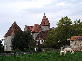 Chateau of Sauvement | |
show Location of Ciry-le-Noble | |
 Ciry-le-Noble | |
| Coordinates: 46°36′21″N 4°18′04″E / 46.6058°N 4.3011°ECoordinates: 46°36′21″N 4°18′04″E / 46.6058°N 4.3011°E | |
| Country | France |
| Region | Bourgogne-Franche-Comté |
| Department | Saône-et-Loire |
| Arrondissement | Autun |
| Canton | Saint-Vallier |
| Intercommunality | CU Creusot Montceau |
| Area 1 | 33.07 km2 (12.77 sq mi) |
| Population (Jan. 2018)[1] | 2,262 |
| • Density | 68/km2 (180/sq mi) |
| Time zone | UTC+01:00 (CET) |
| • Summer (DST) | UTC+02:00 (CEST) |
| INSEE/Postal code | 71132 /71420 |
| Elevation | 262–422 m (860–1,385 ft) (avg. 270 m or 890 ft) |
| 1 French Land Register data, which excludes lakes, ponds, glaciers > 1 km2 (0.386 sq mi or 247 acres) and river estuaries. | |


Ciry-le-Noble is a commune in the Saône-et-Loire department in the region of Bourgogne-Franche-Comté in eastern France.
Geography[]
The Bourbince flows southwest through the middle of the commune and crosses the village.
See also[]
References[]
- ^ "Populations légales 2018". INSEE. 28 December 2020.
| Wikimedia Commons has media related to Ciry-le-Noble. |
| show Authority control |
|---|
This Saône-et-Loire geographical article is a stub. You can help Wikipedia by . |
Categories:
- Communes of Saône-et-Loire
- Saône-et-Loire geography stubs