Dörtyol
Dörtyol | |
|---|---|
 Dörtyol | |
| Coordinates: 36°50′34″N 36°13′28″E / 36.84278°N 36.22444°ECoordinates: 36°50′34″N 36°13′28″E / 36.84278°N 36.22444°E | |
| Country | Turkey |
| Province | Hatay |
| Government | |
| • Mayor | Yaşar Toksoy (MHP) |
| • Kaymakam | Recep Soytürk |
| Area | |
| • District | 599.97 km2 (231.65 sq mi) |
| Elevation | 57 m (187 ft) |
| Population (2012)[2] | |
| • Urban | 75,110 |
| • District | 151,837 |
| • District density | 250/km2 (660/sq mi) |
| Post code | 316xx |
| Website | www.dortyol.bel.tr |

Dörtyol (Western Armenian: Չորք Մարզպան, romanized: Č'ork' Marzban) is a city in Hatay Province, Turkey. It is a port city and oil terminus located 26 km north of the city of Iskenderun, near the easternmost point of the Mediterranean at the head of the Gulf of İskenderun.
Geography[]
The name Dörtyol means "crossroads" (literally "four roads") in Turkish, and the town indeed sits on a crossing of highways, especially the O-53 from Anatolia south into Hatay and on to Syria. The road is channelled along the narrow coastal strip with the Nur Mountains (the ancient Amanos) behind. Dörtyol is at the edge of the Çukurova Plain and being near the coast, it is humid, and the countryside is fairly green and fertile. Therefore, alongside oil handling, the economic activities of the district include forestry, cotton, and the cultivation of citrus fruits, especially a local variety of tangerines.
History[]
This crossroads has seen the passage of numerous armies and some of the biggest military campaigns in history, including the Battle of Issus between Alexander the Great and Darius in 333 BC. In 1895 the Armenians of Chork Marzban resisted the Hamidian Massacres. In 1909, during the Adana Massacre, the Armenians of Chork Marzban resisted the massacres anew, but large numbers perished. From 1919 to 1921, the Armenians again resisted the Armenian genocide, but were almost completely exterminated. After the French and Turks agreed on the Syrian-Turkish border, Dörtyol fell on the Turkish side, and the surviving Armenians fled to Alexandretta, Aleppo, and Amman.
More recently, Dörtyol is remembered in Turkey as the scene of the first fighting in the Turkish War of Independence. The fighting with the occupying forces was ignited in Karakese, which is located on the edge of the mountainous village of Nur. In 1918, Dörtyol was occupied by French troops. Turks in the area retreated to the hills and began their resistance under the leadership of . Thus, Dörtyol ultimately never become part of the Republic of Hatay, but instead functioned as a Turkish district added to Hatay when the province was brought into the Turkish Republic in 1939.
Popular Culture[]
The town is mentioned in The Forty Days of Musa Dagh.[3]
References[]
- ^ "Area of regions (including lakes), km²". Regional Statistics Database. Turkish Statistical Institute. 2002. Retrieved 2013-03-05.
- ^ "Population of province/district centers and towns/villages by districts - 2012". Address Based Population Registration System (ABPRS) Database. Turkish Statistical Institute. Retrieved 2013-02-27.
- ^ Werfel, Franz (1935). The Forty Days of Musa Dagh. New York: The Viking Press. p. 245-246.
External links[]
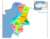
| show Dörtyol in Hatay Province of Turkey |
|---|
| Authority control |
|---|
This article about a Mediterranean Region of Turkey location is a stub. You can help Wikipedia by . |
- Populated places in Hatay Province
- Districts of Hatay Province
- Cities in Turkey
- Mediterranean Region, Turkey geography stubs